Languimberg
From Wikipedia, the free encyclopedia
Commune in Grand Est, France
Languimberg | |
|---|---|
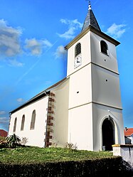 The church in Languimberg | |
 Coat of arms | |
 Languimberg  Languimberg | |
Coordinates:  48°44′48″N 6°51′36″E / 48.7467°N 6.86°E / 48.7467; 6.86Coordinates: 48°44′48″N 6°51′36″E / 48.7467°N 6.86°E / 48.7467; 6.86 48°44′48″N 6°51′36″E / 48.7467°N 6.86°E / 48.7467; 6.86Coordinates: 48°44′48″N 6°51′36″E / 48.7467°N 6.86°E / 48.7467; 6.86 | |
| Country | France |
| Region | Grand Est |
| Department | Moselle |
| Arrondissement | Sarrebourg-Château-Salins |
| Canton | Sarrebourg |
| Intercommunality | Sarrebourg - Moselle Sud |
| Government | |
| • Mayor (2020–2026) | Jean-Marc Wagenheim[1] |
| Area 1 | 18.38 km2 (7.10 sq mi) |
| Population (Jan. 2018)[2] | 168 |
| • Density | 9.1/km2 (24/sq mi) |
| Time zone | UTC+01:00 (CET) |
| • Summer (DST) | UTC+02:00 (CEST) |
| INSEE/Postal code | 57383 /57810 |
| Elevation | 238–304 m (781–997 ft) (avg. 290 m or 950 ft) |
| 1 French Land Register data, which excludes lakes, ponds, glaciers > 1 km2 (0.386 sq mi or 247 acres) and river estuaries. | |

Languimberg (German: Langenberg) is a commune in the Moselle department in Grand Est in north-eastern France.
See also[]
| Wikimedia Commons has media related to Languimberg. |
References[]
- ^ "Répertoire national des élus: les maires". data.gouv.fr, Plateforme ouverte des données publiques françaises (in French). 2 December 2020.
- ^ "Populations légales 2018". INSEE. 28 December 2020.
show
| |
|---|---|
| Prefecture |
|
| Subprefectures |
|
| Other |
|
This Arrondissement of Sarrebourg-Château-Salins geographical article is a stub. You can help Wikipedia by . |
Retrieved from ""
Categories:
- Communes of Moselle (department)
- Sarrebourg-Château-Salins arrondissement geography stubs
Hidden categories:
- CS1 French-language sources (fr)
- Articles with short description
- Short description is different from Wikidata
- Infobox mapframe without OSM relation ID on Wikidata
- Coordinates on Wikidata
- Pages using infobox settlement with image map1 but not image map
- Articles containing German-language text
- Commons category link from Wikidata
- Articles with BNF identifiers
- All stub articles
- Pages using the Kartographer extension