Lianyungang
Lianyungang
连云港市 Lienyunkang | |
|---|---|
 skylines of Lianyungang | |
 Lianyungang is highlighted on this map of Jiangsu | |
 Lianyungang Location of the city center in Jiangsu | |
| Coordinates (Lianyungang municipal government): 34°35′48″N 119°13′17″E / 34.5966°N 119.2214°ECoordinates: 34°35′48″N 119°13′17″E / 34.5966°N 119.2214°E | |
| Country | People's Republic of China |
| Province | Jiangsu |
| Municipal seat | Haizhou District |
| Government | |
| • Type | Prefecture-level city |
| • CPC secretary | Yang Xingshi (杨省世) |
| • Mayor | Xiang Xuelong (项雪龙) |
| Area | |
| • Prefecture-level city | 7,154 km2 (2,762 sq mi) |
| • Urban | 2,252 km2 (870 sq mi) |
| • Metro | 738 km2 (285 sq mi) |
| Population (2010 census) | |
| • Prefecture-level city | 4,393,914 |
| • Density | 610/km2 (1,600/sq mi) |
| • Urban | 2,001,009 |
| • Urban density | 890/km2 (2,300/sq mi) |
| • Metro | 1,050,523 |
| • Metro density | 1,400/km2 (3,700/sq mi) |
| Time zone | UTC+8 (China Standard) |
| Postal code | 222000 (Urban center) 222100-222300, 222500 (Other areas) |
| Area code(s) | 518 |
| ISO 3166 code | CN-JS-07 |
| GDP | ¥216.064 billion (2015) |
| GDP per capita | ¥48,416 (2015) |
| Major Nationalities | Han |
| County-level divisions | 7 |
| License Plate | 苏G |
| City Tree | Ginkgo |
| City Flower | Magnolia |
| Website | www |


| Lianyungang | |||
|---|---|---|---|
| Simplified Chinese | 连云港 | ||
| Traditional Chinese | 連雲港 | ||
| Hanyu Pinyin | Liányúngǎng | ||
| Literal meaning | the port connected to the clouds | ||
| |||
| Other names | |||
|---|---|---|---|
| Chinese | 海州 | ||
| Literal meaning | City of the Sea | ||
| |||
Lianyungang (simplified Chinese: 连云港; traditional Chinese: 連雲港; pinyin: Liányúngǎng) is a prefecture-level city in northeastern Jiangsu province, China. It borders Yancheng to its southeast, Huai'an and Suqian to its south, Xuzhou to its southwest, and the province of Shandong to its north. Its name derives from Lian Island, the largest island in Jiangsu which lies off its coastline, and , the highest peak in Jiangsu, a few miles from the city center, and the fact that it is a port. The name can be literally translated as the Port Connecting the Clouds.
Lianyungang was home to 4,393,914 inhabitants as of the 2010 census whom 1,050,523 lived in the built-up (or metro) area made of Haizhou and Lianyun counties.[1] Lianyungang was known in the West as Haichow (Postal romanization), which means the City of Sea. Haichow was opened to foreign trade by the Qing imperial government in 1905.[citation needed]
Geography[]
Lianyungang is between 118°24' and 119°48' east longitude and 34°11' and 35°07' north latitude. Lianyungang covers an area of 7,777 km2 (3,003 sq mi).
Administration[]
The prefecture-level city of Lianyungang administers six county-level divisions, including three districts and three counties.
| Map | |||||
|---|---|---|---|---|---|
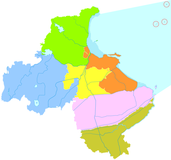
Haizhou
Guanyun
County Disputed islands with Rizhao in Shandong.
| |||||
| Subdivision | Simplified Chinese | Hanyu Pinyin | Population (2010) | Area (km2) | Density (/km2) |
| City Proper | |||||
| Lianyun District | 连云区 | Liányún Qū | 231,697 | 797.10 | 290.67 |
| Haizhou District | 海州区 | Hǎizhōu Qū | 818,134 | 700,71 | 1,167.58 |
| Suburban | |||||
| Ganyu District | 赣榆区 | Gànyú Qū | 949,438 | 1,514.08 | 627.07 |
| Donghai County | 东海县 | Dōnghǎi Xiàn | 952,250 | 2,036.66 | 467.55 |
| Rural | |||||
| Guanyun County | 灌云县 | Guànyún Xiàn | 817,629 | 1,538.33 | 531.50 |
| Guannan County | 灌南县 | Guànnán Xiàn | 624,766 | 1,028.41 | 607.51 |
| Total | 4,393,914 | 7,615.29 | 576.99 | ||
| Dissolved district: Xinpu District | |||||
Economy[]
Lianyungang is one of the first 14 Chinese coastal cities opening to the outside world and a rising center of industry, foreign trade, and tourism in east China. It is the eastern terminus of the New Eurasian Land Bridge and the proposed Northern East West Freight Corridor. The New Eurasia Continental Landbridge continue by land, connecting Lianyungang with over 40 countries and regions in Europe, South Asia and the Middle East by railway networks.
The Lianyun-Port, in the center of the coast, links eastern sea routes with western land routes. Japan and South Korea in the east can be reached economically and conveniently from Lianyungang. Near the port, the Tianwan Nuclear Power Plant is one of the biggest nuclear power plants in China, with two operational units and six more planned. Lianyungang is also rich in mineral resources. Donghai County has 70% of the national reserve of natural crystal, and is manufacturing 80% of China’s crystal products.[2]
The Chinese government has stated its intention to build an economic belt along the New Eurasia Continental Landbridge in "the Ninth Five-Year Plan of the National Economy and Social Development and the Long-range Goal for the Year 2010." On "China's 21st Century Agenda", Lianyungang is to be developed into an international seaport linking countries on the Pacific rim with those in Central Asia. In the "National Ocean Development Plan" it is listed as one of three special development zones.
Lianyungang Economic & Technological Development Zone was approved by the State Council as one of the first batch of state-level development zones in December 1984. It is in the eastern new seashore urban area of Liangyungang City. The distance to the nearest airport, Liangyungang Airport is 10–20 km (6.2–12.4 mi) and the distance to the nearest highway G310 is 10–20 km (6.2–12.4 mi). Lianyungang port is 20–50 km (12–31 mi).[3]
On July 18, 2019, began a construction on a large petrochemical storage dock in the Xuwei area of the port of Lianyungang.[4]
Climate[]
The temperature in Lianyungang can reach average highs of 30 °C in the summer and drop to as low as −4 °C in the winter. Lianyungang’s climate is classified by Köppen and Geiger as Cwa (humid subtropical climate with dry winters).[5]
The vast majority of precipitation occurs between June and August, where it can measure up to 278mm of rainfall on average. Winter precipitation is quite low, making snowfall rare and short-lived.[6]
| hideClimate data for Lianyungang (1981–2010 normals) | |||||||||||||
|---|---|---|---|---|---|---|---|---|---|---|---|---|---|
| Month | Jan | Feb | Mar | Apr | May | Jun | Jul | Aug | Sep | Oct | Nov | Dec | Year |
| Average high °C (°F) | 5.3 (41.5) |
7.9 (46.2) |
13.0 (55.4) |
20.1 (68.2) |
25.5 (77.9) |
28.9 (84.0) |
30.8 (87.4) |
30.2 (86.4) |
26.7 (80.1) |
21.8 (71.2) |
14.4 (57.9) |
7.7 (45.9) |
19.4 (66.8) |
| Daily mean °C (°F) | 0.7 (33.3) |
3.0 (37.4) |
7.8 (46.0) |
14.4 (57.9) |
19.9 (67.8) |
23.9 (75.0) |
26.8 (80.2) |
26.4 (79.5) |
22.4 (72.3) |
16.7 (62.1) |
9.4 (48.9) |
3.0 (37.4) |
14.5 (58.2) |
| Average low °C (°F) | −2.8 (27.0) |
−0.8 (30.6) |
3.5 (38.3) |
9.6 (49.3) |
15.2 (59.4) |
19.9 (67.8) |
23.7 (74.7) |
23.4 (74.1) |
18.8 (65.8) |
12.5 (54.5) |
5.3 (41.5) |
−0.7 (30.7) |
10.6 (51.1) |
| Average precipitation mm (inches) | 16.8 (0.66) |
20.7 (0.81) |
32.2 (1.27) |
42.9 (1.69) |
66.6 (2.62) |
103.3 (4.07) |
254.2 (10.01) |
182.3 (7.18) |
80.2 (3.16) |
37.3 (1.47) |
33.3 (1.31) |
14.0 (0.55) |
883.8 (34.8) |
| Average relative humidity (%) | 65 | 65 | 64 | 63 | 68 | 74 | 82 | 82 | 75 | 70 | 68 | 66 | 70 |
| Source: China Meteorological Administration[7] | |||||||||||||
Tourism[]
Lian Island Resort[]

One of the most popular tourist attractions in Lianyungang and the only AAAA-Class beachfront in Jiangsu Province, Lian Island (Chinese: 连岛; pinyin: lián dǎo) is a beautiful island connected to Lianyun District by a 6.7 km (4.2 mi) sea dyke, the longest in China. There are two main beach and swimming areas, several places to eat, as well as hotels. Lian Island is home to an annual music extravaganza featuring some of China's most famous pop stars.
Huaguo Mountain[]
Lianyungang is famous for its "Huaguo Shan, Shuilian Dong" (花果山水簾洞) attraction. Shuiliandong literally means the "Water Curtain Hole," since, according to legend, the hole was hidden behind a waterfall, therefore resembling a "curtain of water."
The hole is famous because according to legend it is the home of Sun Wukong, commonly known as the Monkey King from the epic novel Journey to the West. In this hole, underneath the mountain is where he and his monkey subjects lived. After learning Tao, the Monkey King traveled back to the hole so that he and his subjects could eat and play for eternity. Eventually, the Jade Emperor sent heavenly armies to battle him at this spot because of his misdeeds. While the Monkey King story is a work of fiction, Xuanzang, the monk who he accompanies on the journey of the novel, was based on a historical person.
Transport[]

Lianyungang has convenient transport including highway, railway, port and airport. It is one of the 42 major transportation hub cities in China.
Airport[]
Lianyungang Baitabu Airport, 25 km (16 mi) west of downtown Lianyungang, provides scheduled passenger service to dozens of airports in China. The new Lianyungang Huaguoshan International Airport is planned to be built in Xiaoyi, 20 km (12 mi) south of downtown by 2020. It will replace Baitabu Airport after completion.[8]
Railway[]


Lianyungang is the eastern end of the Longhai Railway (formerly the Lunghai Railway), connecting it with Lanzhou in central China. As a major arterial east–west railway in China, it runs from Lianyungang to Lanzhou, Gansu through the provinces of Jiangsu, Anhui, Henan, Shaanxi, and Gansu, covering a total length of 1,759 km.
Lianyungang-Xuzhou Highspeed Railway, connecting Lianyungang and the important provincial transportation hub of Xuzhou, is under construction. The length of this railway is 180 km (110 mi)and the speed standard is 350 km/h (220 mph). Planned completion year is 2020.
Qingdao-Yancheng Highspeed Railway, part of China's Coastal High-speed Railway, goes through Lianyungang. The length of this railway is 429 km and the speed standard is 200 km/h.
Lianyungang-Nanjing/Zhenjiang Highspeed Railway connects Lianyungang and the provincial capital, Nanjing. The length of this railway is 300 km (190 mi)and the speed standard is 250 km/h (160 mph). Planned completion year is 2020.
Expressway[]
Lianyungang is the intersection of G15 Shenyang–Haikou Expressway, G25 Changchun–Shenzhen Expressway and G30 Lianyungang–Khorgas Expressway.
Port[]
Lianyungang port is among the 10 largest ports in China and the 30 largest port in the world. The cargo throughput of Lianyungang port is 210 million ton/year (2015). The container throughput is 5 million TEU/year (2015).[9] The port is part of the Maritime Silk Road that runs from the Chinese coast to the south via Singapore towards the southern tip of India, to Mombasa, then through the Suez Canal to the Mediterranean with its connections to Central and Eastern Europe.[10][11]
See also[]

- List of twin towns and sister cities in China
References[]
- ^ "Jiangsu (China): Prefectural Division, Major Cities & Counties - Population Statistics, Maps, Charts, Weather and Web Information". www.citypopulation.de. Retrieved 2019-11-09.
- ^ "Donghai, Jiangsu, China". www.jiangsu.net. Retrieved 2017-09-04.
- ^ Rightsite.asia | Lianyungang Economic & Technological Development Zone
- ^ "Construção começa no cais de armazenamento petroquímico fortemente investido_portuguese.xinhuanet.com". portuguese.xinhuanet.com. Retrieved 2019-12-16.
- ^ "Lianyungang climate: Average Temperature, weather by month, Lianyungang weather averages - Climate-Data.org". en.climate-data.org. Retrieved 2019-12-16.
- ^ "Nancheng Weather Forecast". WorldWeatherOnline.com.
- ^ 中国气象数据网 - WeatherBk Data (in Chinese). China Meteorological Administration. Retrieved 2020-04-12.
- ^ 连云港新机场拟名花果山国际机场 预计2020亮相. Carnoc (in Chinese). 2018-07-15.
- ^ http://www.moc.gov.cn/difangxinwen/xxlb_fabu/fbpd_jiangsu/201601/t20160107_1973189.html
- ^ Lianyungang (China)
- ^ The Maritime Dimension of “One Belt, One Road” in Strategic Perspective
External links[]
- Government website of Lianyungang (in Chinese, English, Japanese, and Korean)
- Lianyungang comprehensive guide with open directory (Jiangsu.NET)
- Tang Seng
| show Jiangsu topics |
|---|
| show Economic Development Zones of China |
|---|
| show Authority control |
|---|
- Lianyungang
- Cities in Jiangsu
- Prefecture-level divisions of Jiangsu
- Port cities and towns in China