Pu'er City
Pu'er
普洱市 | |
|---|---|
 Location of Pu'er City jurisdiction in Yunnan | |
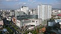
 Pu'er Location of the city centre in Yunnan | |
| Coordinates (Simao District government): 22°47′12″N 100°58′38″E / 22.7868°N 100.9771°ECoordinates: 22°47′12″N 100°58′38″E / 22.7868°N 100.9771°E | |
| Country | People's Republic of China |
| Province | Yunnan |
| GB/T 2260 CODE | 530800 |
| Admin HQ | Simao District |
| Admin units | show
List |
| Area | |
| • Total | 44,264.79 km2 (17,090.73 sq mi) |
| Elevation | 1,306 m (4,285 ft) |
| Highest elevation | 3,306 m (10,846 ft) |
| Lowest elevation | 376 m (1,234 ft) |
| Population (2010) | |
| • Total | 2,542,898 |
| • Density | 57/km2 (150/sq mi) |
| Time zone | UTC+8 (China Standard Time) |
| Postal code | 665000 |
| Area code(s) | 0879 |
| ISO 3166 code | CN-YN-08 |
| Licence plate prefixes | 云J |
| Website | www |
| Yunnan Statistics Bureau[2] Yunnan Portal[3] | |

| Pu'er City | |||
|---|---|---|---|
| Chinese | 普洱 | ||
| Postal | Puerh | ||
| |||
| Simao | |||
| Chinese | 思茅 | ||
| Postal | Szumao | ||
| |||
Pu'er is a prefecture-level city in southern Yunnan Province, China. The urban administrative center of Pu'er is Simao District, which is also the former name of the prefecture-level city itself. A major downturn in the price of tea in 2007 caused severe economic distress in the area.[4] The price of Pu'er has since recovered and Pu'er tea still contributes much to the income of the area.
Etymology[]
Nanzhao set a division called Bu'ri Jian (步日睑)[note 1] in 839 AD; this was the first time the region was integrated into the administrative system of a Chinese dynasty. In the Yuan dynasty, the central government changed the name to Pu'ri (普日) in 1278. Finally in Ming dynasty, the name was changed to "Pu'er" (普耳) in 1384. The character of "er" (耳) was changed to 洱 in Wanli Emperor period. The name "普洱" (Pu'er) has continued to be used to this day.[5]: 31 Wa scholar Ni-ga states that the origin name "Bu'ri" is the exonym of Blang people in Baraoke language, a dialect of Wa language, which means "my brother".[6]: 83
Pu'er tea has the name "Pu'er" because Pu'er was the distribution centre of the tea produced in the south-west of Yunnan during the Ming and Qing dynasty.[7] Pu'er tea became world-famous, and the city Pu'er also became famous as a result of the tea.[8]
History[]
Its name was changed to Simao in 1950 following the Communist victory in the Chinese Civil War, while its surrounding county was known as Pu'er.[9] In 2007, the town's name was changed back to Pu'er; the surrounding area became known as Ning'er County;[9] and the name Simao was taken by a town and district within the city. The change had an effect on the size of the official Pu'er tea production area, a major regional product.
Geography and climate[]
Pu'er is located in southern/southwestern Yunnan, on the lower reaches of the Mekong (known in Chinese as the Lancang), with the bordering prefectures being Yuxi to the northeast, Honghe to the east, Xishuangbanna to the south, Lincang to the northwest, and Dali and Chuxiong. It also shares borders with Vietnam (Điện Biên Province), Laos (Phongsaly Province), and Burma (Shan State), being the only prefecture in Yunnan to border all three countries. As with much of the province, mountainous terrain dominates its administrative area, covering 98.3%. Elevations range from 376 to 3,306 metres (1,234 to 10,846 ft).[1]
Located at an altitude of above 1,300 m (4,300 ft) and within a degree south of the Tropic of Cancer, Pu'er, as with much of southern Yunnan, has a warm humid subtropical climate (Köppen Cwa), with muddled distinction between the seasons and daytime temperatures remaining warm year-round. Highs peak in April and May before the core of the rainy season and reach a minimum in December; however, the warmest and coolest months are June and January, respectively at 22.7 °C (72.9 °F) and 13.4 °C (56.1 °F); the annual mean is 18.93 °C (66.1 °F). June through September accounts for nearly 70% of the annual rainfall of 1,487 mm (58.5 in) and during this time, some rainfall occurs on most days, pushing relative humidity above 80% and there is a marked reduction in sunshine. With monthly percent possible sunshine ranging from 24% in July to 69% in February, the city receives 2,038 hours of bright sunshine annually.
| showClimate data for Simao District, Pu'er (1981−2010) |
|---|
Administrative divisions[]
| Map | |||||
|---|---|---|---|---|---|
| Name | Hanzi | Hanyu Pinyin | Population (2010) |
Area (km²) | Density (/km²) |
| Simao District | 思茅区 | Sīmáo Qū | 296,500 | 4,093 | 72 |
| Ning'er Hani and Yi Autonomous County | 宁洱哈尼族彝族自治县 | Níng'ěr Hānízú Yízú Zìzhìxiàn | 185,700 | 3,670 | 51 |
| Mojiang Hani Autonomous County | 墨江哈尼族自治县 | Mòjiāng Hānízú Zìzhìxiàn | 360,500 | 5,459 | 66 |
| Jingdong Yi Autonomous County | 景东彝族自治县 | Jǐngdōng Yízú Zìzhìxiàn | 359,500 | 4,532 | 79 |
| Jinggu Dai and Yi Autonomous County | 景谷傣族彝族自治县 | Jǐnggǔ Dǎizú Yízú Zìzhìxiàn | 291,700 | 7,777 | 38 |
| Zhenyuan Yi, Hani and Lahu Autonomous County | 镇沅彝族哈尼族拉祜族自治县 | Zhènyuán Yízú Hānízú Lāhùzú Zìzhìxiàn | 208,600 | 4,223 | 49 |
| Jiangcheng Hani and Yi Autonomous County | 江城哈尼族彝族自治县 | Jiāngchéng Hānízú Yízú Zìzhìxiàn | 121,500 | 3,476 | 35 |
| Menglian Dai, Lahu and Va Autonomous County | 孟连傣族拉祜族佤族自治县 | Mènglián Dǎizú Lāhùzú Wǎzú Zìzhìxiàn | 135,500 | 1,957 | 69 |
| Lancang Lahu Autonomous County | 澜沧拉祜族自治县 | Láncāng Lāhùzú Zìzhìxiàn | 491,900 | 8,807 | 56 |
| Ximeng Va Autonomous County | 西盟佤族自治县 | Xīméng Wǎzú Zìzhìxiàn | 91,300 | 1,391 | 66 |

Sports[]
Association football is the most popular sport in Pu'er. The largest sports venue in the city is the 15,000-capacity .[citation needed]
Transport[]
Notes[]
- ^ Jian (睑) is the proper name of the administrative division of Nanzhao.
References[]
- ^ Jump up to: a b 普洱城市介绍以及其后背景分析——中国天气网 最好最全面天气预报信息资讯平台 (in Chinese). Weather China. Retrieved 2012-06-30.
- ^ 云南省统计局 (in Chinese). Yunnan Bureau of Statistics. Archived from the original on 2018-03-12. Retrieved 2009-01-28.
- ^ 云南省人民政府门户网站 (in Chinese). Yunnan People's Government. Archived from the original on 2011-07-16. Retrieved 2009-01-28.
- ^ Jacobs, Andrew. "A County in China sees Its Fortune in Tea Leaves until a Bubble Bursts, International Herald Tribune, January 17, 2009". New York Times.
- ^ Edited by Li Zi-kang and Zhao Hua-yun; Codification Committee of Annals of Pu'er Hani and Yi Autonomous County, Yunnan (1993). 普洱哈尼族彝族自治县志 [Annals of Pu'er Hani and Yi Autonomous County] (in Chinese). Beijing: SDX Joint Publishing Company. ISBN 7-108-00596-4.CS1 maint: extra text: authors list (link)
- ^ Ni-ga (1999). 佤族历史与文化研究 [Studies of the History and Culture of Wa People] (in Chinese). Mangshi: Dehong Nationalities Publishing House. ISBN 7-80525-480-X.
- ^ Fang, Guo-yu (2001). "普洱茶" [Pu'er Tea]. 方国瑜文集(第四辑) [Guoyu Collection Volume 4] (in Chinese). Kunming: Yunnan Education Publishing House. pp. 426–430. ISBN 7-5415-1943-X.
- ^ Jiang, Wen-zhong (2012). ""普洱茶"得名历史考证" [Study of the Etymology and the History of Pu'er Tea]. 云南社会科学 (Social Siences in Yunnan) (in Chinese) (5): 142–144. doi:10.3969/j.issn.1000-8691.2012.05.030.
- ^ Jump up to: a b "Tea, City Share Pu'er Name", CRI English, Beijing: China Radio International, 8 April 2007.
- ^ 中国气象数据网 - WeatherBk Data (in Chinese). China Meteorological Administration. Retrieved 2020-04-15.
- ^ 中国地面国际交换站气候标准值月值数据集(1971-2000年). China Meteorological Administration. Archived from the original on 2013-09-21. Retrieved 2010-05-25.
External links[]
| Wikimedia Commons has media related to Pu'er City. |


| Authority control |
|
|---|
- Pu'er City
- Cities in Yunnan