Binchuan County
Binchuan County
宾川县 | |
|---|---|
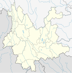
 Location of Binchuan County (pink) and Dali Prefecture (yellow) within Yunnan province of China | |
 Binchuan Location of the seat in Yunnan | |
| Coordinates: 25°49′48″N 100°35′25″E / 25.8299°N 100.5904°ECoordinates: 25°49′48″N 100°35′25″E / 25.8299°N 100.5904°E | |
| Country | People's Republic of China |
| Province | Yunnan |
| Autonomous prefecture | Dali |
| Area | |
| • Total | 2,627 km2 (1,014 sq mi) |
| Population | |
| • Total | 330,000 |
| • Density | 130/km2 (330/sq mi) |
| Time zone | UTC+8 (CST) |
| Postal code | 671600 |
| Area code(s) | 0872 |
| Köppen climate classification | Cwa[citation needed] |
| Website | bch |
Binchuan County (simplified Chinese: 宾川县; traditional Chinese: 賓川縣; pinyin: Bīnchuān Xiàn) is a county in the Dali Bai Autonomous Prefecture located in the west of Yunnan Province, China.
Mount Jizu is located in Binchuan County.
Ethnic groups[]
There are 251 Lahu in Binchuan County, most of whom reside in the following villages of Zhongying Ethnic Lisu Township (钟英傈僳族乡) (Dali Ethnic Gazetteer 2009:251).
- Zhimadeng Village (芝麻登村): Mizideng (米子登)
- Zhaokala Village (赵卡拉村): Yuexia (越下), Baiyangqing (白羊箐), Tanggudi (唐古地)
The Guola (过拉) people consists of 63 individuals in East Caijiawan (东蔡家湾) of Binchuan County (You 2013:134).[1] Their autonym is Nipu (尼濮), and they are most closely related to the Yi of Dayao (大姚) and Yanfeng (盐丰). The Guola of Binchuan had originally migrated from Yanfeng County (盐丰县).
Climate[]
| showClimate data for Binchuan (1981−2010) |
|---|
References[]
- ^ You Weiqiong (尤伟琼) (2013). 云南民族识别研究 [Classifying ethnic groups of Yunnan]. Beijing: Ethnic Publishing House (民族出版社).
External links[]
Categories:
- County-level divisions of Dali Bai Autonomous Prefecture
- Yunnan geography stubs
