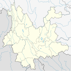
Zhenyuan Yi, Hani and Lahu Autonomous County
Zhenyuan County
镇沅县 | |
|---|---|
| 镇沅彝族哈尼族拉祜族自治县 Zhenyuan Yi, Hani and Lahu Autonomous County | |
 Location of Zhenyuan County (pink) and Pu'er City (yellow) within Yunnan | |
 Zhenyuan Location of the seat in Yunnan | |
| Coordinates: 24°00′14″N 101°06′32″E / 24.004°N 101.109°ECoordinates: 24°00′14″N 101°06′32″E / 24.004°N 101.109°E | |
| Country | People's Republic of China |
| Province | Yunnan |
| Prefecture | Pu'er |
| GB/T 2260 CODE[1] | 530825 |
| Area | |
| • Total | 4,223 km2 (1,631 sq mi) |
| Elevation | 1,741 m (5,712 ft) |
| Population | |
| • Total | 201,526 |
| • Density | 48/km2 (120/sq mi) |
| Time zone | UTC+8 (China Standard Time) |
| Postal code | 666500[2] |
| Area code(s) | 0879[2] |
| Website | www |
| 1Yunnan Statistics Bureau [1] 2Puer Gov. [2] 3Yunnan Portal [3] | |
Zhenyuan Yi, Hani and Lahu Autonomous County (simplified Chinese: 镇沅彝族哈尼族拉祜族自治县; traditional Chinese: 鎮沅彝族哈尼族拉祜族自治縣; pinyin: Zhènyuán Yízú Hānízú Lāhùzú Zìzhìxiàn) is an autonomous county under the jurisdiction of Pu'er City, in the west central part of Yunnan Province, China.
Administrative divisions[]
In the present, Zhenyuan Yi, Hani and Lahu Autonomous County has 8 towns and 1 township.
- 8 towns
- Enle (恩乐镇)
- Anban (按板镇)
- Mengda (勐大镇)
- Zhedong (者东镇)
- Jiujia (九甲镇)
- Gucheng (古城镇)
- Zhentai (振太镇)
- Heping (和平镇)
- 1 township
- Tianba (田坝乡)
Ethnic groups[]
The Zhenyuan County Almanac (1995:74-79) lists the following ethnic groups and locations. All population statistics, given in parentheses, are as of 1988.
- Yi
- Luoluo 倮倮 (30,065 people)
- Lawu 拉乌 (6,455 people): Zhedong 者东乡 Maidi 麦地,[3] Madeng 马邓;[4] Jiading 九甲乡 Santai 三台,[5] Guoji 果吉,[6] Jiujia 九甲[7]
- Xiangtang 香堂 (12,312)
- Mili 米利 (1,127 people): Liwei 里崴乡 Xinjie 新街村 Laomahe 老马河社,[8] Pingdi 平地村 Hetaohe 核桃河社,[9] Wenduo 文夺村[10] Longshucao 龙树槽社; Mengda 勐大乡 Wenlai 文来村,[11] small parts of Zhentai 振太乡 Taitou 台头村[12]
- Menghua 蒙化 (345 people): Zhentai 振太, Liwei 里崴, Mengda 勐大, part of Enle 恩乐镇
- Ache 阿车 (117 people): Heping 和平乡 Yakou 丫口村,[13] Zhedong 者东乡 Zhangpen 樟盆村[14]
- Shansu 山苏 (150 people): Zhedong 者东乡 Zhangpen 樟盆村,[14] Heping 和平乡 Yakou 丫口村[13]
- Guaigun 拐棍 (309 people): Tianba 田坝乡 Tianba 田坝,[15] Santai/Sanhe 三台/三合,[16] Lianhe 联合,[17] Minqiang 民强[18]
- Luowu 罗武 (50 people): Heping 和平乡 Yakou 丫口村[13]
- Hani
- Lahu (autonym: Guocuo 锅挫; exonyms: Kucong 苦聪, Guzong 古宗, Kagui 卡桂)
Climate[]
| showClimate data for Zhenyuan (1981−2010) |
|---|
References[]
- ^ http://www.stats.net/tjbz/xzqhdm/index.htm. Retrieved January 29, 2009. Missing or empty
|title=(help)[dead link] - ^ Jump up to: a b Area Code and Postal Code in Yunnan Province Archived 2007-11-07 at the Wayback Machine
- ^ http://www.ynszxc.net/villagePage/vIndex.aspx?departmentid=167423
- ^ http://www.ynszxc.net/villagePage/vIndex.aspx?departmentid=166247
- ^ http://www.ynszxc.net/villagePage/vIndex.aspx?departmentid=161853
- ^ http://www.ynszxc.net/villagePage/vIndex.aspx?departmentid=161852
- ^ http://www.ynszxc.net/villagePage/vIndex.aspx?departmentid=161021
- ^ http://www.ynszxc.net/villagePage/vIndex.aspx?departmentid=162708
- ^ http://www.ynszxc.net/villagePage/vIndex.aspx?departmentid=157856
- ^ http://www.ynszxc.net/villagePage/vIndex.aspx?departmentid=162744
- ^ http://www.ynszxc.net/villagePage/vIndex.aspx?departmentid=155408
- ^ http://www.ynszxc.net/villagePage/vIndex.aspx?departmentid=163069
- ^ Jump up to: a b c http://www.ynszxc.net/villagePage/vIndex.aspx?departmentid=164165
- ^ Jump up to: a b http://www.ynszxc.net/villagePage/vIndex.aspx?departmentid=167375
- ^ http://www.ynszxc.net/villagePage/vIndex.aspx?departmentid=158015
- ^ http://www.ynszxc.net/villagePage/vIndex.aspx?departmentid=155702
- ^ http://www.ynszxc.net/villagePage/vIndex.aspx?departmentid=155712
- ^ http://www.ynszxc.net/villagePage/vIndex.aspx?departmentid=155719
- ^ http://www.ynszxc.net/villagePage/vIndex.aspx?departmentid=135253
- ^ http://www.ynszxc.net/villagePage/vIndex.aspx?departmentid=135245
- ^ http://www.ynszxc.net/villagePage/vIndex.aspx?departmentid=167312
- ^ http://www.ynszxc.net/villagePage/vIndex.aspx?departmentid=166498
External links[]
Categories:
- County-level divisions of Pu'er City
- Hani autonomous counties
- Lahu autonomous counties
- Yi autonomous counties
