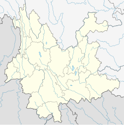
Lanping Bai and Pumi Autonomous County
Lanping County
兰坪县 | |
|---|---|
| 兰坪白族普米族自治县 Lanping Bai and Pumi Autonomous County | |
 Jinding, the county seat | |
 Location of Lanping County (pink) and Nujiang Prefecture (yellow) within Yunnan province | |
 Lanping Location of the seat in Yunnan | |
| Coordinates: 26°35′43″N 99°19′12″E / 26.59528°N 99.32000°ECoordinates: 26°35′43″N 99°19′12″E / 26.59528°N 99.32000°E | |
| Country | People's Republic of China |
| Province | Yunnan |
| Prefecture | Nujiang |
| Area | |
| • Total | 4,455 km2 (1,720 sq mi) |
| Population | |
| • Total | 190,000 |
| • Density | 43/km2 (110/sq mi) |
| Time zone | UTC+8 (CST) |
| Postal code | 671400 |
| Area code(s) | 0886 |
| Website | www |
Lanping Bai and Pumi Autonomous County (simplified Chinese: 兰坪白族普米族自治县; traditional Chinese: 蘭坪白族普米族自治縣; pinyin: Lánpíng Báizú Pǔmǐzú Zìzhìxiàn; Bai: Ketdant Baifcuf Pupmipcuf zibzibxiand) is located in Nujiang Lisu Autonomous Prefecture, Yunnan province, China.
Climate[]
Like most of Yunnan, Lanping has a dry-winter subtropical highland climate (Köppen climate classification: Cwb )
| showClimate data for Lanping (1981−2010) |
|---|
See also[]
- Three Parallel Rivers of Yunnan Protected Areas - Unesco World Heritage Site
External links[]
| Wikimedia Commons has media related to Lanping Bai and Pumi Autonomous County. |
- Lanping County (in Chinese)
Categories:
- County-level divisions of Nujiang Prefecture
- Bai people
- Pumi people
- Autonomous counties of the People's Republic of China
- Yunnan geography stubs
