From Wikipedia, the free encyclopedia
Autonomous county in Yunnan, People's Republic of China
Weixi County |
|---|
|
Weixi Lisu Autonomous County
维西傈僳族自治县 · འབའ་ལུང་ལི་སུའུ་རིགས་རང་སྐྱོང་རྫོང་། |
 Location of Weixi County (pink) and Diqing Prefecture (yellow) within Yunnan |
| Country | People's Republic of China |
|---|
| Province | Yunnan |
|---|
| Prefecture | Diqing |
|---|
|
| • Total | 4,661 km2 (1,800 sq mi) |
|---|
|
| • Total | 152,200 |
|---|
| • Density | 33/km2 (85/sq mi) |
|---|
| Time zone | UTC+8 (CST) |
|---|
| Postal code | 674600 |
|---|
| Area code(s) | 0887 |
|---|
| Website | www.wx.yn.gov.cn |
|---|
Weixi Lisu Autonomous County
(simplified Chinese: 维西傈僳族自治县; traditional Chinese: 維西傈僳族自治縣; pinyin: Wéixī Lìsùzú Zìzhìxiàn; Tibetan: འབའ་ལུང་ལི་སུའུ་རིགས་རང་སྐྱོང་རྫོང།, Wylie: 'ba'-lung li-su'u-rigs rang-skyong rdzong, ZYPY: Balung Lisurig Ranggyong Zong; Lisu: ꓪꓰꓲ-ꓫꓲꓸ ꓡꓲ-ꓢꓴ ꓫꓵꓽ ꓝꓲꓸ ꓛꓬꓽ ꓫꓯꓽ ) is located in Diqing Prefecture, in the northwest of Yunnan Province, China.
Climate[]

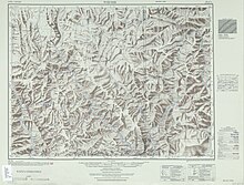
Weixi (labelled as WEI-HSI
維西) (1953)
| showClimate data for Weixi (1981−2010)
|
| Month
|
Jan
|
Feb
|
Mar
|
Apr
|
May
|
Jun
|
Jul
|
Aug
|
Sep
|
Oct
|
Nov
|
Dec
|
Year
|
| Record high °C (°F)
|
23.0
(73.4)
|
23.2
(73.8)
|
26.2
(79.2)
|
28.0
(82.4)
|
31.1
(88.0)
|
31.9
(89.4)
|
30.9
(87.6)
|
31.1
(88.0)
|
30.5
(86.9)
|
27.2
(81.0)
|
23.1
(73.6)
|
21.3
(70.3)
|
31.9
(89.4)
|
| Average high °C (°F)
|
12.3
(54.1)
|
12.7
(54.9)
|
14.7
(58.5)
|
17.7
(63.9)
|
22.0
(71.6)
|
24.6
(76.3)
|
24.7
(76.5)
|
24.4
(75.9)
|
22.6
(72.7)
|
19.9
(67.8)
|
16.7
(62.1)
|
13.8
(56.8)
|
18.8
(65.9)
|
| Daily mean °C (°F)
|
4.2
(39.6)
|
5.4
(41.7)
|
7.8
(46.0)
|
11.0
(51.8)
|
15.3
(59.5)
|
18.4
(65.1)
|
18.8
(65.8)
|
18.2
(64.8)
|
16.5
(61.7)
|
12.7
(54.9)
|
8.0
(46.4)
|
4.8
(40.6)
|
11.8
(53.2)
|
| Average low °C (°F)
|
−1.6
(29.1)
|
0.1
(32.2)
|
2.9
(37.2)
|
6.3
(43.3)
|
10.2
(50.4)
|
14.2
(57.6)
|
15.2
(59.4)
|
14.6
(58.3)
|
13.1
(55.6)
|
8.2
(46.8)
|
2.2
(36.0)
|
−1.3
(29.7)
|
7.0
(44.6)
|
| Record low °C (°F)
|
−8.0
(17.6)
|
−6.8
(19.8)
|
−2.8
(27.0)
|
−0.1
(31.8)
|
4.3
(39.7)
|
8.4
(47.1)
|
9.5
(49.1)
|
9.3
(48.7)
|
2.7
(36.9)
|
−0.3
(31.5)
|
−3.3
(26.1)
|
−8.9
(16.0)
|
−8.9
(16.0)
|
| Average precipitation mm (inches)
|
26.9
(1.06)
|
63.8
(2.51)
|
120.4
(4.74)
|
91.6
(3.61)
|
59.2
(2.33)
|
87.1
(3.43)
|
161.9
(6.37)
|
157.3
(6.19)
|
112.4
(4.43)
|
59.8
(2.35)
|
19.1
(0.75)
|
12.0
(0.47)
|
971.5
(38.24)
|
| Average relative humidity (%)
|
56
|
63
|
68
|
70
|
68
|
73
|
78
|
80
|
80
|
75
|
64
|
56
|
69
|
| Source: China Meteorological Data Service Center
|
External links[]
Coordinates:  27°12′58″N 99°15′58″E / 27.216°N 99.266°E / 27.216; 99.266
showAuthority control  |
|---|
| General | |
|---|
| National libraries | |
|---|
Categories:
- County-level divisions of Diqing Tibetan Autonomous Prefecture
- Lisu people
- Autonomous counties of the People's Republic of China
- Yunnan geography stubs
Hidden categories:
- Articles with short description
- Short description is different from Wikidata
- Articles containing Chinese-language text
- Pages using infobox settlement with no coordinates
- Articles containing simplified Chinese-language text
- Articles containing traditional Chinese-language text
- Articles containing Standard Tibetan-language text
- Coordinates on Wikidata
- Articles with VIAF identifiers
- Articles with LCCN identifiers
- Articles with WORLDCATID identifiers
- All stub articles


