Panlong District
Panlong
盘龙区 | |
|---|---|
District | |
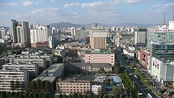 Panlong's Skyline | |
 Location of the 4 contiguous Kunming City Districts (pink) and Kunming prefecture (yellow) within Yunnan province of China | |
| Country | People's Republic of China |
| Province | Yunnan |
| Prefecture | Kunming |
| Established | October 1956 |
| Area | |
| • Total | 340 km2 (130 sq mi) |
| Population (2004) | |
| • Total | 600,000 |
| • Density | 1,800/km2 (4,600/sq mi) |
| Time zone | UTC+8 (CST) |
| Postal code | 650000[1] |
| Area code(s) | 0871 |
| Website | www |
| Kunming Gov Yunnan Portal | |
Panlong District (simplified Chinese: 盘龙区; traditional Chinese: 盤龍區; pinyin: Pánlóng Qū) is one of seven districts of the prefecture-level city of Kunming, the capital of Yunnan Province, Southwest China.
Administrative divisions[]
Tuodong, Gulou, Donghua, Lianmeng, Jinchen, Qingyun, Ciba and Longquan Sub-district Offices, Shuanglong Village and Songhua Village
Demography[]
Panlong District stretches from Kunming's downtown area to the city's northern ring road. Recent boundary changes to accommodate the city's rapid growth have left the district with a population of around 700,000 people (as of 2006). Slightly more than half of them are permanent residents; 160,000 are rural migrants registered with the authorities as temporary residents, and a further 160,000 or so are ‘floating’ migrants with no formal registration in the locality. The migrants come from Yunnan's rural areas, as well as from Sichuan, Jiangsu, Hebei, Xinjiang and Guizhou.[2]
References[]
- ^ Area Code and Postal Code in Yunnan Province
- ^ Youth justice: piloting rights based approaches Archived 2011-07-08 at the Wayback Machine China Development Brief (2006-01-25)
External links[]
| show Authority control |
|---|

- County-level divisions of Kunming