Yuanmou County
This article may require cleanup to meet Wikipedia's quality standards. The specific problem is: tone, formatting, and content. (July 2017) |
Yuanmou County
元谋县 | |
|---|---|
County | |
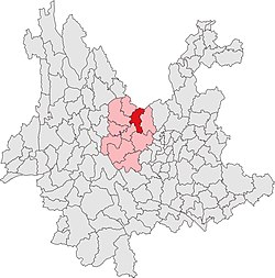 Location in Yunnan | |
| Country | People's Republic of China |
| Province | Yunnan |
| Autonomous prefecture | Chuxiong |
| Area | |
| • Total | 2,021 km2 (780 sq mi) |
| Population | |
| • Total | 210,000 |
| • Density | 100/km2 (270/sq mi) |
| Time zone | UTC+8 (CST) |
| Postal code | 651300 |
| Area code(s) | 0878 |
| Website | yuanmou |
Yuanmou County (simplified Chinese: 元谋县; traditional Chinese: 元謀縣; pinyin: Yuánmóu Xiàn; Chuxiong Yi script: ![]() , IPA: /pʻə33 lə21 bu33/) is under the administration of the Chuxiong Yi Autonomous Prefecture, in the north of Yunnan province, China, bordering Sichuan province to the north.
, IPA: /pʻə33 lə21 bu33/) is under the administration of the Chuxiong Yi Autonomous Prefecture, in the north of Yunnan province, China, bordering Sichuan province to the north.
The famous Yuanmou Man was found in Yuanmou County in 1965.
Administrative divisions[]
Yuanmou County has 3 towns and 7 townships.[1]
- 3 towns
- (元马镇)
- (黄瓜园镇)
- (羊街镇)
- 7 townships
|
|
Tourist Resources[]
Besides the big discovery of Yuanmou Man, Yuanmou County is also famous for its Tulin, which literally means earth forest.It is a natural landscape composed of earth columns or pillars forming like immense forest. The unique landscape was formed by geological movement and soil erosion one or two million years ago. It is named for its shape like immense forest and the main composition of the expansion is earth.There are three scenic areas, which are Wumao Earth Forest, Langbapu Earth Forest and Banguo Earth Forest. Wumao and Langbapu have been developed as scenic areas. Yuanmou Earth Forest has been more and more popular these years.[2]
References[]
- ^ "国家统计局" (in Chinese). National Bureau of Statistics of the People's Republic of China. Retrieved 2021-12-07.
- ^ "Yuanmou Earth Forest" ChinaTour.net Accessed 2014-4-16
External links[]
| Paleolithic | |
|---|---|
| Neolithic |
|
| Chalcolithic | |
| Bronze Age |
|
Coordinates: 25°43′04″N 101°51′40″E / 25.71778°N 101.86111°E

This Yunnan location article is a stub. You can help Wikipedia by . |
- County-level divisions of Chuxiong Prefecture
- Yunnan geography stubs