Ximeng Va Autonomous County
Ximeng County
西盟县 | |
|---|---|
| 西盟佤族自治县 Ximeng Va Autonomous County | |
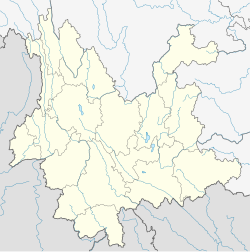
 Location of Ximeng County (pink) and Pu'er City (yellow) within Yunnan | |
 Ximeng Location of the seat in Yunnan | |
| Coordinates: 22°38′40″N 99°35′24″E / 22.6445°N 99.5901°ECoordinates: 22°38′40″N 99°35′24″E / 22.6445°N 99.5901°E | |
| Country | People's Republic of China |
| Province | Yunnan |
| Prefecture-level city | Pu'er |
| GB/T 2260 CODE[1] | 530829 |
| Area | |
| • Total | 1,391 km2 (537 sq mi) |
| Elevation | 1,214 m (3,983 ft) |
| Population | |
| • Total | 81,596 |
| • Density | 59/km2 (150/sq mi) |
| Time zone | UTC+8 (China Standard Time) |
| Postal code | 665700[2] |
| Area code(s) | 0879[2] |
| Website | Archived 2008-09-18 at the Wayback Machine |
| 1Yunnan Statistics Bureau [1] 2Puer Gov. [2] 3Yunnan Portal [3] | |
Ximeng Va Autonomous County (Chinese: 西盟佤族自治县; pinyin: Xīméng Wǎzú Zìzhìxiàn) is an autonomous county under the jurisdiction of Pu'er City, in the southwest of Yunnan Province, China, bordering Myanmar's Shan State to the west. Wa/Va people, who speak the Wa language, are the main inhabitants in Ximeng County.
Administrative divisions[]
In the present, Ximeng Va Autonomous County has 5 towns 1 township and 1 ethnic township.
- 5 towns
- (勐梭镇)
- (勐卡镇)
- (翁嘎科镇)
- (中课镇)
- Xinchang (新厂镇)
- 1 township
- (岳宋乡)
- 1 ethnic township
- (力所拉祜族乡)
Climate[]
| Climate data for Ximeng (1981−2010) | |||||||||||||
|---|---|---|---|---|---|---|---|---|---|---|---|---|---|
| Month | Jan | Feb | Mar | Apr | May | Jun | Jul | Aug | Sep | Oct | Nov | Dec | Year |
| Record high °C (°F) | 27.4 (81.3) |
28.6 (83.5) |
31.6 (88.9) |
33.4 (92.1) |
33.5 (92.3) |
33.2 (91.8) |
31.4 (88.5) |
31.8 (89.2) |
31.4 (88.5) |
30.4 (86.7) |
28.0 (82.4) |
25.8 (78.4) |
33.5 (92.3) |
| Average high °C (°F) | 22.3 (72.1) |
24.5 (76.1) |
27.2 (81.0) |
29.0 (84.2) |
27.8 (82.0) |
27.1 (80.8) |
26.3 (79.3) |
27.2 (81.0) |
27.2 (81.0) |
26.2 (79.2) |
23.7 (74.7) |
21.7 (71.1) |
25.9 (78.5) |
| Daily mean °C (°F) | 14.3 (57.7) |
16.1 (61.0) |
19.1 (66.4) |
21.4 (70.5) |
22.1 (71.8) |
22.7 (72.9) |
22.5 (72.5) |
22.7 (72.9) |
22.1 (71.8) |
20.8 (69.4) |
17.8 (64.0) |
14.6 (58.3) |
19.7 (67.4) |
| Average low °C (°F) | 9.3 (48.7) |
10.2 (50.4) |
13.1 (55.6) |
15.9 (60.6) |
18.2 (64.8) |
20.1 (68.2) |
20.2 (68.4) |
20.1 (68.2) |
19.2 (66.6) |
17.6 (63.7) |
13.4 (56.1) |
10.5 (50.9) |
15.7 (60.2) |
| Record low °C (°F) | 5.1 (41.2) |
6.3 (43.3) |
8.7 (47.7) |
10.4 (50.7) |
12.4 (54.3) |
17.6 (63.7) |
18.1 (64.6) |
16.4 (61.5) |
10.9 (51.6) |
11.1 (52.0) |
7.9 (46.2) |
6.1 (43.0) |
5.1 (41.2) |
| Average precipitation mm (inches) | 11.3 (0.44) |
21.4 (0.84) |
27.4 (1.08) |
84.6 (3.33) |
195.3 (7.69) |
442.1 (17.41) |
540.35 (21.27) |
461.3 (18.16) |
277.8 (10.94) |
203.7 (8.02) |
92.1 (3.63) |
25.7 (1.01) |
2,383.05 (93.82) |
| Average relative humidity (%) | 75 | 65 | 52 | 66 | 78 | 86 | 89 | 87 | 84 | 83 | 81 | 80 | 77 |
| Source: China Meteorological Data Service Center | |||||||||||||
References[]
- ^ "Archived copy". Archived from the original on February 21, 2009. Retrieved January 29, 2009.CS1 maint: archived copy as title (link)
- ^ Jump up to: a b Area Code and Postal Code in Yunnan Province
External links[]
Categories:
- County-level divisions of Pu'er City
- Wa autonomous counties
- Yunnan geography stubs