List of lakes of Pakistan
Pakistan is home to many natural and man made lakes and reservoirs. The largest lake in Pakistan is the Manchar Lake, which is also the largest lake in South Asia. The lake is spread over an area of over 260 square kilometres (100 square miles).[1] The highest lakes in Pakistan are the Paristan lake and Shimshal lake, which both are at an altitude of over 4,755 metres (15,600 ft).[2] The second highest lake in Pakistan is the Karambar Lake, which is located at an altitude of 4,272 metres (14,016 ft), is the 33rd highest lake in the world.[3]
Natural lakes[]
Gilgit Baltistan[]
| class="sortable" ! width="12%" . Agriculture Lake Soghaa | Image | Elevation | Location | Description | Notes |
|---|---|---|---|---|---|
| Attabad Lake | 
|
Hunza Valley, Gilgit-Baltistan | With the area of about 13.5 square km it the largest lake of Gilgit-Baltistan. Also known as Hunza Lake the lake was created in January 2010 due to massive landslides blocking Hunza River. | [4] | |

|
4,512 metres (14,803 ft) | Barah Valley, Ghanche District, Gilgit-Baltistan | Barah lake referred to two lakes in the mountain of Barah town. The area of this lake is 0.21 SQ KM | ||
| 2,900 metres (9,500 ft) | , Hunza District, Gilgit-Baltistan | The Lake lies in the Upper Hunza region of Gilgit-Baltistan in Pakistan. It is just north of the massifs of Batura, at 7,795 metres (25,574 ft), and Passu, at 7,500 metres (24,600 ft). The glacier flows west to east. | |||
| Borith Lake | 
|
2,600 metres (8,500 ft) | Hunza, Gilgit–Baltistan | Borith Lake is a saline water lake, located to the north of in a village near Hussaini, Gojal, in the upper Hunza. | [5][6] |

|
4,771.1 metres (15,653 ft) | Khaplu Valley, Gilgit–Baltistan | Area of Dakholi Lake as calculated by QT at ArcGIS Esri is 0.07 SQ KM as of September 2020. | ||
| 4,599.9 metres (15,092 ft) | Khaplu Valley, Gilgit–Baltistan | Ghanche lake is the source of ghanche stream that waters khaplu town. The area of Ghanche Lake calculated by Arc GIS as of September 2020 by QT is 0.16 SQ KM. | |||
| 2,862.2 metres (9,390 ft) | Kharmang Valley, Gilgit–Baltistan | ||||
| Handarap Lake | 
|
3,285 metres (10,778 ft) | Ghizer Valley, Gilgit–Baltistan | also known as Shandoor lake. | |
| 2,750 metres (9,020 ft) | , Hunza District, Gilgit-Baltistan | Hasanabad lake also known as Shispare lake, located in hassanbad valley off Hunza, formed due to blockage of shispare glacier thus forming a lake having 1.4 km in length. The area of this lake is 0.35 SQ KM( growing day by day). It is 2 hours hike from hassanabad bridge, from where you can go to Batura(7795m), Shispare (7611m), Muchu Chhish (7452m) which is also the highest legal unclimbed mountain in the world and many other 7000m mountains. | |||
| 4,126 metres (13,537 ft) | Khaplu Valley, Gilgit–Baltistan | Hrkolong lake is the source of Hnajuluba stream that waters khaplu, Surmo and youchung broq (high steppes fields). | |||
| Khalti Lake | 
|
Khalti, Ghizer District | [7] | ||
| Paristan Lake | Skardu, Skardu District | ||||

|
2,190 metres (7,190 ft) | Katpanah, Skardu Valley
35°18'57.8"N 75°34'42.5"E |
The only lake in downtown of skardu city. | ||
| Naltar lakes | 
|
Naltar Valley, Gilgit-Baltistan | These are three lakes. | [8] | |
| Lower Kachura Lake | 
|
2,500 metres (8,200 ft) | Skardu District, Gilgit–Baltistan | The lake is also known as Shangrila Lake and is located at a drive of about 20 minutes from Skardu town. Shangrila was named after a book titled Lost Horizon by James Hilton. Shangri-la is a Chinese word meaning "Heaven on earth". | [9] |
| Phander Lake | 
|
Gupis-Yasin District, Gilgit-Baltistan | |||
| Rama Lake | 
|
2,600 metres (8,500 ft) | Astore Valley, Gilgit–Baltistan | Rama Lake is located nine kilometers away from the valley of Astore in Northern Areas. | [10] |
| Rush Lake | 
|
4,693 metres (15,397 ft) | Nagar Valley, Gilgit–Baltistan | Rush Lake is a high altitude lake located near Rush Pari Peak. At over 4,694 meters, Rush is the highest lake in Pakistan and one of the highest alpine lakes in the world. It is located about 15 km north of Miar Peak and Spantik (Golden Peak), which are in the Nagar valley. | [3][11] |
| Satpara Lake | 
|
2,636 metres (8,648 ft) | Skardu Valley, Gilgit–Baltistan | Satpara Lake is located in Skardu Valley and is one of the (Area=4.5square km, 2nd largest of gilgit baltistan)largest fresh water lakes in Pakistan. It supplies water for the town of Skardu. | [12] |
| Sheosar Lake | 
|
4,142 metres (13,589 ft) | Deosai Plains, Gilgit–Baltistan | Sheosar Lake is situated in the Deosai Plateau, which is one of the highest plateaus of the world. | [3][13][14] |
| 4,755 metres (15,600 ft) | Hunza District, Gilgit–Baltistan
Shimshal Lakes, Hunza |
There are 2 lakes having a height of 4,755 metres (15,600 ft), making it the highest lake in Pakistan. These lakes are almost 3 hours hiking from Shimshal valley in Hunza, Gilgit Baltistan, Pakistan. | |||
| Upper Kachura Lake | 
|
2,500 metres (8,200 ft) | Skardu District, Gilgit–Baltistan | The lake is surrounded with wild apricot gardens and has a depth of around 70 meters. Due to rough terrain of the surrounding area, this lake is not well explored. | |
| Zharba Lake | 2,500 metres (8,200 ft) | Shigar Valley, Gilgit–Baltistan | The only lake in Shigar valley. |

sahiwal ka name ka ha (2365)-00lj ;mn ;pihf
Azad Kashmir,Punjab, KPK, Sindh and Balochistan[]
| Name | Image | Elevation | Location | Description | Notes | |
|---|---|---|---|---|---|---|
| Ansoo Lake | 
|
4,126 metres (13,537 ft) | Kaghan Valley, Khyber Pakhtunkhwa | Ansoo Lake is a high-altitude lake (4,126 metres (13,537 ft)) located in the Kaghan Valley in Mansehra District of Khyber Pakhtunkhwa. It is near Malika Parbat in the Himalayan range. | [15] | |
| Baghsar Lake | 975 metres (3,199 ft) | Samahni Valley, Bhimber District | The lake is nearly half a kilometer long and overlooks the Bandala Valley. | [16] | ||
| Chitta Katha Lake | 
|
3,962 metres (12,999 ft) | Shonter Valley, Azad Kashmir | Chitta Katha Lake is located in Shonter Valley of Azad Kashmir. | [17] | |
| Drigh Lake | 
|
Qambar Shahdadkot District, Sindh | Drigh Lake is Located in Qambar Shahdadkot District in Sindh, Pakistan, It is 29 km away from Larkana city and 7 km away from Qambar town. | [18] | ||
| Dudipatsar Lake | 
|
3,800 metres (12,500 ft) | Kaghan Valley, Khyber Pakhtunkhwa | The lake lies in the extreme north of Kaghan Valley at a height of 3,800 metres (12,500 ft). The term dudi in Urdu means white and sar means lake. | [19] | |
| Kaghan Valley, Khyber Pakhtunkhwa | [20] | |||||
| Karambar Lake | 
|
4,272 metres (14,016 ft) | , Chitral | Karambar Lake is the 33rd highest lakes in the world. The approximate length of the lake is 3.9 km, width is 2 km and, average depth is 52m. | [3][21] | |
| Ganga Lake | Bagh District, Azad Kashmir | |||||
| Hadero Lake | Thatta District, Sindh | Hadero is a brackish water lake in Sindh. The lake was declared wildlife sanctuary in 1977. The lake has a surface area of 1321 hectares. | ||||
| Haleji Lake | 
|
Thatta, Sindh | The lake is located at about 70 km from Karachi and is the largest water fowl reserve in Asia. | [23][24] | ||
| Hamal Lake | Qamber Shahdadkot District, Sindh | Hamal Lake is located in Qamber Shahdadkot District in Sindh, Pakistan. | [25] | |||
| Hanna Lake | 
|
1,898 metres (6,227 ft) | Quetta, Balochistan | Hanna Lake is located 10 km from Quetta, near Urak Valley in Balochistan. | [26] | |
| Jahlar Lake | 828 metres (2,717 ft) | Soon Valley, Punjab | Jahlar Lake is part of Uchhali Wetland Complex in Soon Valley | |||
| Kallar Kahar | 
|
Chakwal District, Punjab | The salt water lake is located near Salt Range in Chakwal District, 125 km from Rawalpindi. | [27] | ||
| Keenjhar Lake | 
|
21 metres (69 ft) | Thatta, Sindh | The lake is also called Kalri Lake and is one of the largest freshwater lakes in Pakistan. The Sindhi legend of Noori Jam Tamachi took place around the lake, and to this day there is a shrine in the middle of the lake marking Noor's grave. | [23][26] | |
| Khabikki Lake | 
|
Khushab District, Punjab | It is a salt water lake located in the southern Salt Range. The lake is named after a nearby village, Khabikki. | [28] | ||
| Kundol Lake | 
|
2,743 metres (8,999 ft) | Utror, Swat Valley, Khyber Pakhtunkhwa | This lake is located in the north of Utror via Ladu valley. | ||
| Lulusar Lake | 
|
3,410 metres (11,190 ft) | Naran Valley, Khyber Pakhtunkhwa | The lake is the main source of the Kunhar River and has a baby lake beside it. The word "sar" means "lake" in Shina. | [29] | |
| Mahodand Lake | 
|
2,900 metres (9,500 ft) | Kalam Valley, Khyber Pakhtunkhwa | The lake is located 40 km from Kalam Valley in the valley of Ushu. | [30] | |
| Manchar Lake | 
|
34 metres (112 ft) | Sindh | Lake Manchar is the largest freshwater lake in Pakistan and one of the largest in Asia. It is located west of the Indus River in Sindh. The area of the lake fluctuates with the seasons from as little as 350 km² to 520 km². The lake collects water from numerous small streams in the Kirthar Mountains and empties into the Indus River. | [23][31] | |
| Namal Lake | 
|
Mianwali, Punjab | Namal Lake is located in Namal Valley, in Mianwali. The lake is spread over an area of 5.5 km2 and was built in 1913 after the construction of Namal Dam. | [32] | ||
| Payee Lake | 
|
2,895 metres (9,498 ft) | Kaghan Valley, Khyber Pakhtunkhwa | Payee Lake is located near Shogran in Payee, surrounded by the Makra Peak, Malika Parbat, and the mountains of Kashmir. | [33] | |
| Pyala Lake | 
|
3,410 metres (11,190 ft) | Kaghan Valley, Khyber Pakhtunkhwa
35°0′27.7524″N 73°56′28.8852″E / 35.007709000°N 73.941357000°E |
Pyala Lake is a very small lake besides the Kunhar River at Jalkhad. Since the lake looks more like a bowl Urde:Pyala (پیالہ) hence it is called Pyala Lake. | [34] | |
| Ratti Gali Lake | 
|
3,700 metres (12,100 ft) | Neelam Valley, Azad Kashmir | The lake is accessible from Dowarian by a 19 kilometers (12 mi) hiking trek. Dowarian is the base camp to this lake. | [35] | |
| Saiful Muluk | 
|
3,224 metres (10,577 ft) | Kaghan Valley, Khyber Pakhtunkhwa | The lake is located in the northern end of Kaghan Valley. The lake has total surface area of over 2.5 square kilometer. The lake is famous for its fairytale of Saiful Maluk | [36] | |
| Saral Lake | 
|
4,100 metres (13,500 ft) | Neelam Valley, Azad Kashmir | This lake can be accessed from Sharda, Neelam valley and Kaghan Valley. | [37] | |
| Shakoor Lake | 24°15′28″N 69°04′20″E / 24.2577°N 69.0721°E | Shakoor Lake is situated on the border between India and Pakistan, its area ranges from 300 square kilometres (120 sq mi) | [38] | |||
| Shonter Lake | 
|
Neelum Valley, Azad Kashmir | This is a small lake located in the Azad Kashmir. | |||
| Siri Lake | 
|
2,590 metres (8,500 ft) | Kaghan Valley, Khyber Pakhtunkhwa | Siri Lake is situated near Shogran in Siri, on the way to Payee in Kaghan Valley, Pakistan. | [39] | |
| Spin Khwar Lake | 
|
Swat Valley, Khyber Pakhtunkhwa | [40] | |||
| Subri Lake | Muzaffarabad, Azad Kashmir | Subri lake, also known as Langarpura Lake, is situated 10 kilometers out of Muzaffarabad, where the Jhelum River widens to form the lake. | [41] | |||
| Swaik Lake (Khandowa Lake) | 
|
Khandowa Village Kallar Kahar Tehsil, Chakwal District | Swaik Lake or Khandowa Lake(Urdu: کھنڈوعہ) is a lake situated at 10 km from the Tehsil Kallar Kahar, Chakwal District and 30 kilometers southwest of Chakwal along the motorway. | [42] | ||
| Uchhali Lake | 
|
1,522 metres (4,993 ft) | Soan Sakaser Valley, Salt Range | The lake is located in the southern salt range and has brackish water. | [43] |
Artificial lakes and reservoirs[]
| Name | Image | Elevation | Location | Description | Notes |
|---|---|---|---|---|---|
| Banjosa Lake | 
|
1,981 metres (6,499 ft) | Poonch District, Azad Kashmir | Banjosa is an artificial lake and a tourist attraction near the city of Rawalakot in District Poonch in Azad Kashmir. | [44] |
| Chotiari Lake | Sanghar District, Sindh | Chotiari Lake is an artificial water reservoir situated 35 km away from the Sanghar town in Sanghar District, Sindh. | [45] | ||
| Hub Lake | 
|
Karachi and Lasbela District on Sindh and Balochistan border | Hub Lake is an artificial reservoir 56 km away from Karachi on Sindh and Balochistan border. | [46] | |
| Khanpur Lake | 
|
Khanpur, Khyber Pakhtunkhwa
28°64′91″N 70°65′14″E |
It is situated in Khanpur village, 15 kilometres (9.3 mi) from Haripur. Famous for Water sports and Paragliding. | [47] | |
| Mangla Lake | 
|
Mirpur District, Azad Kashmir | Mangla Lake is an artificial reservoir near Mirpur city in Mirpur District, Azad Kashmir | [48] | |
| Rawal Lake | 
|
Islamabad | Rawal Lake is an artificial reservoir in Islamabad Capital Territory, Pakistan. The lake is spread over an area of 8.8 km2 and is one of the major sources of water for the residents of Islamabad and Rawalpindi. Rawal Lake is located within an isolated section of the Malpur village near Margalla Hills National Park. | [49][50] | |
| Simli Lake | 
|
Islamabad | Simli Lake is located 30 km from Islamabad. The lake is formed from the melting snow and natural springs of Murree Hills. Simli Lake is the largest drinking water source for the residents of Islamabad. | [51] | |
| Tanda Lake | 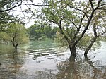
|
Kohat, Khyber Pakhtunkhwa | Tanda Lake is formed from Tanda Dam in Kohat District on Toi River. | [citation needed] | |
| Tarbela Lake | 
|
Haripur District, Khyber Pakhtunkhwa | Tarbela Lake is an artificial reservoir in the Haripur District of North-West Frontier Province. It is near Tarbela Township in the Tarbela range. The name of the lake comes from town of Tarbela in which it is located (Hindko Black Forest). | [52][53] |
See also[]
- Tourism in Pakistan
- List of waterfalls of Pakistan
- List of hill stations of Pakistan
- List of valleys in Pakistan
| Wikimedia Commons has media related to Lakes of Pakistan. |
Notes[]
- ^ "World Bodies of Water Cheatsheet". LASA University. 9 July 2008. Retrieved 9 January 2009.
- ^ "highest lake of pakistan".
- ^ Jump up to: a b c d "The Highest Lake in the World". highestlake.com. 22 September 2004. Retrieved 9 January 2009.
- ^ "Attabad Lake - Hunza Valley". atlasobscura.com. Atlas Obscura. Retrieved 4 November 2019.
- ^ "Ghulkin Village". Hashoo Group. Pearl Tours and Travels. Archived from the original on 20 November 2008. Retrieved 9 January 2009.
- ^ "Borith Lake". X̌ik-Wakhi. 31 July 2008. Retrieved 9 January 2009.
- ^ Mir, Shabbir (25 January 2016). "Secret attraction: Frozen Khalti Lake becomes winter sporting arena". The Express Tribune. Retrieved 4 November 2019.
- ^ "Naltar Lakes in Naltar Valley". skardu.pk. Retrieved 25 August 2018.
- ^ "Shangrila Lake | James Hilton Novel". skardu.pk. 19 November 2016. Retrieved 4 November 2019.
- ^ "Rama Lake". Tourism Development Corporation of Punjab (TDCP). Archived from the original on 3 June 2013. Retrieved 9 January 2009.
- ^ "Rush Lake". EcoExpeditions. Archived from the original on 26 May 2003. Retrieved 9 January 2009.
- ^ "Satpara Lake". Tourism Development Corporation of Punjab (TDCP). Archived from the original on 3 June 2013. Retrieved 9 January 2009.
- ^ "Skardu Pakistan". GLOBOSapiens, Germany. 11 August 2007. Retrieved 9 January 2009.
- ^ "Sheosar Lake @ Deosai". flickr. 12 March 2006. Retrieved 9 January 2009.
- ^ "Ansoo Lake". World 66. 9 July 2008. Archived from the original on 1 May 2013. Retrieved 9 January 2009.
- ^ "Baghsar". Yahoo GeoCities. Archived from the original on 25 October 2009. Retrieved 10 January 2009.
- ^ "About Pakistan". Dollar East. Archived from the original on 5 January 2009. Retrieved 9 January 2009.
- ^ "Drigh Wildlife Sanctuary". Sindh wildlife Department. Archived from the original on 4 May 2013. Retrieved 18 June 2012.
- ^ "15 of the most beautiful lakes in Pakistan". ARY News. 27 March 2018. Retrieved 4 November 2019.
- ^ "Dudibach Sar Travel Guide". Virtual Tourist. 21 October 2005. Retrieved 28 June 2012.
- ^ "Karumbar Lake". Murree.com. Archived from the original on 26 May 2013. Retrieved 9 January 2009.
- ^ "Hudero Sanctuary". Sindh Wildlife Department. Archived from the original on 3 December 2008. Retrieved 10 January 2009.
- ^ Jump up to: a b c "Picturesque Lakes of Pakistan". Pakistan Paedia. Retrieved 9 January 2009.
- ^ "Haliji Lake". (TDCP). Archived from the original on 3 June 2013. Retrieved 9 January 2009.
- ^ "Killer lake continues to bring misery". The News. 29 November 2009. Archived from the original on 21 October 2012. Retrieved 18 June 2012.
- ^ Jump up to: a b "Pakistan Lakes". US National Imagery and Mapping Agency. Index Mundi. 22 January 2006. Retrieved 9 January 2009.
- ^ "Kallar Kahar Map". Google Maps World Gazetter. MapLandia. Retrieved 10 January 2009.
- ^ "Khabikki Lake". Tourism Development Corporation of Punjab (TDCP). Archived from the original on 3 June 2013. Retrieved 10 January 2009.
- ^ "Lulusar Lake". Tourism Development Corporation of Punjab (TDCP). Archived from the original on 3 June 2013. Retrieved 9 January 2009.
- ^ "Mohodand Lake". Tourism Development Corporation of Punjab (TDCP). Archived from the original on 3 June 2013. Retrieved 9 January 2009.
- ^ "Pakistan Lakes". US National Imagery and Mapping Agency. Index Mundi. 22 January 2006. Retrieved 9 January 2009.
- ^ "Namal Lake". Freebase. Archived from the original on 1 May 2013. Retrieved 30 January 2009.
- ^ "Makra-Payee Lake". Peakware.com. Archived from the original on 4 March 2016. Retrieved 10 January 2009.
- ^ "Pyala Lake". Retrieved 11 June 2015.
- ^ "Neelum adventure". Archived from the original on 18 November 2013. Retrieved 11 June 2013.
- ^ "Saiful Malook Lake". Tourism Development Corporation of Punjab (TDCP). Archived from the original on 3 June 2013. Retrieved 9 January 2009.
- ^ Naran Valleys Travel Guide Retrieved 18 June 2012.
- ^ "Relevance of Sir Creek". Retrieved 6 August 2014.
- ^ Kaghan Valley: There's no place like it Retrieved 23 July 2012
- ^ "Spin Khwar (White Stream) Lake". Swat Valley Tourism. Retrieved 14 July 2012.
- ^ "Muzaffarabad City". Muzaffarabad Online. Archived from the original on 1 May 2013. Retrieved 9 January 2009.
- ^ "Swaik Lake - Kallar Kahar". www.spotsclick.com. Retrieved 24 August 2018.
- ^ "Uchali Lake, Soon Valley". Visitsoonvalley.com. Retrieved 24 August 2018.
- ^ "Banjosa Lake". ajktourism.gov.pk. Retrieved 4 November 2019.
- ^ "Chotiari reservoir affectees". Dawn news. 31 October 2011. Retrieved 12 July 2012.
- ^ "Hub Dam". Eco Tourism Development In Pakistan. Archived from the original on 14 January 2016. Retrieved 21 June 2012.
- ^ "Khanpur Lake, Hazara Division". www.pakistantoursguide.com. Retrieved 24 August 2018.
- ^ "Mangla Lake". Tourism in Pakistan. Archived from the original on 2 May 2013. Retrieved 13 July 2012.
- ^ "Rawal Lake | Special Information". global-geography.org. Retrieved 4 November 2019.
- ^ "Archived copy". Archived from the original on 11 April 2012. Retrieved 24 November 2008.CS1 maint: archived copy as title (link)
- ^ "Simli Lake". Tourism Development Corporation of Punjab (TDCP). Archived from the original on 3 June 2013. Retrieved 9 January 2009.
- ^ "Tarbela Dam Project, Haripur District". www.water-technology.net. Retrieved 25 August 2018.
- ^ "Tarbela Lake". Dawn. Retrieved 25 August 2018.
External links[]
| show List of lakes of Asia |
|---|
Categories:
- Lakes of Pakistan
- Lists of lakes by country
- Lists of landforms of Pakistan
- Lists of tourist attractions in Pakistan