List of mountain peaks of Montana
This article comprises three sortable tables of major mountain peaks[1] of the U.S. State of Montana.
The summit of a mountain or hill may be measured in three principal ways:
- The topographic elevation of a summit measures the height of the summit above a geodetic sea level.[2][3] The first table below ranks the 50 highest major summits of Montana by elevation.
- The topographic prominence of a summit is a measure of how high the summit rises above its surroundings.[4][3] The second table below ranks the 50 most prominent summits of Montana.
- The topographic isolation (or radius of dominance) of a summit measures how far the summit lies from its nearest point of equal elevation.[5] The third table below ranks the 50 most isolated major summits of Montana.
Highest major summits[]
Of the highest major summits of Montana, three peaks exceed 3500 meters (11,483 feet) elevation and 44 peaks exceed 3000 meters (9843 feet) elevation.

Most prominent summits[]
Of the most prominent summits of Montana, four peaks are ultra-prominent summits with more than 1500 meters (4921 feet) of topographic prominence and 39 peaks exceed 1000 meters (3281 feet) of topographic prominence.
Most isolated major summits[]
Of the most isolated major summits of Montana, eight peaks exceed 100 kilometers (62.14 miles) of topographic isolation .
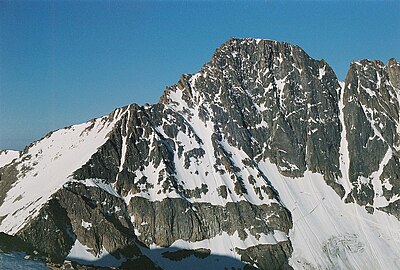
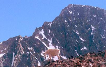
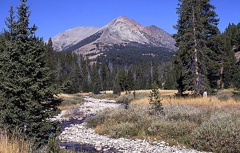
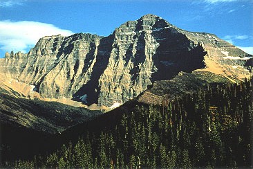
Gallery[]

Mount Stimson in 1917


See also[]
- List of mountain peaks of North America
- List of mountain peaks of Greenland
- List of mountain peaks of Canada
- List of mountain peaks of the Rocky Mountains
- List of mountain peaks of the United States
- List of mountain peaks of Alaska
- List of mountain peaks of Arizona
- List of mountain peaks of California
- List of mountain peaks of Colorado
- List of mountain peaks of Hawaiʻi
- List of mountain peaks of Idaho
- List of mountain peaks of Montana
- List of mountains of Montana
- List of mountain ranges of Montana
- List of mountain peaks of Nevada
- List of mountain peaks of New Mexico
- List of mountain peaks of Oregon
- List of mountain peaks of Utah
- List of mountain peaks of Washington (state)
- List of mountain peaks of Wyoming
- List of mountain peaks of México
- List of mountain peaks of Central America
- List of mountain peaks of the Caribbean
- Montana
- Geography of Montana
- Category:Mountains of Montana
- Geography of Montana
- Physical geography
Notes[]
- ^ Jump up to: a b c The summit of Granite Peak is the highest point of the Beartooth Mountains and the U.S. State of Montana.
- ^ Jump up to: a b The summit of Mount Wood is the highest point of the Granite Range.
- ^ Jump up to: a b The elevation of Mount Wood includes an adjustment of +1.516 m (4.97 ft) from NGVD 29 to NAVD 88.
- ^ Jump up to: a b The summit of Tumble Mountain is the highest point of the .
- ^ Jump up to: a b c The summit of Hilgard Peak is the highest point of the Madison Range.
- ^ Jump up to: a b c The elevation of Hilgard Peak includes an adjustment of +1.49 m (4.89 ft) from NGVD 29 to NAVD 88.
- ^ The elevation of Mount Douglas includes an adjustment of +1.501 m (4.92 ft) from NGVD 29 to NAVD 88.
- ^ Jump up to: a b The elevation of Mount Cowen includes an adjustment of +1.469 m (4.82 ft) from NGVD 29 to NAVD 88.
- ^ Jump up to: a b c The summit of Crazy Peak is the highest point of the Crazy Mountains.
- ^ Jump up to: a b c The elevation of Crazy Peak includes an adjustment of +1.421 m (4.66 ft) from NGVD 29 to NAVD 88.
- ^ The elevation of Two Sisters includes an adjustment of +1.398 m (4.59 ft) from NGVD 29 to NAVD 88.
- ^ Jump up to: a b c The elevation of Lone Mountain includes an adjustment of +1.482 m (4.86 ft) from NGVD 29 to NAVD 88.
- ^ Jump up to: a b c The summit of Tweedy Mountain is the highest point of the Pioneer Mountains.
- ^ Jump up to: a b c The elevation of Tweedy Mountain includes an adjustment of +1.598 m (5.24 ft) from NGVD 29 to NAVD 88.
- ^ Jump up to: a b The elevation of Gallatin Peak includes an adjustment of +1.52 m (4.99 ft) from NGVD 29 to NAVD 88.
- ^ Jump up to: a b c The summit of Electric Peak is the highest point of the Gallatin Range.
- ^ The elevation of includes an adjustment of +1.495 m (4.9 ft) from NGVD 29 to NAVD 88.
- ^ Jump up to: a b c The summit of is the highest point of the Anaconda Range.
- ^ Jump up to: a b c The elevation of includes an adjustment of +1.52 m (4.99 ft) from NGVD 29 to NAVD 88.
- ^ The elevation of includes an adjustment of +1.31 m (4.3 ft) from NGVD 29 to NAVD 88.
- ^ Jump up to: a b The elevation of includes an adjustment of +1.438 m (4.72 ft) from NGVD 29 to NAVD 88.
- ^ Jump up to: a b The elevation of includes an adjustment of +1.543 m (5.06 ft) from NGVD 29 to NAVD 88.
- ^ Jump up to: a b c The summit of is the highest point of the .
- ^ Jump up to: a b c The elevation of includes an adjustment of +1.483 m (4.87 ft) from NGVD 29 to NAVD 88.
- ^ Jump up to: a b c The summit of is the highest point of the .
- ^ Jump up to: a b c The elevation of includes an adjustment of +1.431 m (4.69 ft) from NGVD 29 to NAVD 88.
- ^ Jump up to: a b c The summit of is the highest point of the Tobacco Root Mountains.
- ^ Jump up to: a b c The elevation of includes an adjustment of +1.486 m (4.88 ft) from NGVD 29 to NAVD 88.
- ^ Jump up to: a b c The summit of is the highest point of the Snowcrest Range.
- ^ Jump up to: a b c The elevation of includes an adjustment of +1.553 m (5.1 ft) from NGVD 29 to NAVD 88.
- ^ The elevation of includes an adjustment of +1.514 m (4.97 ft) from NGVD 29 to NAVD 88.
- ^ Jump up to: a b c The summit of Black Butte is the highest point of the Gravelly Range.
- ^ Jump up to: a b c The summit elevation of Black Butte includes a vertical offset of +1 m (3.3 ft) from the station benchmark.
- ^ Jump up to: a b c The summit of Mount Cleveland is the highest point of the Lewis Range.
- ^ The elevation of includes an adjustment of +1.49 m (4.89 ft) from NGVD 29 to NAVD 88.
- ^ Jump up to: a b The elevation of includes an adjustment of +1.532 m (5.03 ft) from NGVD 29 to NAVD 88.
- ^ Jump up to: a b The elevation of Fan Mountain includes an adjustment of +1.42 m (4.66 ft) from NGVD 29 to NAVD 88.
- ^ Jump up to: a b c The summit of is the highest point of the Highland Mountains.
- ^ Jump up to: a b c The elevation of includes an adjustment of +1.467 m (4.81 ft) from NGVD 29 to NAVD 88.
- ^ Jump up to: a b c The summit of Mount Jefferson is the highest point of the Centennial Mountains.
- ^ Jump up to: a b c Mount Jefferson lies on the Continental Divide of the Americas between Idaho and Montana.
- ^ Jump up to: a b c The summit of is the highest point of the Flint Creek Range.
- ^ Jump up to: a b c The summit of Trapper Peak is the highest point of the central Bitterroot Range.
- ^ Jump up to: a b c The elevation of Trapper Peak includes an adjustment of +1.367 m (4.48 ft) from NGVD 29 to NAVD 88.
- ^ Jump up to: a b c The summit of Kintla Peak is the highest point of the Livingston Range.
- ^ Jump up to: a b c The elevation of Kintla Peak includes an adjustment of +1.413 m (4.64 ft) from NGVD 29 to NAVD 88.
- ^ Jump up to: a b The elevation of Mount Jackson includes an adjustment of +1.425 m (4.68 ft) from NGVD 29 to NAVD 88.
- ^ Jump up to: a b The elevation of Mount Siyeh includes an adjustment of +1.435 m (4.71 ft) from NGVD 29 to NAVD 88.
- ^ Jump up to: a b The elevation of Mount Merritt includes an adjustment of +1.372 m (4.5 ft) from NGVD 29 to NAVD 88.
- ^ The elevation of El Capitan includes an adjustment of +1.251 m (4.1 ft) from NGVD 29 to NAVD 88.
- ^ Jump up to: a b The elevation of includes an adjustment of +1.436 m (4.71 ft) from NGVD 29 to NAVD 88.
- ^ Jump up to: a b The elevation of Rainbow Peak includes an adjustment of +1.362 m (4.47 ft) from NGVD 29 to NAVD 88.
- ^ lies on the Continental Divide of the Americas between Idaho and Montana.
- ^ Jump up to: a b c The summit of McDonald Peak is the highest point of the Mission Range.
- ^ Jump up to: a b c The elevation of McDonald Peak includes an adjustment of +1.318 m (4.32 ft) from NGVD 29 to NAVD 88.
- ^ Jump up to: a b c The summit of Sacagawea Peak is the highest point of the Bridger Range.
- ^ The summit of is the highest point of the Big Belt Mountains.
- ^ The elevation of includes an adjustment of +1.249 m (4.1 ft) from NGVD 29 to NAVD 88.
- ^ Jump up to: a b c The summit of is the highest point of the Elkhorn Mountains.
- ^ Jump up to: a b c The elevation of includes an adjustment of +1.353 m (4.44 ft) from NGVD 29 to NAVD 88.
- ^ Jump up to: a b c The summit of Red Mountain is the highest point of the Flathead Range.
- ^ Jump up to: a b The summit of Snowshoe Peak is the highest point of the Cabinet Mountains.
- ^ Jump up to: a b The elevation of Snowshoe Peak includes an adjustment of +1.367 m (4.48 ft) from NGVD 29 to NAVD 88.
- ^ Jump up to: a b The summit of is the highest point of the .
- ^ Jump up to: a b The elevation of includes an adjustment of +1.339 m (4.39 ft) from NGVD 29 to NAVD 88.
- ^ Jump up to: a b The summit of is the highest point of the Pryor Mountains.
- ^ Jump up to: a b The summit of is the highest point of the Bearpaw Mountains.
- ^ Jump up to: a b The summit of Mount Edith is the highest point of the Big Belt Mountains.
- ^ Jump up to: a b The elevation of Mount Edith includes an adjustment of +1.249 m (4.1 ft) from NGVD 29 to NAVD 88.
- ^ Jump up to: a b The summit of is the highest point of the Big Snowy Mountains.
- ^ Jump up to: a b The elevation of includes an adjustment of +1.136 m (3.73 ft) from NGVD 29 to NAVD 88.
- ^ Jump up to: a b The summit of is the highest point of the Swan Range.
- ^ Jump up to: a b The summit of Ch-paa-qn Peak is the highest point of the .
- ^ Jump up to: a b The summit of is the highest point of the Rattlesnake Mountains.
- ^ Jump up to: a b The summit of is the highest point of the Sweetgrass Hills.
- ^ Jump up to: a b The elevation of includes an adjustment of +1.061 m (3.48 ft) from NGVD 29 to NAVD 88.
- ^ Jump up to: a b The summit of Big Baldy Mountain is the highest point of the Little Belt Mountains.
- ^ Jump up to: a b The elevation of Big Baldy Mountain includes an adjustment of +1.183 m (3.88 ft) from NGVD 29 to NAVD 88.
- ^ Jump up to: a b The summit of is the highest point of the Highwood Mountains.
- ^ Jump up to: a b The summit of is the highest point of the Rocky Mountain Front.
- ^ Jump up to: a b The summit of Antoine Butte is the highest point of the Little Rocky Mountains.
- ^ Jump up to: a b The elevation of Antoine Butte includes an adjustment of +0.875 m (2.87 ft) from NGVD 29 to NAVD 88.
References[]
- ^ This article defines a significant summit as a summit with at least 100 meters (328.1 feet) of topographic prominence, and a major summit as a summit with at least 500 meters (1640 feet) of topographic prominence. All summits in this article have at least 500 meters of topographic prominence. An ultra-prominent summit is a summit with at least 1500 meters (4921 feet) of topographic prominence.
- ^ All elevations in this article include an elevation adjustment from the National Geodetic Vertical Datum of 1929 (NGVD 29) to the North American Vertical Datum of 1988 (NAVD 88). For further information, please see this United States National Geodetic Survey note.
- ^ Jump up to: a b If the elevation or prominence of a summit is calculated as a range of values, the arithmetic mean is shown.
- ^ The topographic prominence of a summit is the topographic elevation difference between the summit and its highest or key col to a higher summit. The summit may be near its key col or quite far away. The key col for Denali in Alaska is the Isthmus of Rivas in Nicaragua, 7642 kilometers (4749 miles) away.
- ^ The topographic isolation of a summit is the great-circle distance to its nearest point of equal elevation.
- ^ Jump up to: a b c "GRANITE PEAK". Datasheet for NGS Station QW0616. U.S. National Geodetic Survey. Retrieved 14 June 2016.
- ^ Jump up to: a b c "Granite Peak". Geographic Names Information System. United States Geological Survey.
- ^ Jump up to: a b c "Granite Peak". Peakbagger.com. Retrieved 14 June 2016.
- ^ Jump up to: a b c "Granite Peak". Bivouac.com. Retrieved 14 June 2016.
- ^ Jump up to: a b "Mount Wood". Geographic Names Information System. United States Geological Survey.
- ^ Jump up to: a b "Mount Wood". Peakbagger.com. Retrieved 14 June 2016.
- ^ Jump up to: a b "Mount Wood". Bivouac.com. Retrieved 14 June 2016.
- ^ Jump up to: a b "PLATEAU". Datasheet for NGS Station QW0613. U.S. National Geodetic Survey. Retrieved 14 June 2016.
- ^ Jump up to: a b "Castle Mountain". Geographic Names Information System. United States Geological Survey.
- ^ Jump up to: a b "Castle Mountain". Peakbagger.com. Retrieved 14 June 2016.
- ^ Jump up to: a b "Castle Mountain". Bivouac.com. Retrieved 14 June 2016.
- ^ Jump up to: a b "TUMBLE". Datasheet for NGS Station QX0680. U.S. National Geodetic Survey. Retrieved 14 June 2016.
- ^ Jump up to: a b "Tumble Mountain". Geographic Names Information System. United States Geological Survey.
- ^ Jump up to: a b "Tumble Mountain". Peakbagger.com. Retrieved 14 June 2016.
- ^ Jump up to: a b "Tumble Mountain". Bivouac.com. Retrieved 14 June 2016.
- ^ Jump up to: a b c "Hilgard Peak". Geographic Names Information System. United States Geological Survey.
- ^ Jump up to: a b c "Hilgard Peak". Peakbagger.com. Retrieved 14 June 2016.
- ^ Jump up to: a b c "Hilgard Peak". Bivouac.com. Retrieved 14 June 2016.
- ^ "Mount Douglas". Geographic Names Information System. United States Geological Survey.
- ^ "Mount Douglas". Peakbagger.com. Retrieved 14 June 2016.
- ^ "Mount Douglas". Bivouac.com. Retrieved 14 June 2016.
- ^ Jump up to: a b "Mount Cowen". Geographic Names Information System. United States Geological Survey.
- ^ Jump up to: a b "Mount Cowen". Peakbagger.com. Retrieved 14 June 2016.
- ^ Jump up to: a b "Mount Cowen". Bivouac.com. Retrieved 14 June 2016.
- ^ Jump up to: a b c "Crazy Peak". Geographic Names Information System. United States Geological Survey.
- ^ Jump up to: a b c "Crazy Peak". Peakbagger.com. Retrieved 14 June 2016.
- ^ Jump up to: a b c "Crazy Peak". Bivouac.com. Retrieved 14 June 2016.
- ^ "Two Sisters". Geographic Names Information System. United States Geological Survey.
- ^ "Two Sisters". Peakbagger.com. Retrieved 14 June 2016.
- ^ "Two Sisters". Bivouac.com. Retrieved 14 June 2016.
- ^ Jump up to: a b c "Lone Mountain". Geographic Names Information System. United States Geological Survey.
- ^ Jump up to: a b c "Lone Mountain". Peakbagger.com. Retrieved 14 June 2016.
- ^ Jump up to: a b c "Lone Mountain". Bivouac.com. Retrieved 14 June 2016.
- ^ Jump up to: a b c "TWEEDY MTN SOUTH PEAK". Datasheet for NGS Station QY0549. U.S. National Geodetic Survey. Retrieved 14 June 2016.
- ^ Jump up to: a b c "Tweedy Mountain". Geographic Names Information System. United States Geological Survey.
- ^ Jump up to: a b c "Tweedy Mountain". Peakbagger.com. Retrieved 14 June 2016.
- ^ Jump up to: a b c "Tweedy Mountain". Bivouac.com. Retrieved 14 June 2016.
- ^ Jump up to: a b "Gallatin Peak". Geographic Names Information System. United States Geological Survey.
- ^ Jump up to: a b "Gallatin Peak". Peakbagger.com. Retrieved 14 June 2016.
- ^ Jump up to: a b c "ELECTRIC RM 2". Datasheet for NGS Station QX0707. U.S. National Geodetic Survey. Retrieved 14 June 2016.
- ^ Jump up to: a b c "Electric Peak". Geographic Names Information System. United States Geological Survey.
- ^ Jump up to: a b c "Electric Peak". Peakbagger.com. Retrieved 14 June 2016.
- ^ Jump up to: a b c "GARFIELD". Datasheet for NGS Station PZ0710. U.S. National Geodetic Survey. Retrieved 14 June 2016.
- ^ Jump up to: a b c "Garfield Mountain (Montana)". Geographic Names Information System. United States Geological Survey.
- ^ Jump up to: a b c "Garfield Mountain (Montana)". Peakbagger.com. Retrieved 14 June 2016.
- ^ Jump up to: a b c "Garfield Mountain (Montana)". Bivouac.com. Retrieved 14 June 2016.
- ^ Jump up to: a b "EMIGRANT". Datasheet for NGS Station QX0697. U.S. National Geodetic Survey. Retrieved 14 June 2016.
- ^ Jump up to: a b "Emigrant Peak". Geographic Names Information System. United States Geological Survey.
- ^ Jump up to: a b "Emigrant Peak". Peakbagger.com. Retrieved 14 June 2016.
- ^ Jump up to: a b "Emigrant Peak". Bivouac.com. Retrieved 14 June 2016.
- ^ "Sphinx Mountain". Geographic Names Information System. United States Geological Survey.
- ^ "Sphinx Mountain". Peakbagger.com. Retrieved 14 June 2016.
- ^ "Sphinx Mountain". Bivouac.com. Retrieved 14 June 2016.
- ^ Jump up to: a b c "West Goat Peak". Geographic Names Information System. United States Geological Survey.
- ^ Jump up to: a b c "West Goat Peak". Peakbagger.com. Retrieved 14 June 2016.
- ^ Jump up to: a b c "West Goat Peak". Bivouac.com. Retrieved 14 June 2016.
- ^ "Cutoff Mountain". Geographic Names Information System. United States Geological Survey.
- ^ "Cutoff Mountain". Peakbagger.com. Retrieved 14 June 2016.
- ^ "Cutoff Mountain". Bivouac.com. Retrieved 14 June 2016.
- ^ Jump up to: a b "Sage Peak". Geographic Names Information System. United States Geological Survey.
- ^ Jump up to: a b "Sage Peak". Peakbagger.com. Retrieved 14 June 2016.
- ^ Jump up to: a b "Sage Peak". Bivouac.com. Retrieved 14 June 2016.
- ^ Jump up to: a b "Mount Evans". Geographic Names Information System. United States Geological Survey.
- ^ Jump up to: a b "Mount Evans". Peakbagger.com. Retrieved 14 June 2016.
- ^ Jump up to: a b "Mount Evans". Bivouac.com. Retrieved 14 June 2016.
- ^ Jump up to: a b c "Homer Youngs Peak". Geographic Names Information System. United States Geological Survey.
- ^ Jump up to: a b c "Homer Youngs Peak". Peakbagger.com. Retrieved 14 June 2016.
- ^ Jump up to: a b c "Homer Youngs Peak". Bivouac.com. Retrieved 14 June 2016.
- ^ Jump up to: a b c "South Sheep Mountain". Peakbagger.com. Retrieved 14 June 2016.
- ^ Jump up to: a b c "South Sheep Mountain". Bivouac.com. Retrieved 14 June 2016.
- ^ Jump up to: a b c "Hollowtop Mountain". Geographic Names Information System. United States Geological Survey.
- ^ Jump up to: a b c "Hollowtop Mountain". Peakbagger.com. Retrieved 14 June 2016.
- ^ Jump up to: a b c "Hollowtop Mountain". Bivouac.com. Retrieved 14 June 2016.
- ^ Jump up to: a b c "Sunset Peak". Geographic Names Information System. United States Geological Survey.
- ^ Jump up to: a b c "Sunset Peak". Peakbagger.com. Retrieved 14 June 2016.
- ^ Jump up to: a b c "Sunset Peak". Bivouac.com. Retrieved 14 June 2016.
- ^ "Hogback Mountain". Geographic Names Information System. United States Geological Survey.
- ^ "Hogback Mountain". Peakbagger.com. Retrieved 14 June 2016.
- ^ "Hogback Mountain". Bivouac.com. Retrieved 14 June 2016.
- ^ Jump up to: a b c "BLACK BUTTE RESET". Datasheet for NGS Station PY1200. U.S. National Geodetic Survey. Retrieved 14 June 2016.
- ^ Jump up to: a b c "Black Butte". Geographic Names Information System. United States Geological Survey.
- ^ Jump up to: a b c "Black Butte". Peakbagger.com. Retrieved 14 June 2016.
- ^ Jump up to: a b c "Black Butte". Bivouac.com. Retrieved 14 June 2016.
- ^ Jump up to: a b "SHEEP MTN". Datasheet for NGS Station QX0701. U.S. National Geodetic Survey. Retrieved 14 June 2016.
- ^ Jump up to: a b "Sheep Mountain". Geographic Names Information System. United States Geological Survey.
- ^ Jump up to: a b "Sheep Mountain". Peakbagger.com. Retrieved 14 June 2016.
- ^ Jump up to: a b "Sheep Mountain". Bivouac.com. Retrieved 14 June 2016.
- ^ Jump up to: a b c "CLEVELAND". Datasheet for NGS Station TM1009. U.S. National Geodetic Survey. Retrieved 14 June 2016.
- ^ Jump up to: a b c "Mount Cleveland". Geographic Names Information System. United States Geological Survey.
- ^ Jump up to: a b c "Mount Cleveland". Peakbagger.com. Retrieved 14 June 2016.
- ^ Jump up to: a b c "Mount Cleveland". Bivouac.com. Retrieved 14 June 2016.
- ^ "Sliderock Mountain". Geographic Names Information System. United States Geological Survey.
- ^ "Sliderock Mountain". Peakbagger.com. Retrieved 14 June 2016.
- ^ "Sliderock Mountain". Bivouac.com. Retrieved 14 June 2016.
- ^ Jump up to: a b "Mount Chisholm". Geographic Names Information System. United States Geological Survey.
- ^ Jump up to: a b "Mount Chisholm". Peakbagger.com. Retrieved 14 June 2016.
- ^ Jump up to: a b "Mount Chisholm". Bivouac.com. Retrieved 14 June 2016.
- ^ Jump up to: a b "Fan Mountain". Geographic Names Information System. United States Geological Survey.
- ^ Jump up to: a b "Fan Mountain". Peakbagger.com. Retrieved 14 June 2016.
- ^ Jump up to: a b c "TABLE MTN". Datasheet for NGS Station QY0501. U.S. National Geodetic Survey. Retrieved 14 June 2016.
- ^ Jump up to: a b c "Table Mountain". Geographic Names Information System. United States Geological Survey.
- ^ Jump up to: a b c "Table Mountain". Peakbagger.com. Retrieved 14 June 2016.
- ^ Jump up to: a b c "Table Mountain". Bivouac.com. Retrieved 14 June 2016.
- ^ Jump up to: a b c "SAWTELLE". Datasheet for NGS Station PY1196. U.S. National Geodetic Survey. Retrieved 14 June 2016.
- ^ Jump up to: a b c "Mount Jefferson". Geographic Names Information System. United States Geological Survey.
- ^ Jump up to: a b c "Mount Jefferson". Peakbagger.com. Retrieved 14 June 2016.
- ^ Jump up to: a b c "Mount Jefferson". Bivouac.com. Retrieved 14 June 2016.
- ^ Jump up to: a b c "POWELL ET". Datasheet for NGS Station RX1032. U.S. National Geodetic Survey. Retrieved 14 June 2016.
- ^ Jump up to: a b c "Mount Powell". Geographic Names Information System. United States Geological Survey.
- ^ Jump up to: a b c "Mount Powell". Peakbagger.com. Retrieved 14 June 2016.
- ^ Jump up to: a b c "Trapper Peak". Geographic Names Information System. United States Geological Survey.
- ^ Jump up to: a b c "Trapper Peak". Peakbagger.com. Retrieved 14 June 2016.
- ^ Jump up to: a b c "Trapper Peak". Bivouac.com. Retrieved 14 June 2016.
- ^ Jump up to: a b c "STIMSON". Datasheet for NGS Station TM0942. U.S. National Geodetic Survey. Retrieved 14 June 2016.
- ^ Jump up to: a b c "Mount Stimson". Geographic Names Information System. United States Geological Survey.
- ^ Jump up to: a b c "Mount Stimson". Peakbagger.com. Retrieved 14 June 2016.
- ^ Jump up to: a b c "Mount Stimson". Bivouac.com. Retrieved 14 June 2016.
- ^ Jump up to: a b c "Kintla Peak". Geographic Names Information System. United States Geological Survey.
- ^ Jump up to: a b c "Kintla Peak". Peakbagger.com. Retrieved 14 June 2016.
- ^ Jump up to: a b c "Kintla Peak". Bivouac.com. Retrieved 14 June 2016.
- ^ Jump up to: a b "Mount Jackson". Geographic Names Information System. United States Geological Survey.
- ^ Jump up to: a b "Mount Jackson". Peakbagger.com. Retrieved 14 June 2016.
- ^ Jump up to: a b "Mount Jackson". Bivouac.com. Retrieved 14 June 2016.
- ^ Jump up to: a b "Mount Siyeh". Geographic Names Information System. United States Geological Survey.
- ^ Jump up to: a b "Mount Siyeh". Peakbagger.com. Retrieved 14 June 2016.
- ^ Jump up to: a b "Mount Siyeh". Bivouac.com. Retrieved 14 June 2016.
- ^ Jump up to: a b "Mount Merritt". Geographic Names Information System. United States Geological Survey.
- ^ Jump up to: a b "Mount Merritt". Peakbagger.com. Retrieved 14 June 2016.
- ^ Jump up to: a b "Mount Merritt". Bivouac.com. Retrieved 14 June 2016.
- ^ "El Capitan". Geographic Names Information System. United States Geological Survey.
- ^ "El Capitan". Peakbagger.com. Retrieved 14 June 2016.
- ^ "El Capitan". Bivouac.com. Retrieved 14 June 2016.
- ^ Jump up to: a b "Baldy Mountain". Geographic Names Information System. United States Geological Survey.
- ^ Jump up to: a b "Baldy Mountain". Peakbagger.com. Retrieved 14 June 2016.
- ^ Jump up to: a b "Baldy Mountain". Bivouac.com. Retrieved 14 June 2016.
- ^ Jump up to: a b "Rainbow Peak". Geographic Names Information System. United States Geological Survey.
- ^ Jump up to: a b "Rainbow Peak". Peakbagger.com. Retrieved 14 June 2016.
- ^ Jump up to: a b "Rainbow Peak". Bivouac.com. Retrieved 14 June 2016.
- ^ "GLO POST 10". Datasheet for NGS Station PY1198. U.S. National Geodetic Survey. Retrieved 14 June 2016.
- ^ "Taylor Mountain". Geographic Names Information System. United States Geological Survey.
- ^ "Taylor Mountain". Peakbagger.com. Retrieved 14 June 2016.
- ^ "Taylor Mountain". Bivouac.com. Retrieved 14 June 2016.
- ^ Jump up to: a b c "McDonald Peak". Geographic Names Information System. United States Geological Survey.
- ^ Jump up to: a b c "McDonald Peak". Peakbagger.com. Retrieved 14 June 2016.
- ^ Jump up to: a b c "McDonald Peak". Bivouac.com. Retrieved 14 June 2016.
- ^ Jump up to: a b c "ROSS 2". Datasheet for NGS Station QX0748. U.S. National Geodetic Survey. Retrieved 14 June 2016.
- ^ Jump up to: a b c "Sacagawea Peak". Geographic Names Information System. United States Geological Survey.
- ^ Jump up to: a b c "Sacagawea Peak". Peakbagger.com. Retrieved 14 June 2016.
- ^ Jump up to: a b c "Sacagawea Peak". Bivouac.com. Retrieved 14 June 2016.
- ^ Jump up to: a b c "SAINT JO ET". Datasheet for NGS Station RY1027. U.S. National Geodetic Survey. Retrieved 14 June 2016.
- ^ Jump up to: a b c "Saint Joseph Peak". Geographic Names Information System. United States Geological Survey.
- ^ Jump up to: a b c "Saint Joseph Peak". Peakbagger.com. Retrieved 14 June 2016.
- ^ Jump up to: a b c "Saint Joseph Peak". Bivouac.com. Retrieved 14 June 2016.
- ^ "Mount Edith". Geographic Names Information System. United States Geological Survey.
- ^ "Mount Edith". Peakbagger.com. Retrieved 14 June 2016.
- ^ "Mount Edith". Bivouac.com. Retrieved 14 June 2016.
- ^ Jump up to: a b c "Crow Peak". Geographic Names Information System. United States Geological Survey.
- ^ Jump up to: a b c "Crow Peak". Peakbagger.com. Retrieved 14 June 2016.
- ^ Jump up to: a b c "RED". Datasheet for NGS Station ST0521. U.S. National Geodetic Survey. Retrieved 14 June 2016.
- ^ Jump up to: a b c "Red Mountain". Geographic Names Information System. United States Geological Survey.
- ^ Jump up to: a b c "Red Mountain". Peakbagger.com. Retrieved 14 June 2016.
- ^ Jump up to: a b c "Red Mountain". Bivouac.com. Retrieved 14 June 2016.
- ^ Jump up to: a b "Snowshoe Peak". Geographic Names Information System. United States Geological Survey.
- ^ Jump up to: a b "Snowshoe Peak". Peakbagger.com. Retrieved 14 June 2016.
- ^ Jump up to: a b "Snowshoe Peak". Bivouac.com. Retrieved 14 June 2016.
- ^ Jump up to: a b "NORTHWEST PEAK LOOKOUT". Datasheet for NGS Station TN0958. U.S. National Geodetic Survey. Retrieved 14 June 2016.
- ^ Jump up to: a b "Northwest Peak". Geographic Names Information System. United States Geological Survey.
- ^ Jump up to: a b "Northwest Peak". Peakbagger.com. Retrieved 14 June 2016.
- ^ Jump up to: a b "Northwest Peak". Bivouac.com. Retrieved 14 June 2016.
- ^ Jump up to: a b "ICE CAVE". Datasheet for NGS Station QW0538. U.S. National Geodetic Survey. Retrieved 14 June 2016.
- ^ Jump up to: a b "Big Pryor Mountain". Geographic Names Information System. United States Geological Survey.
- ^ Jump up to: a b "Big Pryor Mountain". Peakbagger.com. Retrieved 14 June 2016.
- ^ Jump up to: a b "Big Pryor Mountain". Bivouac.com. Retrieved 14 June 2016.
- ^ Jump up to: a b "BALDY". Datasheet for NGS Station TK0492. U.S. National Geodetic Survey. Retrieved 14 June 2016.
- ^ Jump up to: a b "Baldy Mountain". Geographic Names Information System. United States Geological Survey.
- ^ Jump up to: a b "Baldy Mountain". Peakbagger.com. Retrieved 14 June 2016.
- ^ Jump up to: a b "Mount Edith". Geographic Names Information System. United States Geological Survey.
- ^ Jump up to: a b "Mount Edith". Peakbagger.com. Retrieved 14 June 2016.
- ^ Jump up to: a b "Mount Edith". Bivouac.com. Retrieved 14 June 2016.
- ^ Jump up to: a b "BALDY". Datasheet for NGS Station SU0971. U.S. National Geodetic Survey. Retrieved 14 June 2016.
- ^ Jump up to: a b "Baldy Mountain". Geographic Names Information System. United States Geological Survey.
- ^ Jump up to: a b "Baldy Mountain". Peakbagger.com. Retrieved 14 June 2016.
- ^ Jump up to: a b "Greathouse Peak". Geographic Names Information System. United States Geological Survey.
- ^ Jump up to: a b "Greathouse Peak". Peakbagger.com. Retrieved 14 June 2016.
- ^ Jump up to: a b "Greathouse Peak". Bivouac.com. Retrieved 14 June 2016.
- ^ Jump up to: a b "HOLLAND". Datasheet for NGS Station ST0612. U.S. National Geodetic Survey. Retrieved 14 June 2016.
- ^ Jump up to: a b "Holland Peak". Geographic Names Information System. United States Geological Survey.
- ^ Jump up to: a b "Holland Peak". Peakbagger.com. Retrieved 14 June 2016.
- ^ Jump up to: a b "Holland Peak". Bivouac.com. Retrieved 14 June 2016.
- ^ Jump up to: a b "SQUAW PEAK". Datasheet for NGS Station SU0960. U.S. National Geodetic Survey. Retrieved 14 June 2016.
- ^ Jump up to: a b "Ch-paa-qn Peak". Geographic Names Information System. United States Geological Survey.
- ^ Jump up to: a b "Ch-paa-qn Peak". Peakbagger.com. Retrieved 14 June 2016.
- ^ Jump up to: a b "YAAK". Datasheet for NGS Station TN0902. U.S. National Geodetic Survey. Retrieved 14 June 2016.
- ^ Jump up to: a b "Robinson Mountain (Lincoln County)". Geographic Names Information System. United States Geological Survey.
- ^ Jump up to: a b "Robinson Mountain (Lincoln County)". Peakbagger.com. Retrieved 14 June 2016.
- ^ Jump up to: a b "Robinson Mountain (Lincoln County)". Bivouac.com. Retrieved 14 June 2016.
- ^ Jump up to: a b "MCLEOD CAIRN". Datasheet for NGS Station ST0598. U.S. National Geodetic Survey. Retrieved 14 June 2016.
- ^ Jump up to: a b "McLeod Peak". Geographic Names Information System. United States Geological Survey.
- ^ Jump up to: a b "McLeod Peak". Peakbagger.com. Retrieved 14 June 2016.
- ^ Jump up to: a b "MOUNT HEADLEY". Datasheet for NGS Station SU0990. U.S. National Geodetic Survey. Retrieved 14 June 2016.
- ^ Jump up to: a b "Mount Headley". Geographic Names Information System. United States Geological Survey.
- ^ Jump up to: a b "Mount Headley". Peakbagger.com. Retrieved 14 June 2016.
- ^ Jump up to: a b "West Butte". Geographic Names Information System. United States Geological Survey.
- ^ Jump up to: a b "West Butte". Peakbagger.com. Retrieved 14 June 2016.
- ^ Jump up to: a b "West Butte". Bivouac.com. Retrieved 14 June 2016.
- ^ Jump up to: a b "Big Baldy Mountain". Geographic Names Information System. United States Geological Survey.
- ^ Jump up to: a b "Big Baldy Mountain". Peakbagger.com. Retrieved 14 June 2016.
- ^ Jump up to: a b "Big Baldy Mountain". Bivouac.com. Retrieved 14 June 2016.
- ^ Jump up to: a b "HIGHWOOD". Datasheet for NGS Station SS1526. U.S. National Geodetic Survey. Retrieved 14 June 2016.
- ^ Jump up to: a b "Highwood Baldy". Geographic Names Information System. United States Geological Survey.
- ^ Jump up to: a b "Highwood Baldy". Peakbagger.com. Retrieved 14 June 2016.
- ^ Jump up to: a b "Highwood Baldy". Bivouac.com. Retrieved 14 June 2016.
- ^ Jump up to: a b "ROCKY". Datasheet for NGS Station ST0546. U.S. National Geodetic Survey. Retrieved 14 June 2016.
- ^ Jump up to: a b "Rocky Mountain". Geographic Names Information System. United States Geological Survey.
- ^ Jump up to: a b "Rocky Mountain". Peakbagger.com. Retrieved 14 June 2016.
- ^ Jump up to: a b "Rocky Mountain". Bivouac.com. Retrieved 14 June 2016.
- ^ Jump up to: a b "Antoine Butte". Geographic Names Information System. United States Geological Survey.
- ^ Jump up to: a b "Antoine Butte". Peakbagger.com. Retrieved 14 June 2016.
- ^ Jump up to: a b "Antoine Butte". Bivouac.com. Retrieved 14 June 2016.
External links[]
Mountains of Montanaat Wikipedia's sister projects
 Definitions from Wiktionary
 Media from Wikimedia Commons
 News from Wikinews
 Quotations from Wikiquote
 Texts from Wikisource
 Textbooks from Wikibooks
 Resources from Wikiversity
- United States Geological Survey (USGS)
- United States National Geodetic Survey (NGS)
- Bivouac.com
- Peakbagger.com
- Peaklist.org
- Peakware.com
- Summitpost.org

Coordinates: 45°09′48″N 109°48′27″W / 45.1634°N 109.8075°W
Categories:
- Mountains of Montana
- Lists of landforms of Montana
- Rocky Mountains
- Lists of mountains of the United States
- Lists of mountains by elevation
- Lists of mountains by prominence
- Lists of mountains by isolation