Longvilliers, Yvelines
Longvilliers | |
|---|---|
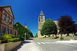 The town hall and church in the centre of Longvilliers | |
show Location of Longvilliers | |
 Longvilliers | |
| Coordinates: 48°34′47″N 1°59′34″E / 48.5797°N 1.9928°ECoordinates: 48°34′47″N 1°59′34″E / 48.5797°N 1.9928°E | |
| Country | France |
| Region | Île-de-France |
| Department | Yvelines |
| Arrondissement | Rambouillet |
| Canton | Rambouillet |
| Government | |
| • Mayor (2020–2026) | Maurice Chanclud |
| Area 1 | 13.91 km2 (5.37 sq mi) |
| Population (Jan. 2018)[1] | 504 |
| • Density | 36/km2 (94/sq mi) |
| Time zone | UTC+01:00 (CET) |
| • Summer (DST) | UTC+02:00 (CEST) |
| INSEE/Postal code | 78349 /78730 |
| Elevation | 79–160 m (259–525 ft) (avg. 91 m or 299 ft) |
| 1 French Land Register data, which excludes lakes, ponds, glaciers > 1 km2 (0.386 sq mi or 247 acres) and river estuaries. | |


Longvilliers (French: [lɔ̃vilje] (![]() listen)) is a commune in the Yvelines department in the Île-de-France region in north-central France.
listen)) is a commune in the Yvelines department in the Île-de-France region in north-central France.
See also[]
- Communes of the Yvelines department
References[]
- ^ "Populations légales 2018". INSEE. 28 December 2020.
| Wikimedia Commons has media related to Longvilliers (Yvelines). |
| show Communes of the Yvelines department |
|---|
This Yvelines geographical article is a stub. You can help Wikipedia by . |
Categories:
- Communes of Yvelines
- Yvelines geography stubs