Macheren
Macheren | |
|---|---|
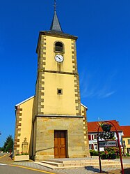 The church in Macheren | |
 Coat of arms | |
show Location of Macheren | |
 Macheren | |
| Coordinates: 49°06′02″N 6°44′37″E / 49.1006°N 6.7436°ECoordinates: 49°06′02″N 6°44′37″E / 49.1006°N 6.7436°E | |
| Country | France |
| Region | Grand Est |
| Department | Moselle |
| Arrondissement | Forbach-Boulay-Moselle |
| Canton | Saint-Avold |
| Intercommunality | |
| Government | |
| • Mayor (2020–2026) | Jean Meketyn[1] |
| Area 1 | 16.95 km2 (6.54 sq mi) |
| Population (Jan. 2018)[2] | 2,761 |
| • Density | 160/km2 (420/sq mi) |
| Time zone | UTC+01:00 (CET) |
| • Summer (DST) | UTC+02:00 (CEST) |
| INSEE/Postal code | 57428 /57730 |
| Elevation | 217–332 m (712–1,089 ft) (avg. 330 m or 1,080 ft) |
| 1 French Land Register data, which excludes lakes, ponds, glaciers > 1 km2 (0.386 sq mi or 247 acres) and river estuaries. | |


Macheren (French pronunciation: [maʃʁən]; German: Machern) is a commune in the Moselle department in the Grand Est region of north-eastern France.
The village is situated on the N56 road.
Population[]
| Year | Pop. | ±% |
|---|---|---|
| 2006 | 2,946 | — |
| 2007 | 2,944 | −0.1% |
| 2008 | 2,941 | −0.1% |
| 2009 | 2,932 | −0.3% |
| 2010 | 2,920 | −0.4% |
| 2011 | 2,909 | −0.4% |
| 2012 | 2,891 | −0.6% |
| 2013 | 2,885 | −0.2% |
| 2014 | 2,849 | −1.2% |
| 2015 | 2,815 | −1.2% |
| 2016 | 2,781 | −1.2% |
See also[]
| Wikimedia Commons has media related to Macheren. |
References[]
- ^ "Répertoire national des élus: les maires". data.gouv.fr, Plateforme ouverte des données publiques françaises (in French). 2 December 2020.
- ^ "Populations légales 2018". INSEE. 28 December 2020.
| show Authority control |
|---|
Categories:
- Communes of Moselle (department)
- Forbach-Boulay-Moselle arrondissement geography stubs