Maldegem
Maldegem | |
|---|---|
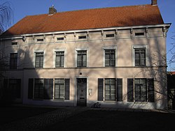 Maldegem rectory | |
 Flag  Coat of arms | |
 Maldegem Location in Belgium
show Location of Maldegem in East Flanders | |
| Coordinates: 51°12′N 03°26′E / 51.200°N 3.433°ECoordinates: 51°12′N 03°26′E / 51.200°N 3.433°E | |
| Country | Belgium |
| Community | Flemish Community |
| Region | Flemish Region |
| Province | East Flanders |
| Arrondissement | Eeklo |
| Government | |
| • Mayor | Bart Van Hulle (OpenVLD) |
| • Governing party/ies | , , |
| Area | |
| • Total | 94.64 km2 (36.54 sq mi) |
| Population (2018-01-01)[1] | |
| • Total | 23,689 |
| • Density | 250/km2 (650/sq mi) |
| Postal codes | 9990-9992 |
| Area codes | 050 |
| Website | www.maldegem.be |


Maldegem (Dutch pronunciation: [ˈmɑldəɣɛm]) (West Flemish: Moaldegem), earlier spelled Maldeghem, is a municipality located in the Belgian province of East Flanders. The municipality comprises the villages of Maldegem, and Middelburg. and have always been separate hamlets of Maldegem. On January 1, 2006, Maldegem had a total population of 22,289. The total area is 94.64 square kilometres (36.54 sq mi) which gives a population density of 236 inhabitants per km².
The Stoomcentrum Maldegem is located at the former NMBS railway station at Maldegem.
World War II airfield[]
An airfield established in 1939 near Maldegem was taken over by the invading German army in 1940 and used by the Luftwaffe. Seized by British Forces in September 1944, it was designated "Advanced Landing Ground B-65".
Notable inhabitants[]
- Joanna Courtmans (1811–1890), writer
International relations[]
Twin towns — Sister cities[]
Maldegem is twinned with the following towns:
References[]
- ^ "Wettelijke Bevolking per gemeente op 1 januari 2018". Statbel. Retrieved 9 March 2019.
External links[]

 Media related to Maldegem at Wikimedia Commons
- Official website (in Dutch)
| show Places adjacent to Maldegem |
|---|

| show Authority control |
|---|
This East Flanders location article is a stub. You can help Wikipedia by . |
- ^ "Het weekblad van Maldeghem en omstreken. [newspaper]". lib.ugent.be. Retrieved 2020-09-28.
- Maldegem
- Municipalities of East Flanders
- East Flanders geography stubs