Oosterzele
Oosterzele | |
|---|---|
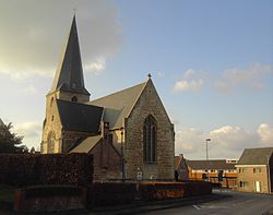 Church of Landskouter (2008) | |
 Flag  Coat of arms | |
 Oosterzele Location in Belgium
show Location of Oosterzele in East Flanders | |
| Coordinates: 50°57′N 03°48′E / 50.950°N 3.800°ECoordinates: 50°57′N 03°48′E / 50.950°N 3.800°E | |
| Country | Belgium |
| Community | Flemish Community |
| Region | Flemish Region |
| Province | East Flanders |
| Arrondissement | Ghent |
| Government | |
| • Mayor | Johan Van Durme(CD&V/N-VA) |
| • Governing party/ies | CD&V/N-VA |
| Area | |
| • Total | 43.12 km2 (16.65 sq mi) |
| Population (2018-01-01)[1] | |
| • Total | 13,546 |
| • Density | 310/km2 (810/sq mi) |
| Postal codes | 9860 |
| Area codes | 09 |
| Website | www.oosterzele.be |


Oosterzele (Dutch pronunciation: [ˈoːstərzeːlə]) is a municipality located in the Flemish province of East Flanders, in Belgium. The municipality comprises the towns of Balegem, Gijzenzele, Landskouter, Moortsele, Oosterzele proper and Scheldewindeke. On January 1, 2006, Oosterzele had a total population of 13,172. The total area is 43.12 km² which gives a population density of 305 inhabitants per km². Its twin town is Oberkirch in Germany.
Geography[]
Oosterzele is subdivided into 6 sub-municipalities:
| # | Deelgemeentes | Area (km²) | Population | Population density |
|---|---|---|---|---|
| I | Oosterzele | |||
| II | Balegem | 12,02 | ||
| III | Scheldewindeke | 11,84 | ||
| IV | Moortsele | 3,64 | ||
| V | Landskouter | |||
| VI | Gijzenzele | 1,87 |

Famous inhabitants[]
- Els De Temmerman, journalist, activist
- Johan Van Hecke, politician
- Gustaaf Joos, Roman Catholic cardinal
- (1909-2002), missionary
- (1933), poet
- (1961), politician
- Tom De Sutter (1985), football player
- , linguist, dialectologist, professor-emeritus UGent
References[]
- ^ "Wettelijke Bevolking per gemeente op 1 januari 2018". Statbel. Retrieved 9 March 2019.
External links[]
 Media related to Oosterzele at Wikimedia Commons
- (in Dutch) Official website (in Dutch)
| show Places adjacent to Oosterzele |
|---|

| show Authority control |
|---|
This East Flanders location article is a stub. You can help Wikipedia by . |
Categories:
- Municipalities of East Flanders
- East Flanders geography stubs