Evergem
Evergem | |
|---|---|
 Sleidinge | |
 Flag  Coat of arms | |
 Evergem Location in Belgium
show Location of Evergem in East Flanders | |
| Coordinates: 51°07′N 03°42′E / 51.117°N 3.700°ECoordinates: 51°07′N 03°42′E / 51.117°N 3.700°E | |
| Country | Belgium |
| Community | Flemish Community |
| Region | Flemish Region |
| Province | East Flanders |
| Arrondissement | Ghent |
| Government | |
| • Mayor | Joeri De Maertelaere (N-VA) |
| • Governing party/ies | N-VA, CD&V |
| Area | |
| • Total | 75.04 km2 (28.97 sq mi) |
| Population (2018-01-01)[1] | |
| • Total | 35,239 |
| • Density | 470/km2 (1,200/sq mi) |
| Postal codes | 9940 |
| Area codes | 09 |
| Website | www.evergem.be |


Evergem (Dutch pronunciation: [ˈeːvərɣɛm]) is a municipality located in the Belgian province of East Flanders. The municipality comprises the towns of , Doornzele, Ertvelde, Evergem proper, , Kluizen, , Sleidinge and Wippelgem. On January 1, 2020, Evergem had a total population of 35,628. The total area is 75.04 square kilometres (28.97 sq mi) which gives a population density of 430 inhabitants per km2.
Demographics[]

Opm:Bron:NIS
History[]
This section may need to be rewritten to comply with Wikipedia's quality standards. (October 2020) |
In the 1st world war, Ertvelde was used as a blockade in case the Netherlands attacked from the north. Ertvelde has a lot of bunkers due that, almost every 200m you can find one. Now they're mostly on fields used by farmers. The government decided that the bunkers are from the people where it stand. Some farmers destroyed it and some use it as storage, but some are still visitable.
Famous inhabitants[]
- Angelus de Baets, portrait painter (1793- Ghent, 1855)
- Luc De Vos, singer of the band Gorki
- Wilfried Martens, former Belgian prime minister, former chairman of the European People's Party (1963 - 2013)
- Eddy Wally, singer
- Jun Song, winner
International relations[]
Twin towns — Sister cities[]
Evergem is twinned with:
Gallery[]
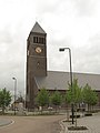
Evergem, church: de Sint Kristoffelkerk

Sleidinge, Dorp 4 tm 6

Wippelgem, windmill: de Gerardsmolen

Kluizen, church: de Onze Lieve Vrouw Geboortekerk
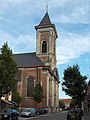
Ertvelde, church: parochiekerk Onze Lieve Vrouwe Hemelvaart

Ertvelde, windmill: de Stenenmolen


References[]
- ^ "Wettelijke Bevolking per gemeente op 1 januari 2018". Statbel. Retrieved 9 March 2019.
- ^ Błażejowski, Tomasz (4 June 2010). "Stalowa Wola podpisała porozumienie z Belgami" (in Polish). Stalowka.NET. Retrieved 2013-07-21.
External links[]
| Wikimedia Commons has media related to Evergem. |
- Official website (in Dutch)
| show Places adjacent to Evergem |
|---|

| show Authority control |
|---|
- Evergem
- Municipalities of East Flanders