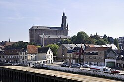
Wetteren
This article needs additional citations for verification. (April 2018) |
Wetteren | |
|---|---|
 | |
 Flag  Coat of arms | |
 Wetteren Location in Belgium
show Location of Wetteren in East Flanders | |
| Coordinates: 51°00′N 03°53′E / 51.000°N 3.883°ECoordinates: 51°00′N 03°53′E / 51.000°N 3.883°E | |
| Country | Belgium |
| Community | Flemish Community |
| Region | Flemish Region |
| Province | East Flanders |
| Arrondissement | Dendermonde |
| Government | |
| • Mayor | Alain Pardaen (CD&V) |
| • Governing party/ies | CD&V, VLD |
| Area | |
| • Total | 36.68 km2 (14.16 sq mi) |
| Population (2018-01-01)[1] | |
| • Total | 25,477 |
| • Density | 690/km2 (1,800/sq mi) |
| Postal codes | 9230 |
| Area codes | 09 |
| Website | www.wetteren.be |


Wetteren (Dutch pronunciation: [ˈʋɛtərə(n)]) is a municipality located in the Belgian province of East Flanders. The municipality comprises the towns of Massemen, Westrem and Wetteren proper. On January 1, 2006, Wetteren had a total population of 23,209. The total area is 36.68 km² which gives a population density of 633 inhabitants per km².

Wetteren town hall
Educational institutions[]
- Gemeenschapsonderwijs [1] Noordlaan 10, Wetteren
- Basischool Scheppers [2] Cooppallaan 82, Wetteren
- Basisschool Sint-Gertrudis [3] F. Leirensstraat 31, Wetteren
- Basisschool Sint-Jozef [4] Wegvoeringstraat 59 a, Wetteren
- Scheppersinstituut [5] Cooppaallaan 128, Wetteren
- Sint-Gertrudiscollege [6] Wegvoeringstraat 21, Wetteren
- Sint-Jozefinstituut [7] Wegvoeringstraat 59 a, Wetteren
- Mariagaard [8] Oosterzelsesteenweg 80, Wetteren
Notable people[]
- Julien De Wilde (b. Wetteren, 7 January 1967), businessman
- Émile Pierre Joseph Storms (1846-1918) Explorer of Congo Free State, General
- Cecile Bombeek, serial killer
References[]
- ^ "Wettelijke Bevolking per gemeente op 1 januari 2018". Statbel. Retrieved 9 March 2019.
External links[]
 Media related to Wetteren at Wikimedia Commons
- Official website (in Dutch)
- Chiro Overschelde Wetteren Liefkenshoek 24, Wetteren
- Scouts & Gidsen Vlaanderen Wetteren (St.-Jan) Groenstraat 33, Wetteren
- Scouts & Gidsen Vlaanderen Wetteren (Prins Boudewijn) Groene Wegel, Wetteren
- Chess Club De Wetterse Vrijpion Warandelaan 14, Wetteren
| show Places adjacent to Wetteren |
|---|

| show Authority control |
|---|
This East Flanders location article is a stub. You can help Wikipedia by . |
Categories:
- Municipalities of East Flanders
- East Flanders geography stubs