Sint-Laureins
This article needs additional citations for verification. (January 2013) |
Sint-Laureins | |
|---|---|
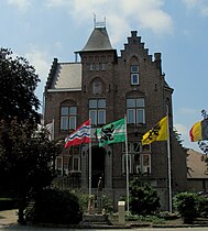 Sint-Laureins town hall | |
 Flag  Coat of arms | |
 Sint-Laureins Location in Belgium
show Location of Sint-Laureins in East Flanders | |
| Coordinates: 51°15′N 03°31′E / 51.250°N 3.517°ECoordinates: 51°15′N 03°31′E / 51.250°N 3.517°E | |
| Country | Belgium |
| Community | Flemish Community |
| Region | Flemish Region |
| Province | East Flanders |
| Arrondissement | Eeklo |
| Government | |
| • Mayor | Annick Willems |
| • Governing party/ies | CD&V |
| Area | |
| • Total | 74.50 km2 (28.76 sq mi) |
| Population (2018-01-01)[1] | |
| • Total | 6,684 |
| • Density | 90/km2 (230/sq mi) |
| Postal codes | 9980-9982, 9988 |
| Area codes | 09 |
| Website | www.sint-laureins.be |


Sint-Laureins (Dutch pronunciation: [sɪnt lʌu̯ˈrɛi̯ns]; Dutch for Saint Lawrence) is a municipality located in the Flemish province of East Flanders, in Belgium. The municipality comprises the towns of , Sint-Laureins proper, , and Watervliet. On January 1, 2011, Sint-Laureins had a total population of 6,535. The total area is 74.50 km² which gives a population density of 88 inhabitants per km².
The Our Lady-Church in Watervliet, built in the 16th century, is called the 'Cathedral of the North'[citation needed].

The Boerekreek is one of several lakes in Sint-Laureins
References[]
- ^ "Wettelijke Bevolking per gemeente op 1 januari 2018". Statbel. Retrieved 9 March 2019.
External links[]
 Media related to Sint-Laureins at Wikimedia Commons
- Official website (in Dutch)
- Official website of the youth council (in Dutch)
| show Places adjacent to Sint-Laureins |
|---|

| Authority control |
|
|---|
This East Flanders location article is a stub. You can help Wikipedia by . |
Categories:
- Municipalities of East Flanders
- East Flanders geography stubs