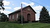
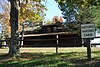
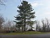
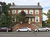
National Register of Historic Places listings in Pickaway County, Ohio

Location of Pickaway County in Ohio
This is a list of the National Register of Historic Places listings in Pickaway County, Ohio.
This is intended to be a complete list of the properties and districts on the National Register of Historic Places in Pickaway County, Ohio, United States. The locations of National Register properties and districts for which the latitude and longitude coordinates are included below, may be seen in an online map.[1]
There are 32 properties and districts listed on the National Register in the county.
This National Park Service list is complete through NPS recent listings posted March 11, 2022.[2]
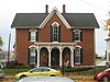
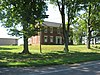
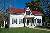
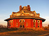
Current listings[]


See also[]
| Wikimedia Commons has media related to National Register of Historic Places in Pickaway County, Ohio. |
- List of National Historic Landmarks in Ohio
- Listings in neighboring counties: Fairfield, Fayette, Franklin, Hocking, Madison, Ross
- National Register of Historic Places listings in Ohio
References[]
- ^ The latitude and longitude information provided in this table was derived originally from the National Register Information System, which has been found to be fairly accurate for about 99% of listings. Some locations in this table may have been corrected to current GPS standards.
- ^ National Park Service, United States Department of the Interior, "National Register of Historic Places: Weekly List Actions", retrieved March 11, 2022.
- ^ Numbers represent an alphabetical ordering by significant words. Various colorings, defined here, differentiate National Historic Landmarks and historic districts from other NRHP buildings, structures, sites or objects.
- ^ a b "National Register Information System". National Register of Historic Places. National Park Service. April 24, 2008.
- ^ The eight-digit number below each date is the number assigned to each location in the National Register Information System database, which can be viewed by clicking the number.
- ^ "Front Cover". Ohio Archaeologist 34.2 (1984): 3.
- ^ Meeting minutes for Monday, 18 December 2006[permanent dead link], Pickaway County Commissioners, 2006. Accessed 2009-10-14.
- ^ Location derived from Mills, William C. Archeological Atlas of Ohio. Columbus: Ohio State Archeological and Historical Society, 1914, page 65 and plate 65. The NRIS lists the site as "Address Restricted".
- ^ Location derived from the parcel report from the Pickaway County Auditor's Office; the NRIS lists the site as "Address Restricted".
- ^ Location derived from its GNIS feature record; the NRIS lists the site as "Address Restricted"
- ^ "Deer Creek Park", Record Herald, 2010-08-17. Accessed 2013-03-14.

Municipalities and communities of Pickaway County, Ohio, United States | ||
|---|---|---|
| City |  | |
| Villages | ||
| Townships | ||
| CDPs | ||
| Unincorporated communities | ||
| Ghost town | ||
| Footnotes | ‡This populated place also has portions in an adjacent county or counties | |
| ||
Categories:
- National Register of Historic Places in Pickaway County, Ohio
- Lists of National Register of Historic Places in Ohio by county