Ongles
show This article may be expanded with text translated from the corresponding article in French. (December 2008) Click [show] for important translation instructions. |
Ongles | |
|---|---|
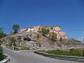 Rocher d'Ongle hamlet | |
 Coat of arms | |
show Location of Ongles | |
 Ongles | |
| Coordinates: 44°01′44″N 5°44′03″E / 44.0289°N 5.7342°ECoordinates: 44°01′44″N 5°44′03″E / 44.0289°N 5.7342°E | |
| Country | France |
| Region | Provence-Alpes-Côte d'Azur |
| Department | Alpes-de-Haute-Provence |
| Arrondissement | Forcalquier |
| Canton | Forcalquier |
| Intercommunality | |
| Government | |
| • Mayor (2020–2026) | Maryse Blanc-Ventre[1] |
| Area 1 | 31.46 km2 (12.15 sq mi) |
| Population (Jan. 2018)[2] | 367 |
| • Density | 12/km2 (30/sq mi) |
| Time zone | UTC+01:00 (CET) |
| • Summer (DST) | UTC+02:00 (CEST) |
| INSEE/Postal code | 04141 /04230 |
| Elevation | 517–1,320 m (1,696–4,331 ft) |
| 1 French Land Register data, which excludes lakes, ponds, glaciers > 1 km2 (0.386 sq mi or 247 acres) and river estuaries. | |


Ongles (French pronunciation: [ɔ̃ɡl]; Occitan: Onglas) is a commune in the Alpes-de-Haute-Provence department in southeastern France.
Population[]
| Year | Pop. | ±% |
|---|---|---|
| 2006 | 325 | — |
| 2007 | 324 | −0.3% |
| 2008 | 331 | +2.2% |
| 2009 | 338 | +2.1% |
| 2010 | 344 | +1.8% |
| 2011 | 351 | +2.0% |
| 2012 | 347 | −1.1% |
| 2013 | 348 | +0.3% |
| 2014 | 356 | +2.3% |
| 2015 | 363 | +2.0% |
| 2016 | 371 | +2.2% |
See also[]
References[]
- ^ "Répertoire national des élus: les maires". data.gouv.fr, Plateforme ouverte des données publiques françaises (in French). 2 December 2020.
- ^ "Populations légales 2018". INSEE. 28 December 2020.
| Wikimedia Commons has media related to Ongles. |
| Authority control |
|
|---|
This Alpes-de-Haute-Provence geographical article is a stub. You can help Wikipedia by . |
Categories:
- Communes of Alpes-de-Haute-Provence
- Alpes-de-Haute-Provence geography stubs