Val-de-Chalvagne
This article may be expanded with text translated from the corresponding article in French. (December 2008) Click [show] for important translation instructions.
|
Val-de-Chalvagne | |
|---|---|
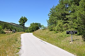 The Col de Laval à Montblanc | |
 Coat of arms | |
Location of Val-de-Chalvagne  | |
 Val-de-Chalvagne | |
| Coordinates: 43°54′54″N 6°48′30″E / 43.915°N 6.8083°ECoordinates: 43°54′54″N 6°48′30″E / 43.915°N 6.8083°E | |
| Country | France |
| Region | Provence-Alpes-Côte d'Azur |
| Department | Alpes-de-Haute-Provence |
| Arrondissement | Castellane |
| Canton | Castellane |
| Government | |
| • Mayor (2020–2026) | Anabel Oncina |
| Area 1 | 32.57 km2 (12.58 sq mi) |
| Population (Jan. 2018)[1] | 87 |
| • Density | 2.7/km2 (6.9/sq mi) |
| Time zone | UTC+01:00 (CET) |
| • Summer (DST) | UTC+02:00 (CEST) |
| INSEE/Postal code | 04043 /04320 |
| Elevation | 599–1,587 m (1,965–5,207 ft) (avg. 900 m or 3,000 ft) |
| 1 French Land Register data, which excludes lakes, ponds, glaciers > 1 km2 (0.386 sq mi or 247 acres) and river estuaries. | |


Val-de-Chalvagne (French pronunciation: [val də ʃalvaɲ]; Occitan: Vau de Chalvanha) is a commune in the Alpes-de-Haute-Provence department in southeastern France.
Population[]
| Year | Pop. | ±% |
|---|---|---|
| 1793 | 47 | — |
| 1800 | 70 | +48.9% |
| 1806 | 80 | +14.3% |
| 1821 | 56 | −30.0% |
| 1831 | 139 | +148.2% |
| 1836 | 106 | −23.7% |
| 1841 | 89 | −16.0% |
| 1846 | 82 | −7.9% |
| 1851 | 83 | +1.2% |
| 1856 | 90 | +8.4% |
| 1861 | 90 | +0.0% |
| 1866 | 90 | +0.0% |
| 1872 | 86 | −4.4% |
| 1876 | 71 | −17.4% |
| 1881 | 75 | +5.6% |
| 1886 | 74 | −1.3% |
| 1891 | 62 | −16.2% |
| 1896 | 68 | +9.7% |
| 1901 | 81 | +19.1% |
| 1906 | 55 | −32.1% |
| 1911 | 50 | −9.1% |
| 1921 | 40 | −20.0% |
| 1926 | 44 | +10.0% |
| 1931 | 41 | −6.8% |
| 1936 | 44 | +7.3% |
| 1946 | 45 | +2.3% |
| 1954 | 37 | −17.8% |
| 1962 | 21 | −43.2% |
| 1968 | 11 | −47.6% |
| 1975 | 52 | +372.7% |
| 1982 | 68 | +30.8% |
| 1990 | 38 | −44.1% |
| 1999 | 48 | +26.3% |
| 2008 | 65 | +35.4% |
See also[]
References[]
- ^ "Populations légales 2018". The National Institute of Statistics and Economic Studies. 28 December 2020.
| Wikimedia Commons has media related to Val-de-Chalvagne. |
This Alpes-de-Haute-Provence geographical article is a stub. You can help Wikipedia by . |
Categories:
- Communes of Alpes-de-Haute-Provence
- Alpes-de-Haute-Provence geography stubs