Orcet
Orcet | |
|---|---|
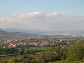 A general view of Orcet | |
 Coat of arms | |
show Location of Orcet | |
 Orcet | |
| Coordinates: 45°42′14″N 3°10′08″E / 45.704°N 3.169°ECoordinates: 45°42′14″N 3°10′08″E / 45.704°N 3.169°E | |
| Country | France |
| Region | Auvergne-Rhône-Alpes |
| Department | Puy-de-Dôme |
| Arrondissement | Clermont-Ferrand |
| Canton | Les Martres-de-Veyre |
| Intercommunality | Mond'Arverne Communauté |
| Area 1 | 6 km2 (2 sq mi) |
| Population (Jan. 2018)[1] | 2,702 |
| • Density | 450/km2 (1,200/sq mi) |
| Time zone | UTC+01:00 (CET) |
| • Summer (DST) | UTC+02:00 (CEST) |
| INSEE/Postal code | 63262 /63670 |
| Elevation | 349–477 m (1,145–1,565 ft) (avg. 400 m or 1,300 ft) |
| 1 French Land Register data, which excludes lakes, ponds, glaciers > 1 km2 (0.386 sq mi or 247 acres) and river estuaries. | |


Orcet is a commune in the Puy-de-Dôme department in Auvergne in central France.
See also[]
References[]
- ^ "Populations légales 2018". INSEE. 28 December 2020.
| Wikimedia Commons has media related to Orcet. |
| show Authority control |
|---|
This Puy-de-Dôme geographical article is a stub. You can help Wikipedia by . |
Categories:
- Communes of Puy-de-Dôme
- Puy-de-Dôme geography stubs