Otsego County, Michigan
Otsego County | |
|---|---|
U.S. county | |
 | |
 Seal | |
 Location within the U.S. state of Michigan | |
 Michigan's location within the U.S. | |
| Coordinates: 45°01′N 84°37′W / 45.02°N 84.61°W | |
| Country | |
| State | |
| Founded | 1840 (created) 1875 (organized)[1] |
| Seat | Gaylord |
| Largest city | Gaylord |
| Area | |
| • Total | 526 sq mi (1,360 km2) |
| • Land | 514 sq mi (1,330 km2) |
| • Water | 11 sq mi (30 km2) 2.1%% |
| Population | |
| • Estimate (2018) | 24,665 |
| • Density | 47/sq mi (18/km2) |
| Time zone | UTC−5 (Eastern) |
| • Summer (DST) | UTC−4 (EDT) |
| Congressional district | 1st |

Otsego County (/ˌɒtsiːɡoʊ/ 'aat-SEE-go') is a county located in the U.S. state of Michigan. As of the 2010 census, the population was 24,164.[2] The county seat is Gaylord.[3] The county was founded in 1840 and organized in 1875.[1]
Etymology[]
Otsego may be a Native American name meaning "place of the rock". However, an alternative theory is that it derives from a lake and a county in New York state, which are said to bear the name derived from a Mohawk Iroquoian word meaning either "clear water" or "meeting place."[4] It may be a neologism coined by Henry Schoolcraft, who was a borrower of words and pieces of words from many languages (including Arabic, Greek, Latin, and various American Indian dialects).[5] See List of Michigan county name etymologies.
History[]
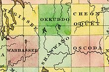
The county was created in 1840 as Okkuddo County (meaning "sickly water," although the reason for using a name with such a negative meaning is lost). The name was changed to Otsego in 1843.[6] It was organized in 1875.[1]
Geography[]
According to the U.S. Census Bureau, the county has a total area of 526 square miles (1,360 km2), of which 515 square miles (1,330 km2) is land and 11 square miles (28 km2) (2.1%) is water.[7] It is the fifth-smallest county by total area in Michigan. Although it is located on Michigan's Lower Peninsula, Otsego County is considered to be part of Northern Michigan.
Otsego County has more than 370 lakes, mostly in the southern part of the county. Otsego Lake, is the county's largest, and has a surface area of 1,972 acres (7.98 km2). Other large lakes in the southern part of the county include Big Lake, Big Bear Lake, Buhl Lake, Crapo Lake, Dixon Lake, Douglas Lake, Guthrie Lake, Heart Lake, Lake Tecon, Manuka Lake, Opal Lake, Pencil Lake, and Turtle Lake. The larger lakes in the northern part of the county are Five Lakes, Hardwood Lake, Lake Twenty Seven, and Pickerel Lake. Many of these are so-called 'kettle lakes,' formed by the melting of blocks of glacial ice, left as the glacier retreated, which created a depression in the soil.[6]
Glaciers shaped the area, creating a unique regional ecosystem. A large portion of the area is the Grayling outwash plain, a broad outwash plain including sandy ice-disintegration ridges; jack pine barrens, some white pine-red pine forest, and northern hardwood forest. Large lakes were created by glacial action.[8]
Headwaters of the Au Sable, Black, Manistee, Pigeon, and Sturgeon Rivers are in Otsego County. The Au Sable River watershed is the county's largest watershed.[6]
Adjacent counties[]
- Cheboygan County - north
- Montmorency County - east
- Oscoda County - southeast
- Crawford County - south
- Kalkaska County - southwest
- Antrim County - west
- Charlevoix County - northwest
Transportation[]
Major highways[]
 I-73 – planned to run concurrent with Interstate 75 up to the Canada–US border.
 I-75 – runs generally north–south through the west-central part of the county, passing Vanderbilt, Gaylord and Oak Grove.
 BL I-75 – loop route running through Gaylord. It follows the former route of US 27.
 M-32 – runs east–west through the county, linking East Jordan to the west and Alpena to the east.
 C-38
C-38 C-42
C-42 F-01
F-01 F-38
F-38 F-42
F-42 F-44
F-44 F-97
F-97
Other Routes[]
- Old US 27 serves as a scenic alternative to I-75.[9]
Airport[]
Gaylord Regional Airport – on SW edge of Gaylord, owned and operated by Otsego County, is a General Utility Airport. It is listed as a tier one airport in all categories of the Michigan Airport System Plan.[10][11]
Demographics[]
| Historical population | |||
|---|---|---|---|
| Census | Pop. | %± | |
| 1880 | 1,974 | — | |
| 1890 | 4,272 | 116.4% | |
| 1900 | 6,175 | 44.5% | |
| 1910 | 6,552 | 6.1% | |
| 1920 | 6,043 | −7.8% | |
| 1930 | 5,554 | −8.1% | |
| 1940 | 5,827 | 4.9% | |
| 1950 | 6,435 | 10.4% | |
| 1960 | 7,545 | 17.2% | |
| 1970 | 10,422 | 38.1% | |
| 1980 | 14,993 | 43.9% | |
| 1990 | 17,957 | 19.8% | |
| 2000 | 23,301 | 29.8% | |
| 2010 | 24,164 | 3.7% | |
| 2018 (est.) | 24,665 | [12] | 2.1% |
| US Decennial Census[13] 1790-1960[14] 1900-1990[15] 1990-2000[16] 2010-2018[2] | |||
As of the 2000 United States Census,[17] there were 23,301 people, 8,995 households, and 6,539 families residing in the county. The population density was 45 people per square mile (17/km2). There were 13,375 housing units at an average density of 26 per square mile (10/km2). The racial makeup of the county was 97.51% White, 0.18% Black or African American, 0.62% Native American, 0.34% Asian, 0.04% Pacific Islander, 0.15% from other races, and 1.16% from two or more races. 0.75% of the population were Hispanic or Latino of any race. 22.1% were of German, 17.6% Polish, 10.5% Irish, 9.9% English and 9.4% American ancestry. 96.8% spoke English and 1.3% Polish as their first language.
There were 8,995 households, out of which 34.10% had children under the age of 18 living with them, 60.40% were married couples living together, 8.30% had a female householder with no husband present, and 27.30% were non-families. 22.50% of all households were made up of individuals, and 9.10% had someone living alone who was 65 years of age or older. The average household size was 2.56 and the average family size was 3.00.
The county population contained 26.80% under the age of 18, 7.00% from 18 to 24, 28.50% from 25 to 44, 24.00% from 45 to 64, and 13.70% who were 65 years of age or older. The median age was 38 years. For every 100 females there were 98.60 males. For every 100 females age 18 and over, there were 96.70 males.
The median income for a household in the county was $40,876, and the median income for a family was $46,628. Males had a median income of $34,413 versus $21,204 for females. The per capita income for the county was $19,810. About 5.30% of families and 6.80% of the population were below the poverty line, including 7.50% of those under age 18 and 7.10% of those age 65 or over.
Government[]
Otsego County voters have been reliably Republican from the start. They have selected the Republican Party nominee in 88% of national elections (30 of 34).
Political Culture[]
The county government operates the jail, maintains rural roads, operates the major local courts, records deeds, mortgages, and vital records, administers public health regulations, and participates with the state in the provision of social services. The county board of commissioners controls the budget and has limited authority to make laws or ordinances. In Michigan, most local government functions — police and fire, building and zoning, tax assessment, street maintenance, etc. — are the responsibility of individual cities and townships.
Elected officials[]
- Prosecuting Attorney: Michael A. Rola
- Sheriff: Matthew Nowicki
- County Clerk/Register of Deeds: Susan I. DeFeyter
- County Treasurer: Diann M. Axford
- County Surveyor: Ronald C. Brand[19]
(information as of September 2005)
Media[]
The Gaylord Herald Times is the newspaper of record for Otsego County. It is published twice weekly, and is the oldest surviving business. It was founded in 1875, the year that the county was organized.[20]
Communities[]

City[]
- Gaylord (county seat)
Village[]
Civil townships[]
Unincorporated communities[]
- Arbutus Beach
- Elmira
- Eyedylwild Beach
- Johannesburg
- Oak Grove
- Otsego Lake
- Sparr
- Vienna Corners (partial)
- Waters
See also[]
- List of Michigan State Historic Sites in Otsego County, Michigan
- National Register of Historic Places listings in Otsego County, Michigan
References[]
- ^ Jump up to: a b c "Bibliography on Otsego County". Clarke Historical Library, Central Michigan University. Retrieved January 29, 2013.
- ^ Jump up to: a b "State & County QuickFacts". US Census Bureau. Archived from the original on June 6, 2011. Retrieved August 29, 2013.
- ^ "Find a County". National Association of Counties. Retrieved June 7, 2011.
- ^ Otsego County history page. Archived February 19, 2008, at the Wayback Machine
- ^ Michigan government on place names in Michigan
- ^ Jump up to: a b c Soil Survey of Otsego County, US Dept. of Agriculture, Michigan State University Agricultural Extension Service Archived April 10, 2008, at the Wayback Machine
- ^ "2010 Census Gazetteer Files". US Census Bureau. August 22, 2012. Archived from the original on November 13, 2013. Retrieved September 27, 2014.
- ^ "NPWRC :: Regional Landscape". usgs.gov. Archived from the original on June 25, 2013.
- ^ Old US 27 history Archived February 22, 2008, at the Wayback Machine
- ^ Gaylord Airport, County page. Archived February 19, 2008, at the Wayback Machine
- ^ *Gaylord Regional Airport Information
- ^ "Population and Housing Unit Estimates". Retrieved May 17, 2019.
- ^ "US Decennial Census". US Census Bureau. Retrieved September 27, 2014.
- ^ "Historical Census Browser". University of Virginia Library. Retrieved September 27, 2014.
- ^ "Population of Counties by Decennial Census: 1900 to 1990". US Census Bureau. Retrieved September 27, 2014.
- ^ "Census 2000 PHC-T-4. Ranking Tables for Counties: 1990 and 2000" (PDF). US Census Bureau. Retrieved September 27, 2014.
- ^ "U.S. Census website". US Census Bureau. Retrieved January 31, 2008.
- ^ US Election Atlas
- ^ "Election results". Traverse City Record-Eagle. August 4, 2004. Archived from the original on March 4, 2016. Retrieved July 1, 2012.
- ^ "Gaylord". Petoskey News-Review. Archived from the original on February 6, 2005.
External links[]
- "Bibliography on Otsego County". Clarke Historical Library, Central Michigan University.
- Enchanted forest, Northern Michigan source for information, calendars, etc.
- Gaylord Herald Times home page
- Otsego Community Connection
- Otsego County Historical Society
- Otsego County home page
- Gaylord Regional Airport Information
- Soil Survey of Otsego County, U.S. Department of Agriculture, Michigan State University Agricultural Extension Service (lots more here, such as history, economy, etc.)
| show Places adjacent to Otsego County, Michigan |
|---|
| show Municipalities and communities of Otsego County, Michigan, United States |
|---|

| show |
|---|

| show Authority control |
|---|
- Michigan counties
- Otsego County, Michigan
- 1875 establishments in Michigan
- Populated places established in 1875