Perryton, Texas
Perryton, Texas | |
|---|---|
City | |
 Location of Perryton, Texas | |
| Coordinates: 36°23′30″N 100°48′22″W / 36.39167°N 100.80611°WCoordinates: 36°23′30″N 100°48′22″W / 36.39167°N 100.80611°W | |
| Area | |
| • Total | 4.80 sq mi (12.43 km2) |
| • Land | 4.80 sq mi (12.43 km2) |
| • Water | 0.00 sq mi (0.00 km2) |
| Elevation | 2,940 ft (896 m) |
| Population (2010) | |
| • Total | 8,802 |
| • Estimate (2019)[2] | 8,512 |
| • Density | 1,774.07/sq mi (685.04/km2) |
| Time zone | UTC−6 |
| • Summer (DST) | UTC−5 (CDT) |
| ZIP code | 79070 |
| Area code(s) | 806 |
| FIPS code | 48-56912 |
| Website | www |

Perryton is a city in and the county seat of Ochiltree County, Texas, United States. Its population was 8,802 at the 2010 census.[3]
Geography[]
Perryton is located at 36°23′30″N 100°48′22″W / 36.39167°N 100.80611°W (36.391752, -100.806109).[4] According to the United States Census Bureau, the city has a total area of 4.5 sq mi (12 km2), of which 0.04 square miles (0.10 km2) (0.45%) is covered by water.
Climate[]
Perryton has a borderline cool semiarid climate (Köppen BSk) just short of either a humid subtropical climate (Cfa) or a humid continental climate (Dfa). Winter mornings are very cold: 137.9 mornings on average fall to or below freezing and 4.4 mornings each year can be expected to fall so low as 0 °F or −17.8 °C. This indicates heavy continental influence courtesy of its far inland position. Winter weather can be extremely variable, ranging from extremely cold due to Arctic outbreaks from the Yukon to a three-month winter average of six afternoons above 70 °F or 21.1 °C due to hot chinook winds blowing off the Rocky Mountains. In some cases, these chinooks can produce extremely rapid increases in temperature; during February 10, 2017, the temperature rose from 25 °F (−3.9 °C) in the morning to 92 °F (33.3 °C) in the afternoon and down to 46 °F (7.8 °C) the following morning.
Summers are hot, and mornings remain relatively mild. Nine mornings each year can be expected to stay above 68 °F or 20 °C, but virtually none stay above 77 °F or 25 °C, although the temperature did not fall below 79 °F or 26.1 °C on July 10, 2016. However, 70.5 afternoons reach 90 °F or 32.2 °C, with 12.3 afternoons topping 100 °F or 37.8 °C, and a record high of 113 °F (45 °C) on June 26, 2011. The coldest morning was −17 °F (−27.2 °C) on January 7, 1988, and the coldest maximum 3 °F (−16.1 °C) on December 22 and 23 (twice on consecutive days) of 1990.
| hideClimate data for Perryton, Texas (1981-2010; extremes since 1907) | |||||||||||||
|---|---|---|---|---|---|---|---|---|---|---|---|---|---|
| Month | Jan | Feb | Mar | Apr | May | Jun | Jul | Aug | Sep | Oct | Nov | Dec | Year |
| Record high °F (°C) | 81 (27) |
92 (33) |
96 (36) |
101 (38) |
106 (41) |
113 (45) |
112 (44) |
106 (41) |
106 (41) |
102 (39) |
92 (33) |
78 (26) |
113 (45) |
| Average high °F (°C) | 48.2 (9.0) |
51.6 (10.9) |
60.6 (15.9) |
69.7 (20.9) |
78.0 (25.6) |
87.0 (30.6) |
92.4 (33.6) |
90.8 (32.7) |
83.2 (28.4) |
71.0 (21.7) |
59.2 (15.1) |
47.5 (8.6) |
70.0 (21.1) |
| Daily mean °F (°C) | 33.6 (0.9) |
36.7 (2.6) |
44.9 (7.2) |
53.6 (12.0) |
63.2 (17.3) |
72.6 (22.6) |
77.8 (25.4) |
76.6 (24.8) |
68.5 (20.3) |
56.3 (13.5) |
44.0 (6.7) |
33.9 (1.1) |
55.2 (12.9) |
| Average low °F (°C) | 19.0 (−7.2) |
21.9 (−5.6) |
29.2 (−1.6) |
37.5 (3.1) |
48.4 (9.1) |
58.2 (14.6) |
63.2 (17.3) |
62.4 (16.9) |
53.9 (12.2) |
41.7 (5.4) |
28.9 (−1.7) |
20.4 (−6.4) |
40.5 (4.7) |
| Record low °F (°C) | −17 (−27) |
−15 (−26) |
−5 (−21) |
13 (−11) |
23 (−5) |
41 (5) |
47 (8) |
46 (8) |
29 (−2) |
11 (−12) |
−4 (−20) |
−12 (−24) |
−17 (−27) |
| Average precipitation inches (mm) | 0.47 (12) |
0.62 (16) |
1.75 (44) |
1.82 (46) |
2.96 (75) |
3.32 (84) |
3.12 (79) |
2.63 (67) |
1.86 (47) |
1.83 (46) |
0.88 (22) |
0.84 (21) |
22.1 (559) |
| Average snowfall inches (cm) | 3.8 (9.7) |
4.1 (10) |
4.3 (11) |
0.8 (2.0) |
0.0 (0.0) |
0.0 (0.0) |
0.0 (0.0) |
0.0 (0.0) |
0.0 (0.0) |
0.3 (0.76) |
1.0 (2.5) |
4.0 (10) |
18.3 (45.96) |
| Average precipitation days (≥ 0.01 inch) | 3.0 | 2.9 | 5.5 | 5.4 | 7.5 | 6.8 | 5.8 | 6.5 | 5.5 | 3.7 | 3.4 | 3.2 | 59.2 |
| Average snowy days (≥ 0.1 inch) | 2.1 | 1.6 | 1.6 | 0.3 | trace | 0.0 | 0.0 | 0.0 | trace | 0.0 | 1.0 | 1.5 | 8.2 |
| Source 1: NOAA[5] | |||||||||||||
| Source 2: National Weather Service[6] | |||||||||||||
Demographics[]
| Historical population | |||
|---|---|---|---|
| Census | Pop. | %± | |
| 1930 | 2,824 | — | |
| 1940 | 2,325 | −17.7% | |
| 1950 | 4,417 | 90.0% | |
| 1960 | 7,903 | 78.9% | |
| 1970 | 7,810 | −1.2% | |
| 1980 | 7,991 | 2.3% | |
| 1990 | 7,607 | −4.8% | |
| 2000 | 7,774 | 2.2% | |
| 2010 | 8,802 | 13.2% | |
| 2019 (est.) | 8,512 | [2] | −3.3% |
| U.S. Decennial Census[7] | |||
At the 2000 census,[8] 7,774 people, 2,785 households and 2,113 families were residing in the city. The population density was 1,753.2 people/sq mi (677.6/km2). The 3,180 housing units had an average density of 717.2 per square mile (277.2/km2). The racial makeup of the city was 85.23% White, 0.15% African American, 0.98% Native American, 0.40% Asian, 11.11% from other races, and 2.12% from two or more races. Hispanics or Latinos of any race were 34.13% of the population.
Of the 2,785 households, 42.3% had children under the age of 18 living with them, 62.6% were married couples living together, 8.7% had a female householder with no husband present, and 24.1% were not families. About 21.3% of all households were made up of individuals, and 9.5% had someone living alone who was 65 or older. The average household size was 2.77, and the average family size was 3.22.
Age distribution was 31.3% under 18, 8.7% from 18 to 24, 28.9% from 25 to 44, 19.8% from 45 to 64, and 11.3% who were 65 or older. The median age was 33 years. For every 100 females, there were 98.1 males. For every 100 females age 18 and over, there were 94.4 males.
The median household income was $37,363, and the median family income was $45,045. Males had a median income of $31,803 compared with $19,694 for females. The per capita income for the city was $16,431. About 9.7% of families and 13.2% of the population were below the poverty line, including 18.4% of those under age 18 and 10.2% of those age 65 or over.
Education[]
The City of Perryton is served by the Perryton Independent School District and the Perryton High School.
Notable people[]
- Caleb Campbell, NFL player
- Jeremy Campbell, 2008 Summer Paralympics athlete
- John Erickson, author of the Hank the Cowdog series
- Keith Flowers, NFL player
- Mickey Gates, member of the Arkansas House of Representatives
- Mike Hargrove, MLB player and manager
- Ryan Culwell, singer-songwriter
Gallery[]

Perryton: "Wheatheart of the Nation"
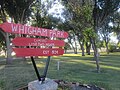
Whigham Park (established 1934) offers two free nights of camping.
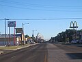
U.S. Highway 83 as it proceeds through downtown

Former Hotel Perryton in downtown

Ellis Theater in downtown


References[]
- ^ "2019 U.S. Gazetteer Files". United States Census Bureau. Retrieved August 7, 2020.
- ^ Jump up to: a b "Population and Housing Unit Estimates". United States Census Bureau. May 24, 2020. Retrieved May 27, 2020.
- ^ "Find a County". National Association of Counties. Retrieved 2011-06-07.
- ^ "US Gazetteer files: 2010, 2000, and 1990". United States Census Bureau. 2011-02-12. Retrieved 2011-04-23.
- ^ National Oceanic and Atmospheric Administration;
- ^ National Weather Service, Amarillo, Texas; NOW Data – NOAA Online Weather Data
- ^ "Census of Population and Housing". Census.gov. Retrieved June 4, 2015.
- ^ "U.S. Census website". United States Census Bureau. Retrieved 2008-01-31.
External links[]
| show Municipalities and communities of Ochiltree County, Texas, United States |
|---|


| show Authority control |
|---|
- Cities in Ochiltree County, Texas
- Cities in Texas
- County seats in Texas