Canadian, Texas
Canadian, Texas | |
|---|---|
City | |
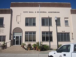 City Hall and Municipal Auditorium | |
 Location of Canadian, Texas | |
 | |
| Coordinates: 35°54′39″N 100°23′2″W / 35.91083°N 100.38389°WCoordinates: 35°54′39″N 100°23′2″W / 35.91083°N 100.38389°W | |
| Country | United States |
| State | Texas |
| County | Hemphill |
| Area | |
| • Total | 1.30 sq mi (3.36 km2) |
| • Land | 1.30 sq mi (3.36 km2) |
| • Water | 0.00 sq mi (0.00 km2) |
| Elevation | 2,425 ft (739 m) |
| Population (2010) | |
| • Total | 2,649 |
| • Estimate (2019)[4] | 2,699 |
| • Density | 2,079.35/sq mi (802.61/km2) |
| Time zone | UTC-6 (Central (CST)) |
| • Summer (DST) | UTC-5 (CDT) |
| ZIP code | 79014 |
| Area code(s) | 806 Exchange: 323 |
| FIPS code | 48-12412[2] |
| GNIS feature ID | 1372905[3] |
| Website | www |

Canadian (/kæn/) is a city in, and the county seat of, Hemphill County, Texas, United States.[5] The population was 2,649 at the 2010 census,[6] up from 2,233 in 2000. It is named for the nearby Canadian River, a tributary of the Arkansas River. Incorporated in 1908, Canadian is sometimes called "the oasis of the High Plains". Canadian is on the eastern side of the Texas Panhandle, close to the border with Oklahoma.
History[]
The trails along the river are older than recorded history. Francisco Coronado came through the area in 1541 in a vain search for the Seven Cities of Cibola. In 1840, Josiah Gregg and 34 men from Missouri passed through Canadian with trading goods worth $25,000 while en route to Santa Fe, New Mexico. In 1849, parties headed for the California Gold Rush passed through, led by Captain Randolph B. Marcy. In the 1870s and 1880, hunters, cattlemen, and settlers alike used the trails as the Panhandle was opened for Anglo-American settlement.[7]
By the first decade of the 1900s, Canadian was a railroad and marketing center; it was served in the late 1920s by the Clinton-Oklahoma-Western Railroad Company of Texas, one of the Frank Kell properties.[8]
Canadian had a Baptist academy. Robert Moody (1838–1915), a banker, rancher, and academy trustee, built the Moody Hotel downtown to reflect on the future of the community. The three-story, brick-veneer structure replaced the former McIntosh Hotel. The Moody opened late in 1910 with 40 guest rooms and an oak stairway. The hotel flourished until changing travel patterns caused it to close. It was purchased by pioneer merchant Nahim Abraham in 1950 and now houses the Abraham Companies, operated by his great-grandsons.[9] Robert Moody's grandson, Robert R. Young, also a native of Canadian, was subsequently the chief officer of the New York Central Railroad.[10]
A portion of the Tom Hanks movie Cast Away was filmed in Canadian.[11]
Geography[]
Canadian is northwest of the center of Hemphill County, 1 mile (1.6 km) south of the Canadian River, where it is joined by Red Deer Creek. U.S. Routes 60 and 83 pass through the center of town as Second Street. US 60 leads northeast 162 miles (261 km) to Enid, Oklahoma, and southwest 101 miles (163 km) to Amarillo, while US 83 leads northwest 46 miles (74 km) to Perryton and south 51 miles (82 km) to Shamrock.
According to the U.S. Census Bureau, Canadian has a total area of 1.3 square miles (3.4 km2), all land.[6]
Climate[]
Canadian has a cool semi-arid climate (Köppen BSk) that is almost wet enough to qualify as a humid subtropical climate (Cfa).[12]
| hideClimate data for Canadian, Texas | |||||||||||||
|---|---|---|---|---|---|---|---|---|---|---|---|---|---|
| Month | Jan | Feb | Mar | Apr | May | Jun | Jul | Aug | Sep | Oct | Nov | Dec | Year |
| Record high °F (°C) | 85 (29) |
90 (32) |
95 (35) |
99 (37) |
105 (41) |
112 (44) |
111 (44) |
110 (43) |
108 (42) |
101 (38) |
90 (32) |
84 (29) |
112 (44) |
| Average high °F (°C) | 47 (8) |
54 (12) |
62 (17) |
71 (22) |
79 (26) |
88 (31) |
94 (34) |
93 (34) |
85 (29) |
74 (23) |
59 (15) |
48 (9) |
71 (22) |
| Average low °F (°C) | 19 (−7) |
23 (−5) |
30 (−1) |
41 (5) |
52 (11) |
62 (17) |
66 (19) |
65 (18) |
56 (13) |
43 (6) |
30 (−1) |
21 (−6) |
42 (6) |
| Record low °F (°C) | −14 (−26) |
−14 (−26) |
−4 (−20) |
15 (−9) |
24 (−4) |
39 (4) |
47 (8) |
45 (7) |
27 (−3) |
11 (−12) |
−2 (−19) |
−13 (−25) |
−14 (−26) |
| Average precipitation inches (mm) | 0.46 (12) |
0.75 (19) |
1.70 (43) |
1.72 (44) |
3.75 (95) |
3.33 (85) |
2.19 (56) |
2.36 (60) |
2.36 (60) |
1.47 (37) |
0.94 (24) |
0.69 (18) |
21.72 (553) |
| Average snowfall inches (cm) | 3.80 (9.7) |
2.40 (6.1) |
1.90 (4.8) |
0.30 (0.76) |
0 (0) |
0 (0) |
0 (0) |
0 (0) |
0 (0) |
0.10 (0.25) |
1.00 (2.5) |
7.00 (17.8) |
16.50 (41.9) |
| Source: [13] | |||||||||||||
Demographics[]
| Historical population | |||
|---|---|---|---|
| Census | Pop. | %± | |
| 1910 | 1,648 | — | |
| 1920 | 2,187 | 32.7% | |
| 1930 | 2,068 | −5.4% | |
| 1940 | 2,151 | 4.0% | |
| 1950 | 2,700 | 25.5% | |
| 1960 | 2,239 | −17.1% | |
| 1970 | 2,292 | 2.4% | |
| 1980 | 3,491 | 52.3% | |
| 1990 | 2,417 | −30.8% | |
| 2000 | 2,233 | −7.6% | |
| 2010 | 2,649 | 18.6% | |
| 2019 (est.) | 2,699 | [4] | 1.9% |
| 1930-2000,[14] | |||
As of the census[2] of 2000, 2,233 people, 869 households, and 625 families resided in the city. The population density was 1,731.0 people per square mile (668.3/km2). The 1,047 housing units averaged 811.6 per square mile (313.4/km2). The racial makeup of the city was 88.94% White, 0.22% African American, 0.76% Native American, 0.13% Asian, 0.04% Pacific Islander, 9.00% from other races, and 0.90% from two or more races. Hispanics or Latinos of any race were 18.76% of the population.
Of the 869 households, 35.0% had children under the age of 18 living with them, 60.9% were married couples living together, 7.6% had a female householder with no husband present, and 28.0% were not families. About 26.1% of all households were made up of individuals, and 13.5% had someone living alone who was 65 years of age or older. The average household size was 2.52 and the average family size was 3.04.
In the city, the population was distributed as 27.5% under the age of 18, 7.2% from 18 to 24, 26.8% from 25 to 44, 22.9% from 45 to 64, and 15.5% who were 65 years of age or older. The median age was 38 years. For every 100 females, there were 91.7 males. For every 100 females age 18 and over, there were 87.0 males.
The median income for a household in the city was $31,929, and for a family was $38,676. Males had a median income of $30,240 versus $17,083 for females. The per capita income for the city was $16,384. About 12.3% of families and 14.1% of the population were below the poverty line, including 19.4% of those under age 18 and 16.4% of those age 65 or over.
Education[]
The City of Canadian is served by the Canadian Independent School District.
Notable people[]
- Malouf Abraham Sr. (1915–1994), businessman and politician
- Nahim Abraham (1885–1965), businessman
- Ken King (born 1971), businessman and politician
- Dave McCurdy (born 1950), businessman and politician
- Richard A. Waterfield (1939–2007), rancher and politician
- Robert R. Young (1897–1958), businessman
Gallery[]

Palace Theater in downtown Canadian, restored through a $1 million gift from futures trader
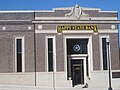
Happy State Bank and Trust
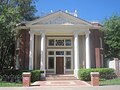
's Citadelle Art Foundation

Sculpture at Citadel Garden


References[]
- ^ "2019 U.S. Gazetteer Files". United States Census Bureau. Retrieved August 7, 2020.
- ^ Jump up to: a b "U.S. Census website". United States Census Bureau. Retrieved 2008-01-31.
- ^ "US Board on Geographic Names". United States Geological Survey. 2007-10-25. Retrieved 2008-01-31.
- ^ Jump up to: a b "Population and Housing Unit Estimates". United States Census Bureau. May 24, 2020. Retrieved May 27, 2020.
- ^ "Find a County". National Association of Counties. Archived from the original on 2011-05-31. Retrieved 2011-06-07.
- ^ Jump up to: a b "Geographic Identifiers: 2010 Census Summary File 1 (G001): Canadian city, Texas". American Factfinder. U.S. Census Bureau. Archived from the original on February 13, 2020. Retrieved February 9, 2018.
- ^ Texas Historical Commission, historical marker, Canadian River, 1966
- ^ "Clinton-Oklahoma-Western Railroad". tshaonline.org. Retrieved April 27, 2013.
- ^ Texas Historical Commission, Historical marker, Moody Building, Canadian, Texas
- ^ Texas Historical Commission, historical marker, Canadian River, 1967
- ^ Carlson, Paul (August 2007). "Cast Away and the Texas Panhandle" (PDF). The Cyclone, Volume XIV, Issue 2. West Texas Historical Association. pp. 1–2. Retrieved 2 January 2015.
- ^ Climate Summary for Canadian, Texas
- ^ The Weather Channel: Monthly data for Canadian, TX[permanent dead link]
- ^ Texasalmanac
External links[]
- City of Canadian official website
- Canadian, TX in the Handbook of Texas
- New York Times, "New Life Where Towns and Teams Are Dying"
| show Municipalities and communities of Hemphill County, Texas, United States |
|---|


| show Authority control |
|---|
- Cities in Texas
- Cities in Hemphill County, Texas
- County seats in Texas