Port-de-Bouc
show This article may be expanded with text translated from the corresponding article in French. (December 2008) Click [show] for important translation instructions. |
Port-de-Bouc | |
|---|---|
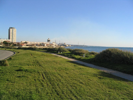 Aigues Douces area | |
 Coat of arms | |
show Location of Port-de-Bouc | |
 Port-de-Bouc | |
| Coordinates: 43°24′21″N 4°59′21″E / 43.4058°N 4.9892°ECoordinates: 43°24′21″N 4°59′21″E / 43.4058°N 4.9892°E | |
| Country | France |
| Region | Provence-Alpes-Côte d'Azur |
| Department | Bouches-du-Rhône |
| Arrondissement | Istres |
| Canton | Martigues |
| Intercommunality | Aix-Marseille-Provence |
| Government | |
| • Mayor (2020–2026) | Laurent Belsola |
| Area 1 | 11.46 km2 (4.42 sq mi) |
| Population (Jan. 2018)[1] | 16,569 |
| • Density | 1,400/km2 (3,700/sq mi) |
| Time zone | UTC+01:00 (CET) |
| • Summer (DST) | UTC+02:00 (CEST) |
| INSEE/Postal code | 13077 /13110 |
| Elevation | 0–68 m (0–223 ft) (avg. 15 m or 49 ft) |
| 1 French Land Register data, which excludes lakes, ponds, glaciers > 1 km2 (0.386 sq mi or 247 acres) and river estuaries. | |


Port-de-Bouc (French pronunciation: [pɔʁ də buk]; Occitan: Lo Pòrt de Boc) is a commune in the Bouches-du-Rhône department in southern France.
Population[]
| Year | Pop. | ±% |
|---|---|---|
| 1866 | 1,379 | — |
| 1872 | 995 | −27.8% |
| 1876 | 929 | −6.6% |
| 1881 | 1,473 | +58.6% |
| 1886 | 1,442 | −2.1% |
| 1891 | 1,479 | +2.6% |
| 1896 | 1,300 | −12.1% |
| 1901 | 2,239 | +72.2% |
| 1906 | 2,602 | +16.2% |
| 1911 | 3,437 | +32.1% |
| 1921 | 4,141 | +20.5% |
| 1926 | 4,385 | +5.9% |
| 1931 | 5,695 | +29.9% |
| 1936 | 6,163 | +8.2% |
| 1946 | 6,625 | +7.5% |
| 1954 | 8,551 | +29.1% |
| 1962 | 12,510 | +46.3% |
| 1968 | 14,080 | +12.5% |
| 1975 | 21,424 | +52.2% |
| 1982 | 20,106 | −6.2% |
| 1990 | 18,786 | −6.6% |
| 1999 | 16,686 | −11.2% |
| 2008 | 17,207 | +3.1% |
| 2016 | 16,682 | −3.1% |
See also[]
References[]
- ^ "Populations légales 2018". INSEE. 28 December 2020.
| Wikimedia Commons has media related to Port-de-Bouc. |
| show Authority control |
|---|
This Bouches-du-Rhône geographical article is a stub. You can help Wikipedia by . |
Categories:
- Communes of Bouches-du-Rhône
- Avatici
- Bouches-du-Rhône geography stubs