Cuges-les-Pins
show This article may be expanded with text translated from the corresponding article in French. (December 2008) Click [show] for important translation instructions. |
Cuges-les-Pins | |
|---|---|
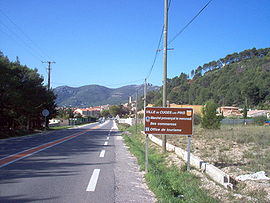 Entrance of Cuges-les-Pins | |
 Coat of arms | |
show Location of Cuges-les-Pins | |
 Cuges-les-Pins | |
| Coordinates: 43°16′38″N 5°42′05″E / 43.2772°N 5.7014°ECoordinates: 43°16′38″N 5°42′05″E / 43.2772°N 5.7014°E | |
| Country | France |
| Region | Provence-Alpes-Côte d'Azur |
| Department | Bouches-du-Rhône |
| Arrondissement | Marseille |
| Canton | La Ciotat |
| Intercommunality | Aix-Marseille-Provence |
| Government | |
| • Mayor (2020–2026) | Bernard Destrost |
| Area 1 | 38.81 km2 (14.98 sq mi) |
| Population (Jan. 2018)[1] | 5,147 |
| • Density | 130/km2 (340/sq mi) |
| Time zone | UTC+01:00 (CET) |
| • Summer (DST) | UTC+02:00 (CEST) |
| INSEE/Postal code | 13042 /13420 |
| Dialling codes | 0491 |
| Elevation | 165–1,041 m (541–3,415 ft) (avg. 191 m or 627 ft) |
| 1 French Land Register data, which excludes lakes, ponds, glaciers > 1 km2 (0.386 sq mi or 247 acres) and river estuaries. | |


Cuges-les-Pins (French pronunciation: [kyʒ le pɛ̃]; Occitan: Cuja) is a commune situated east of Marseille in the department of Bouches-du-Rhône in the Provence-Alpes-Côte d'Azur region in southern France.
Population[]
|
|
See also[]
References[]
- ^ "Populations légales 2018". INSEE. 28 December 2020.
External links[]
- (in French) Official town website
| Wikimedia Commons has media related to Cuges-les-Pins. |
| show Authority control |
|---|
This Bouches-du-Rhône geographical article is a stub. You can help Wikipedia by . |
Categories:
- Communes of Bouches-du-Rhône
- Bouches-du-Rhône geography stubs