Rettel
Rettel | |
|---|---|
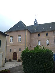 The abbey in Rettel | |
 Coat of arms | |
show Location of Rettel | |
 Rettel | |
| Coordinates: 49°26′37″N 6°19′43″E / 49.4436°N 6.3286°ECoordinates: 49°26′37″N 6°19′43″E / 49.4436°N 6.3286°E | |
| Country | France |
| Region | Grand Est |
| Department | Moselle |
| Arrondissement | Thionville |
| Canton | Bouzonville |
| Intercommunality | |
| Government | |
| • Mayor (2020–2026) | Rémi Schwenck[1] |
| Area 1 | 6.89 km2 (2.66 sq mi) |
| Population (Jan. 2018)[2] | 766 |
| • Density | 110/km2 (290/sq mi) |
| Time zone | UTC+01:00 (CET) |
| • Summer (DST) | UTC+02:00 (CEST) |
| INSEE/Postal code | 57576 /57480 |
| Elevation | 145–300 m (476–984 ft) (avg. 150 m or 490 ft) |
| 1 French Land Register data, which excludes lakes, ponds, glaciers > 1 km2 (0.386 sq mi or 247 acres) and river estuaries. | |


Rettel is a commune in the Moselle department in Grand Est in north-eastern France.
Population[]
| Year | Pop. | ±% |
|---|---|---|
| 2006 | 736 | — |
| 2007 | 748 | +1.6% |
| 2008 | 745 | −0.4% |
| 2009 | 743 | −0.3% |
| 2010 | 740 | −0.4% |
| 2011 | 737 | −0.4% |
| 2012 | 727 | −1.4% |
| 2013 | 719 | −1.1% |
| 2014 | 722 | +0.4% |
| 2015 | 724 | +0.3% |
| 2016 | 726 | +0.3% |
Politics[]
Presidential Elections 2nd Round [3][]
| Election | Winning Candidate | Party | % | |
|---|---|---|---|---|
| 2017 | Emmanuel Macron | EM | 60.67 | |
| 2012 | Nicolas Sarkozy | UMP | 58.91 | |
| 2007 | Nicolas Sarkozy | UMP | 62.16 | |
| 2002 | Jacques Chirac | RPR | 81.21 | |
See also[]
| Wikimedia Commons has media related to Rettel. |
References[]
- ^ "Répertoire national des élus: les maires". data.gouv.fr, Plateforme ouverte des données publiques françaises (in French). 2 December 2020.
- ^ "Populations légales 2018". INSEE. 28 December 2020.
- ^ http://www.lemonde.fr/data/france/presidentielle-2017/
Categories:
- Communes of Moselle (department)
- Thionville arrondissement geography stubs