Rockvale, Colorado
Rockvale, Colorado | |
|---|---|
Town | |
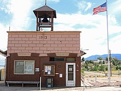 Rockvale's town hall on Railroad St. | |
 Location of Rockvale in Fremont County, Colorado. | |
| Coordinates: 38°22′8″N 105°9′53″W / 38.36889°N 105.16472°WCoordinates: 38°22′8″N 105°9′53″W / 38.36889°N 105.16472°W | |
| Country | |
| State | |
| County[1] | Fremont County[2] |
| Incorporated (town) | September 30, 1886[3] |
| Government | |
| • Type | Statutory Town[1] |
| Area | |
| • Total | 2.04 sq mi (5.28 km2) |
| • Land | 2.04 sq mi (5.28 km2) |
| • Water | 0.00 sq mi (0.00 km2) |
| Elevation | 5,463 ft (1,665 m) |
| Population (2010) | |
| • Total | 487 |
| • Estimate (2019)[5] | 519 |
| • Density | 254.41/sq mi (98.25/km2) |
| Time zone | UTC-7 (Mountain (MST)) |
| • Summer (DST) | UTC-6 (MDT) |
| ZIP code[6] | 81244 (PO Box) |
| Area code(s) | 719 |
| FIPS code | 08-64970 |
| GNIS feature ID | 0203568 |
| Highways | none |

Rockvale is a statutory town in Fremont County, Colorado, United States. The population was 487 at the 2010 census,[7] up from 426 at the 2000 census.
Geography[]
Rockvale is located in southeastern Fremont County at 38°22′8″N 105°9′53″W / 38.36889°N 105.16472°W (38.368845, -105.164813).[8] It is bordered to the north by the town of Williamsburg, and the town of Coal Creek is to the east.
According to the United States Census Bureau, the town of Rockvale has a total area of 1.9 square miles (5.0 km2), all of it land.[7]
Demographics[]
| Historical population | |||
|---|---|---|---|
| Census | Pop. | %± | |
| 1900 | 870 | — | |
| 1910 | 1,413 | 62.4% | |
| 1920 | 1,249 | −11.6% | |
| 1930 | 710 | −43.2% | |
| 1940 | 575 | −19.0% | |
| 1950 | 380 | −33.9% | |
| 1960 | 413 | 8.7% | |
| 1970 | 359 | −13.1% | |
| 1980 | 338 | −5.8% | |
| 1990 | 321 | −5.0% | |
| 2000 | 426 | 32.7% | |
| 2010 | 487 | 14.3% | |
| 2019 (est.) | 519 | [5] | 6.6% |
| U.S. Decennial Census[9] | |||
As of the census[10] of 2000, there were 426 people, 166 households, and 122 families residing in the town. The population density was 445.0 people per square mile (171.3/km2). There were 191 housing units at an average density of 199.5 per square mile (76.8/km2). The racial makeup of the town was 94.60% White, 0.23% African American, 0.47% Native American, 0.23% Asian, 1.64% from other races, and 2.82% from two or more races. Hispanic or Latino of any race were 4.23% of the population.
There were 166 households, out of which 27.7% had children under the age of 18 living with them, 57.8% were married couples living together, 12.0% had a female householder with no husband present, and 26.5% were non-families. 22.9% of all households were made up of individuals, and 9.6% had someone living alone who was 65 years of age or older. The average household size was 2.57 and the average family size was 2.98.
In the town, the population was spread out, with 24.9% under the age of 18, 6.8% from 18 to 24, 28.4% from 25 to 44, 28.2% from 45 to 64, and 11.7% who were 65 years of age or older. The median age was 39 years. For every 100 females, there were 96.3 males. For every 100 females age 18 and over, there were 92.8 males.
The median income for a household in the town was $30,000, and the median income for a family was $33,182. Males had a median income of $28,182 versus $17,679 for females. The per capita income for the town was $13,965. About 13.1% of families and 17.8% of the population were below the poverty line, including 27.1% of those under age 18 and 17.0% of those age 65 or over.
See also[]
- Outline of Colorado
- State of Colorado
- Colorado cities and towns
- Colorado municipalities
- Colorado counties
- List of statistical areas in Colorado
- Colorado cities and towns
References[]
- ^ a b "Active Colorado Municipalities". State of Colorado, Department of Local Affairs. Archived from the original on 2009-12-12. Retrieved 2007-09-01.
- ^ a b "US Board on Geographic Names". United States Geological Survey. 2007-10-25. Retrieved 2008-01-31.
- ^ "Colorado Municipal Incorporations". State of Colorado, Department of Personnel & Administration, Colorado State Archives. 2004-12-01. Retrieved 2007-09-02.
- ^ "2019 U.S. Gazetteer Files". United States Census Bureau. Retrieved July 1, 2020.
- ^ a b "Population and Housing Unit Estimates". United States Census Bureau. May 24, 2020. Retrieved May 27, 2020.
- ^ "ZIP Code Lookup" (JavaScript/HTML). United States Postal Service. Retrieved December 25, 2007.
- ^ a b "Geographic Identifiers: 2010 Census Summary File 1 (G001): Rockvale town, Colorado". American Factfinder. U.S. Census Bureau. Archived from the original on February 13, 2020. Retrieved April 21, 2016.
- ^ "US Gazetteer files: 2010, 2000, and 1990". United States Census Bureau. 2011-02-12. Retrieved 2011-04-23.
- ^ "Census of Population and Housing". Census.gov. Retrieved June 4, 2015.
- ^ "U.S. Census website". United States Census Bureau. Retrieved 2008-01-31.
External links[]
Municipalities and communities of Fremont County, Colorado, United States | ||
|---|---|---|
| Cities |  | |
| Towns | ||
| CDPs | ||
| Unincorporated communities | ||
| Ghost towns | ||
| ||

- Towns in Fremont County, Colorado
- Towns in Colorado