Romescamps
From Wikipedia, the free encyclopedia
Commune in Hauts-de-France, France
Romescamps | |
|---|---|
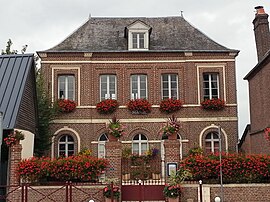 The town hall in Romescamps | |
 Romescamps  Romescamps | |
Coordinates:  49°42′43″N 1°48′20″E / 49.7119°N 1.8056°E / 49.7119; 1.8056Coordinates: 49°42′43″N 1°48′20″E / 49.7119°N 1.8056°E / 49.7119; 1.8056 49°42′43″N 1°48′20″E / 49.7119°N 1.8056°E / 49.7119; 1.8056Coordinates: 49°42′43″N 1°48′20″E / 49.7119°N 1.8056°E / 49.7119; 1.8056 | |
| Country | France |
| Region | Hauts-de-France |
| Department | Oise |
| Arrondissement | Beauvais |
| Canton | Grandvilliers |
| Intercommunality | Picardie Verte |
| Government | |
| • Mayor (2020–2026) | Jacques Peigné[1] |
| Area 1 | 10.48 km2 (4.05 sq mi) |
| Population (Jan. 2018)[2] | 534 |
| • Density | 51/km2 (130/sq mi) |
| Time zone | UTC+01:00 (CET) |
| • Summer (DST) | UTC+02:00 (CEST) |
| INSEE/Postal code | 60545 /60220 |
| Elevation | 174–217 m (571–712 ft) (avg. 213 m or 699 ft) |
| 1 French Land Register data, which excludes lakes, ponds, glaciers > 1 km2 (0.386 sq mi or 247 acres) and river estuaries. | |

Romescamps is a commune in the Oise department in northern France.
See also[]
References[]
- ^ "Répertoire national des élus: les maires". data.gouv.fr, Plateforme ouverte des données publiques françaises (in French). 2 December 2020.
- ^ "Populations légales 2018". INSEE. 28 December 2020.
| Wikimedia Commons has media related to Romescamps. |
show
| |
|---|---|
| Prefecture |
|
| Subprefectures |
|
| Other |
|
This Oise geographical article is a stub. You can help Wikipedia by . |
- v
- t
Retrieved from ""
Categories:
- Communes of Oise
- Oise geography stubs
Hidden categories:
- CS1 French-language sources (fr)
- Articles with short description
- Short description is different from Wikidata
- Infobox mapframe without OSM relation ID on Wikidata
- Coordinates on Wikidata
- Pages using infobox settlement with image map1 but not image map
- Commons category link from Wikidata
- Articles with BNF identifiers
- All stub articles
- Pages using the Kartographer extension