Saint-Sauveur, Oise
Saint-Sauveur | |
|---|---|
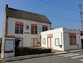 The town hall in Saint-Sauveur | |
show Location of Saint-Sauveur | |
 Saint-Sauveur | |
| Coordinates: 49°19′09″N 2°47′02″E / 49.3192°N 2.7839°ECoordinates: 49°19′09″N 2°47′02″E / 49.3192°N 2.7839°E | |
| Country | France |
| Region | Hauts-de-France |
| Department | Oise |
| Arrondissement | Compiègne |
| Canton | Compiègne-2 |
| Intercommunality | CA Région de Compiègne et Basse Automne |
| Government | |
| • Mayor (2020–2026) | Claude Lebon[1] |
| Area 1 | 16.5 km2 (6.4 sq mi) |
| Population (Jan. 2018)[2] | 1,728 |
| • Density | 100/km2 (270/sq mi) |
| Time zone | UTC+01:00 (CET) |
| • Summer (DST) | UTC+02:00 (CEST) |
| INSEE/Postal code | 60597 /60320 |
| Elevation | 33–133 m (108–436 ft) (avg. 58 m or 190 ft) |
| 1 French Land Register data, which excludes lakes, ponds, glaciers > 1 km2 (0.386 sq mi or 247 acres) and river estuaries. | |


Saint-Sauveur (French pronunciation: [sɛ̃ sovœʁ] (![]() listen)) is a commune in the Oise department in northern France.
listen)) is a commune in the Oise department in northern France.
Mineral water spring[]
Among the numerous ponds and springs which dot the surrounding Compiègne Forest, the Spring of Saint-Sauveur is widely regarded as therapeutic.[3] The spring, which is a pair of two separate mineral water springs, runs both hot and cold and is reputed to provide relief for rheumatism and other ailments.[4]
See also[]
References[]
- ^ Maires au 17-06-2020, data.gouv.fr, accessed 1 December 2020
- ^ "Populations légales 2018". INSEE. 28 December 2020.
- ^ Stevens, Anthony (2001). Ariadne's Clue: A Guide to the Symbols of Humankind. Princeton, NJ: Princeton University Press. p. 131. ISBN 0-691-08661-3. Retrieved 2011-01-03.
- ^ Stedman, Thomas Lathrop (1918). A Practical Medical Dictionary (Fifth Ed.). New York: William Wood and Co. p. 869. OCLC 68605315. Retrieved 2011-01-03.
spring of Saint-Sauveur Oise.
| Wikimedia Commons has media related to Saint-Sauveur (Oise). |
This Oise geographical article is a stub. You can help Wikipedia by . |
Categories:
- Communes of Oise
- Oise geography stubs