San Francisco, Cebu
San Francisco | |
|---|---|
| Municipality of San Francisco | |
 Mangodlong Rock Beach Resort | |
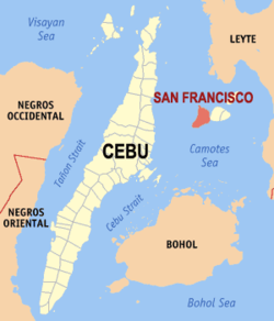 Map of Cebu with San Francisco highlighted | |
show OpenStreetMap | |
 San Francisco Location within the Philippines | |
| Coordinates: 10°39′N 124°21′E / 10.65°N 124.35°ECoordinates: 10°39′N 124°21′E / 10.65°N 124.35°E | |
| Country | Philippines |
| Region | Central Visayas |
| Province | Cebu |
| District | 5th district |
| Named for | St. Francis of Assisi |
| Barangays | 15 (see Barangays) |
| Government | |
| • Type | Sangguniang Bayan |
| • Mayor | Alfredo A. Arquillano Jr. |
| • Vice Mayor | Aly A. Arquillano |
| • Representative | Vincent Franco D. Frasco |
| • Municipal Council | show
Members |
| • Electorate | 31,632 voters (2019) |
| Area | |
| • Total | 106.93 km2 (41.29 sq mi) |
| Elevation | 29 m (95 ft) |
| Highest elevation | 774 m (2,539 ft) |
| Lowest elevation | 0 m (0 ft) |
| Population (2020 census) [3] | |
| • Total | 59,236 |
| • Density | 550/km2 (1,400/sq mi) |
| • Households | 12,212 |
| Economy | |
| • Income class | 3rd municipal income class |
| • Poverty incidence | 44.13% (2015)[4] |
| • Revenue | ₱116,862,176.33 (2016) |
| Service provider | |
| • Electricity | Camotes Electric Cooperative (CELCO) |
| Time zone | UTC+8 (PST) |
| ZIP code | 6050 |
| PSGC | |
| IDD : area code | +63 (0)32 |
| Climate type | tropical climate |
| Native languages | Porohanon Cebuano Tagalog |
| Website | sanfranciscocamotes |


San Francisco, officially the Municipality of San Francisco (Cebuano: Lungsod sa San Francisco; Tagalog: Bayan ng San Francisco), is a 3rd class municipality in the province of Cebu, Philippines. According to the 2020 census, it has a population of 59,236 people. [3]
It is one of the municipalities that comprise the Camotes Islands.
San Francisco is bordered to the north by the Province of Leyte in the Camotes Sea, to the west is the Camotes Sea Facing Catmon, to the east is the island of Poro with town of Poro and to the south is the Camotes Sea
History[]
Protohistory[]
Carl Guthe, director of the University of Michigan Anthropological Museum, during his 1923-25 collecting trip and explorations of archaeological sites in the Philippines,[5] conducted an archeological dig in a cave site on Tulang. Located on the southeastern coast of the island, the cave measures about 3.7 by 2.7 metres (12 by 9 feet). Guthe reported it to contain bone fragments and teeth of about 60 individuals. Associated grave goods included earthenware pottery, shell bracelets, bronze and iron artefacts (iron tang, bronze chisel, iron blade), glass and stone beads, hammerstone and pestle. Filed teeth were also recovered from this site.[a]
21st century[]
Just before Typhoon Yolanda struck in November 2013, the mayor of San Francisco ordered the evacuation of all the residents (approximately 1,000) to the main island. This was credited with saving their lives as all houses on the island (about 500) were completely destroyed.[6]
Geography[]
San Francisco consists primarily of Pacijan Island (also known as Pajican Island[7]), as well as the tiny Tulang islet (area less than 1 km2) just north of Pacijan. Both islands are part of the Camotes Islands group in the Camotes Sea (that also includes Poro Island and Ponson Island). They are located east of the main island of Cebu, south and west of Leyte and north of Bohol.
Pacijan Island[]
Pacijan Island is about 14.75 kilometres (9.17 mi) long and 8.5 kilometres (5.3 mi) wide. A 1,400-metre (1,500 yd) causeway crosses the mangrove swamp to connect Pacijan and Poro Island. It was constructed during the Spanish era, to bridge the islands for easier trading and attending services in Poro church.
Tulang islet[]
Tulang island (known locally as Tulang Diot) is a five-minute boat ride from Tulang Dako on the main island of Pacijan. Both Tulang Diot and Tulang Dako are part of Esperanza barangay. The islet is almost entirely covered with coconut palms and measures about 1.6 by 0.6 kilometres (1.0 by 0.4 mi): the residential area is confined to a small triangle at the southern end. Total area is less than 1 km2 or 40 ha (100 acres), of which only 3.5 ha (8.6 acres) (8.8%) is inhabited.
Barangays[]
San Francisco comprises 15 barangays:
| PSGC | Barangay | Population | ±% p.a. | |||
|---|---|---|---|---|---|---|
| 2020 [3] | 2010 [8] | |||||
| 072242002 | Cabunga‑an | 3.8% | 2,226 | 1,764 | 2.27% | |
| 072242003 | Campo | 5.3% | 3,123 | 2,517 | 2.10% | |
| 072242004 | Consuelo | 9.7% | 5,750 | 4,827 | 1.70% | |
| 072242006 | Esperanza | 10.8% | 6,370 | 5,629 | 1.20% | |
| 072242007 | Himensulan | 3.9% | 2,331 | 2,169 | 0.70% | |
| 072242001 | Montealegre | 2.9% | 1,735 | 1,288 | 2.92% | |
| 072242008 | Northern Poblacion | 8.1% | 4,786 | 3,779 | 2.31% | |
| 072242009 | San Isidro | 7.3% | 4,346 | 3,668 | 1.65% | |
| 072242010 | Santa Cruz | 9.2% | 5,465 | 4,717 | 1.43% | |
| 072242011 | Santiago | 4.1% | 2,412 | 2,132 | 1.20% | |
| 072242012 | Sonog | 6.4% | 3,799 | 3,366 | 1.17% | |
| 072242013 | Southern Poblacion | 7.0% | 4,143 | 3,453 | 1.77% | |
| 072242014 | Unidos | 1.7% | 992 | 1,035 | −0.41% | |
| 072242015 | Union | 8.5% | 5,023 | 4,721 | 0.60% | |
| 072242016 | Western Poblacion | 4.5% | 2,679 | 2,292 | 1.52% | |
| Total | 59,236 | 47,357 | 2.18% | |||
Climate[]
| hideClimate data for San Francisco, Cebu | |||||||||||||
|---|---|---|---|---|---|---|---|---|---|---|---|---|---|
| Month | Jan | Feb | Mar | Apr | May | Jun | Jul | Aug | Sep | Oct | Nov | Dec | Year |
| Average high °C (°F) | 28 (82) |
29 (84) |
29 (84) |
30 (86) |
30 (86) |
30 (86) |
29 (84) |
29 (84) |
29 (84) |
29 (84) |
29 (84) |
29 (84) |
29 (84) |
| Average low °C (°F) | 22 (72) |
22 (72) |
22 (72) |
23 (73) |
25 (77) |
25 (77) |
25 (77) |
25 (77) |
25 (77) |
24 (75) |
24 (75) |
23 (73) |
24 (75) |
| Average precipitation mm (inches) | 78 (3.1) |
57 (2.2) |
84 (3.3) |
79 (3.1) |
118 (4.6) |
181 (7.1) |
178 (7.0) |
169 (6.7) |
172 (6.8) |
180 (7.1) |
174 (6.9) |
128 (5.0) |
1,598 (62.9) |
| Average rainy days | 16.7 | 13.8 | 17.3 | 18.5 | 23.2 | 26.5 | 27.1 | 26.0 | 26.4 | 27.5 | 24.6 | 21.0 | 268.6 |
| Source: Meteoblue [9] | |||||||||||||
Demographics[]
| Year | Pop. | ±% p.a. |
|---|---|---|
| 1903 | 8,110 | — |
| 1918 | 10,772 | +1.91% |
| 1939 | 16,980 | +2.19% |
| 1948 | 19,286 | +1.42% |
| 1960 | 20,894 | +0.67% |
| 1970 | 23,028 | +0.98% |
| 1975 | 27,766 | +3.82% |
| 1980 | 28,806 | +0.74% |
| 1990 | 36,521 | +2.40% |
| 1995 | 39,115 | +1.29% |
| 2000 | 41,327 | +1.19% |
| 2007 | 44,588 | +1.05% |
| 2010 | 47,357 | +2.22% |
| 2015 | 55,180 | +2.95% |
| 2020 | 59,236 | +1.40% |
| Source: Philippine Statistics Authority [10] [8] [11] | ||
Language[]
The town is home to the Porohanon language, one of the most endangered languages in the Visayas. The language is only used in the Poro islands. The language is classified as distinct from Sebwano (Bisaya) by the Komisyon ng Wikang Filipino and is vital to the culture and arts of the Porohanon people.
Economy[]
| Poverty Incidence of San Francisco | |
| Source: Philippine Statistics Authority[12][13][14][15][16][17] | |
Notes[]
- ^ Carl Guthe explored 485 sites comprising 120 caves, 134 burial grounds and 231 graves all over the Philippines that are contained in an inventory report now deposited at the University of Michigan.
References[]
- ^ Municipality of San Francisco | (DILG)
- ^ "2015 Census of Population, Report No. 3 – Population, Land Area, and Population Density" (PDF). Philippine Statistics Authority. Quezon City, Philippines. August 2016. ISSN 0117-1453. Archived (PDF) from the original on May 25, 2021. Retrieved July 16, 2021.
- ^ Jump up to: a b c Census of Population (2020). "Region VII (Central Visayas)". Total Population by Province, City, Municipality and Barangay. PSA. Retrieved 8 July 2021.
- ^ https://psa.gov.ph/sites/default/files/City%20and%20Municipal-level%20Small%20Area%20Poverty%20Estimates_%202009%2C%202012%20and%202015_0.xlsx; publication date: 10 July 2019; publisher: Philippine Statistics Authority.
- ^ Guthe 1927
- ^ McElroy 2013
- ^ Famous Destinations - Camotes group of islands, Cebu Province Official Website. Retrieved on 2010-06-23.
- ^ Jump up to: a b Census of Population and Housing (2010). "Region VII (Central Visayas)". Total Population by Province, City, Municipality and Barangay. NSO. Retrieved 29 June 2016.
- ^ "San Francisco: Average Temperatures and Rainfall". Meteoblue. Retrieved 10 May 2020.
- ^ Census of Population (2015). "Region VII (Central Visayas)". Total Population by Province, City, Municipality and Barangay. PSA. Retrieved 20 June 2016.
- ^ Censuses of Population (1903–2007). "Region VII (Central Visayas)". Table 1. Population Enumerated in Various Censuses by Province/Highly Urbanized City: 1903 to 2007. NSO.
- ^ "Poverty incidence (PI):". Philippine Statistics Authority. Retrieved 28 December 2020.
- ^ https://psa.gov.ph/sites/default/files/NSCB_LocalPovertyPhilippines_0.pdf; publication date: 29 November 2005; publisher: Philippine Statistics Authority.
- ^ https://psa.gov.ph/sites/default/files/2003%20SAE%20of%20poverty%20%28Full%20Report%29_1.pdf; publication date: 23 March 2009; publisher: Philippine Statistics Authority.
- ^ https://psa.gov.ph/sites/default/files/2006%20and%202009%20City%20and%20Municipal%20Level%20Poverty%20Estimates_0_1.pdf; publication date: 3 August 2012; publisher: Philippine Statistics Authority.
- ^ https://psa.gov.ph/sites/default/files/2012%20Municipal%20and%20City%20Level%20Poverty%20Estima7tes%20Publication%20%281%29.pdf; publication date: 31 May 2016; publisher: Philippine Statistics Authority.
- ^ https://psa.gov.ph/sites/default/files/City%20and%20Municipal-level%20Small%20Area%20Poverty%20Estimates_%202009%2C%202012%20and%202015_0.xlsx; publication date: 10 July 2019; publisher: Philippine Statistics Authority.
Sources[]
- Alkuino, Xerxes (8 March 2015). "Lake water is suitable for crops". Cebu Provincial Government. Archived from the original on 2 April 2015.
- Groombridge, B. & Wright, L., eds. (1982). The IUCN Amphibia–reptilia Red Data Book. International Union for Conservation of Nature and Natural Resources. Species Survival Commission. ISBN 9782880326012.
- Guthe, Carl E. (1927). "The University of Michigan Philippine Expedition" (PDF). American Anthropologist. 29 (1): 69–76. doi:10.1525/aa.1927.29.1.02a00040. ISSN 1548-1433.
- Magsalay, Perla M. (2010). "PHILIPPINES INTRODUCTION - Ramsar Sites Information Service" (PDF). Haribon Foundation. ASEAN Centre for Biodiversity. pp. 36–37. Archived from the original on 15 December 2010.CS1 maint: unfit URL (link)
- McElroy, Andy (15 November 2013). "Evacuation saves whole island from Typhoon Haiyan". United Nations Office for Disaster Risk Reduction. Archived from the original on 19 November 2013.
External links[]
- San Francisco Municipality Camotes
- San Francisco Profile at PhilAtlas.com
- Philippine Standard Geographic Code
Places adjacent to San Francisco, Cebu | ||||||||||
|---|---|---|---|---|---|---|---|---|---|---|
| ||||||||||
| show Authority control |
|---|
- Municipalities of Cebu
- Island municipalities in the Philippines