Tudela, Cebu
Tudela | |
|---|---|
| Municipality of Tudela | |
 Flag | |
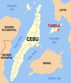 Map of Cebu with Tudela highlighted | |
show OpenStreetMap | |
 Tudela Location within the Philippines | |
| Coordinates: 10°40′N 124°29′E / 10.67°N 124.48°ECoordinates: 10°40′N 124°29′E / 10.67°N 124.48°E | |
| Country | Philippines |
| Region | Central Visayas |
| Province | Cebu |
| District | 5th district |
| Barangays | 11 (see Barangays) |
| Government | |
| • Type | Sangguniang Bayan |
| • Mayor | Greman B. Solante |
| • Vice Mayor | Erwin P. Yu |
| • Representative | Vincent Franco D. Frasco |
| • Municipal Council | show
Members |
| • Electorate | 8,393 voters (2019) |
| Area | |
| • Total | 33.02 km2 (12.75 sq mi) |
| Elevation | 65 m (213 ft) |
| Highest elevation | 377 m (1,237 ft) |
| Lowest elevation | 0 m (0 ft) |
| Population (2020 census) [3] | |
| • Total | 11,304 |
| • Density | 340/km2 (890/sq mi) |
| • Households | 2,757 |
| Economy | |
| • Income class | 5th municipal income class |
| • Poverty incidence | 33.00% (2015)[4] |
| • Revenue | ₱46,170,877.52 (2016) |
| Service provider | |
| • Electricity | Camotes Electric Cooperative (CELCO) |
| Time zone | UTC+8 (PST) |
| ZIP code | 6051 |
| PSGC | |
| IDD : area code | +63 (0)32 |
| Climate type | tropical monsoon climate |
| Native languages | Porohanon Cebuano Tagalog |


Tudela, officially the Municipality of Tudela (Cebuano: Lungsod sa Tudela; Tagalog: Bayan ng Tudela), is a 5th class municipality in the province of Cebu, Philippines. According to the 2020 census, it has a population of 11,304 people. [3]
Tudela is eight kilometres (5 mi) east of the town center of Poro. Along with the town of Poro, Tudela is located on Poro Island. The town celebrates the fiesta of parish patron Our Lady of the Immaculate Conception each 8 December.
The town center comprises two barangays: Northern and Southern Poblacion. The nearly symmetrical arrangement of the streets allows pedestrians to navigate easily while viewing old houses (early 1900s) standing side by side with new ones.
Tudela is bordered to the north by the Province of Leyte in the Camotes Sea, to the west is the town of Poro, to the east is the island of Ponson with town of Pilar and the Province of Leyte, and to the south is the Camotes Sea
Barangays[]
Tudela is politically subdivided into 11 barangays.
| PSGC | Barangay | Population | ±% p.a. | |||
|---|---|---|---|---|---|---|
| 2020 [3] | 2010 [5] | |||||
| 072253001 | Buenavista | 4.8% | 547 | 485 | 1.17% | |
| 072253002 | Calmante | 13.0% | 1,464 | 1,291 | 1.22% | |
| 072253003 | Daan Secante | 4.1% | 460 | 415 | 1.00% | |
| 072253004 | General | 9.5% | 1,079 | 1,028 | 0.47% | |
| 072253005 | McArthur | 10.7% | 1,208 | 977 | 2.07% | |
| 072253006 | Northern Poblacion | 3.9% | 442 | 264 | 5.10% | |
| 072253007 | Puertobello | 27.1% | 3,067 | 2,578 | 1.69% | |
| 072253008 | Santander | 5.0% | 565 | 593 | −0.47% | |
| 072253009 | Secante Bag‑o | 5.1% | 577 | 508 | 1.24% | |
| 072253010 | Southern Poblacion | 6.7% | 763 | 696 | 0.89% | |
| 072253011 | Villahermosa | 9.9% | 1,124 | 1,024 | 0.90% | |
| Total | 11,304 | 9,859 | 1.33% | |||
Climate[]
| hideClimate data for Tudela, Cebu | |||||||||||||
|---|---|---|---|---|---|---|---|---|---|---|---|---|---|
| Month | Jan | Feb | Mar | Apr | May | Jun | Jul | Aug | Sep | Oct | Nov | Dec | Year |
| Average high °C (°F) | 28 (82) |
29 (84) |
29 (84) |
30 (86) |
30 (86) |
30 (86) |
29 (84) |
29 (84) |
29 (84) |
29 (84) |
29 (84) |
29 (84) |
29 (84) |
| Average low °C (°F) | 22 (72) |
22 (72) |
22 (72) |
23 (73) |
25 (77) |
25 (77) |
25 (77) |
25 (77) |
25 (77) |
24 (75) |
24 (75) |
23 (73) |
24 (75) |
| Average precipitation mm (inches) | 78 (3.1) |
57 (2.2) |
84 (3.3) |
79 (3.1) |
118 (4.6) |
181 (7.1) |
178 (7.0) |
169 (6.7) |
172 (6.8) |
180 (7.1) |
174 (6.9) |
128 (5.0) |
1,598 (62.9) |
| Average rainy days | 16.7 | 13.8 | 17.3 | 18.5 | 23.2 | 26.5 | 27.1 | 26.0 | 26.4 | 27.5 | 24.6 | 21.0 | 268.6 |
| Source: Meteoblue [6] | |||||||||||||
Demographics[]
| Year | Pop. | ±% p.a. |
|---|---|---|
| 1903 | 3,561 | — |
| 1918 | 4,896 | +2.15% |
| 1939 | 6,703 | +1.51% |
| 1948 | 6,837 | +0.22% |
| 1960 | 7,380 | +0.64% |
| 1970 | 8,052 | +0.87% |
| 1975 | 9,020 | +2.30% |
| 1980 | 9,611 | +1.28% |
| 1990 | 9,537 | −0.08% |
| 1995 | 9,358 | −0.35% |
| 2000 | 10,401 | +2.29% |
| 2007 | 11,266 | +1.11% |
| 2010 | 9,859 | −4.74% |
| 2015 | 11,296 | +2.63% |
| 2020 | 11,304 | +0.01% |
| Source: Philippine Statistics Authority [7] [5] [8] | ||
Local dialect is Cebuano. Waray is also spoken due to its proximity to Leyte.
The town is home to the Porohanon language, one of the most endangered languages in the Visayas. The language is only used in the Poro islands. The language is classified as distinct from Cebuano (Bisaya) by the Komisyon ng Wikang Filipino and is vital to the culture and arts of the Porohanon people.
Economy[]
| Poverty Incidence of Tudela | |
| Source: Philippine Statistics Authority[9][10][11][12][13][14] | |
Transportation[]
Tudela may be reached by boat through Poro port. A large pump boat typically takes 3½ hours from Danao City pier. A fast craft (called Golden Bridge) takes 1½ hour from Pier 1, Cebu City. The slowest option is a ship that takes 5 hours from Pier 1, Cebu City. Motorcycles and jeepneys are available for ground transportation on arrival - all expensive.
References[]
- ^ Municipality of Tudela | (DILG)
- ^ "2015 Census of Population, Report No. 3 – Population, Land Area, and Population Density" (PDF). Philippine Statistics Authority. Quezon City, Philippines. August 2016. ISSN 0117-1453. Archived (PDF) from the original on May 25, 2021. Retrieved July 16, 2021.
- ^ Jump up to: a b c Census of Population (2020). "Region VII (Central Visayas)". Total Population by Province, City, Municipality and Barangay. PSA. Retrieved 8 July 2021.
- ^ https://psa.gov.ph/sites/default/files/City%20and%20Municipal-level%20Small%20Area%20Poverty%20Estimates_%202009%2C%202012%20and%202015_0.xlsx; publication date: 10 July 2019; publisher: Philippine Statistics Authority.
- ^ Jump up to: a b Census of Population and Housing (2010). "Region VII (Central Visayas)". Total Population by Province, City, Municipality and Barangay. NSO. Retrieved 29 June 2016.
- ^ "Tudela: Average Temperatures and Rainfall". Meteoblue. Retrieved 10 May 2020.
- ^ Census of Population (2015). "Region VII (Central Visayas)". Total Population by Province, City, Municipality and Barangay. PSA. Retrieved 20 June 2016.
- ^ Censuses of Population (1903–2007). "Region VII (Central Visayas)". Table 1. Population Enumerated in Various Censuses by Province/Highly Urbanized City: 1903 to 2007. NSO.
- ^ "Poverty incidence (PI):". Philippine Statistics Authority. Retrieved 28 December 2020.
- ^ https://psa.gov.ph/sites/default/files/NSCB_LocalPovertyPhilippines_0.pdf; publication date: 29 November 2005; publisher: Philippine Statistics Authority.
- ^ https://psa.gov.ph/sites/default/files/2003%20SAE%20of%20poverty%20%28Full%20Report%29_1.pdf; publication date: 23 March 2009; publisher: Philippine Statistics Authority.
- ^ https://psa.gov.ph/sites/default/files/2006%20and%202009%20City%20and%20Municipal%20Level%20Poverty%20Estimates_0_1.pdf; publication date: 3 August 2012; publisher: Philippine Statistics Authority.
- ^ https://psa.gov.ph/sites/default/files/2012%20Municipal%20and%20City%20Level%20Poverty%20Estima7tes%20Publication%20%281%29.pdf; publication date: 31 May 2016; publisher: Philippine Statistics Authority.
- ^ https://psa.gov.ph/sites/default/files/City%20and%20Municipal-level%20Small%20Area%20Poverty%20Estimates_%202009%2C%202012%20and%202015_0.xlsx; publication date: 10 July 2019; publisher: Philippine Statistics Authority.
External links[]
Places adjacent to Tudela, Cebu | ||||||||||
|---|---|---|---|---|---|---|---|---|---|---|
| ||||||||||
| show Authority control |
|---|
- Municipalities of Cebu