Sedan, Kansas
Sedan, Kansas | |
|---|---|
City and County seat | |
 Downtown Sedan (2013) | |
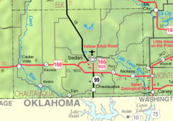
 Location within Chautauqua County and Kansas | |
 | |
| Coordinates: 37°7′42″N 96°11′10″W / 37.12833°N 96.18611°WCoordinates: 37°7′42″N 96°11′10″W / 37.12833°N 96.18611°W | |
| Country | United States |
| State | Kansas |
| County | Chautauqua |
| Founded | 1871 |
| Incorporated | 1876 |
| Named for | Battle of Sedan |
| Area | |
| • Total | 0.82 sq mi (2.13 km2) |
| • Land | 0.82 sq mi (2.13 km2) |
| • Water | 0.00 sq mi (0.00 km2) |
| Elevation | 863 ft (263 m) |
| Population | |
| • Total | 1,124 |
| • Estimate (2019)[3] | 998 |
| • Density | 1,215.59/sq mi (469.37/km2) |
| Time zone | UTC-6 (CST) |
| • Summer (DST) | UTC-5 (CDT) |
| ZIP code | 67361 |
| Area code | 620 |
| FIPS code | 20-63750 [4] |
| GNIS ID | 469151 [5] |
| Website | cityofsedan.com |

Sedan is the county seat of and the largest city in Chautauqua County, Kansas, United States. As of the 2010 census, the city population was 1,124.[6]
History[]
Sedan was founded in 1871.[7] The city was named in commemoration of the 1870 Battle of Sedan.[8] Sedan was incorporated as a city in 1876.[9]
Geography[]
Sedan is located at 37°7′42″N 96°11′10″W / 37.12833°N 96.18611°W (37.128472, -96.186220),[10] which is approximately the middle-point between New York City and Los Angeles. According to the United States Census Bureau, the city has a total area of 0.81 square miles (2.10 km2), all of it land.[11]
Climate[]
The climate in this area is characterized by hot, humid summers and generally mild to cool winters. According to the Köppen Climate Classification system, Sedan has a humid subtropical climate, abbreviated "Cfa" on climate maps.[12]
Demographics[]
| Historical population | |||
|---|---|---|---|
| Census | Pop. | %± | |
| 1880 | 665 | — | |
| 1890 | 970 | 45.9% | |
| 1900 | 1,067 | 10.0% | |
| 1910 | 1,211 | 13.5% | |
| 1920 | 1,885 | 55.7% | |
| 1930 | 1,776 | −5.8% | |
| 1940 | 1,948 | 9.7% | |
| 1950 | 1,640 | −15.8% | |
| 1960 | 1,677 | 2.3% | |
| 1970 | 1,555 | −7.3% | |
| 1980 | 1,579 | 1.5% | |
| 1990 | 1,306 | −17.3% | |
| 2000 | 1,342 | 2.8% | |
| 2010 | 1,124 | −16.2% | |
| 2019 (est.) | 998 | [3] | −11.2% |
| U.S. Decennial Census | |||
2010 census[]
As of the census[2] of 2010, there were 1,124 people, 482 households, and 269 families residing in the city. The population density was 1,387.7 inhabitants per square mile (535.8/km2). There were 615 housing units at an average density of 759.3 per square mile (293.2/km2). The racial makeup of the city was 91.3% White, 0.4% African American, 2.8% Native American, 0.1% Asian, 0.2% Pacific Islander, 2.2% from other races, and 3.0% from two or more races. Hispanic or Latino of any race were 5.2% of the population.
There were 482 households, of which 25.5% had children under the age of 18 living with them, 40.9% were married couples living together, 11.0% had a female householder with no husband present, 3.9% had a male householder with no wife present, and 44.2% were non-families. 40.5% of all households were made up of individuals, and 19.1% had someone living alone who was 65 years of age or older. The average household size was 2.19 and the average family size was 2.86.
The median age in the city was 48.1 years. 21.6% of residents were under the age of 18; 6.7% were between the ages of 18 and 24; 18.2% were from 25 to 44; 26.5% were from 45 to 64; and 26.8% were 65 years of age or older. The gender makeup of the city was 47.3% male and 52.7% female.
2000 census[]
As of the census[4] of 2000, there were 1,342 people, 560 households, and 346 families residing in the city. The population density was 1,712.6 people per square mile (664.3/km2). There were 652 housing units at an average density of 832.1 per square mile (322.7/km2). The racial makeup of the city was 93.44% White, 0.52% African American, 3.35% Native American, 0.22% Asian, 0.15% Pacific Islander, 0.45% from other races, and 1.86% from two or more races. Hispanic or Latino of any race were 2.09% of the population.
There were 560 households, out of which 23.9% had children under the age of 18 living with them, 48.9% were married couples living together, 10.0% had a female householder with no husband present, and 38.2% were non-families. 35.2% of all households were made up of individuals, and 18.4% had someone living alone who was 65 years of age or older. The average household size was 2.25 and the average family size was 2.90.
In the city, the population was spread out, with 23.0% under the age of 18, 7.9% from 18 to 24, 21.3% from 25 to 44, 19.8% from 45 to 64, and 27.9% who were 65 years of age or older. The median age was 43 years. For every 100 females, there were 83.8 males. For every 100 females age 18 and over, there were 80.6 males.
The median income for a household in the city was $24,324, and the median income for a family was $32,574. Males had a median income of $21,490 versus $19,261 for females. The per capita income for the city was $14,153. About 6.8% of families and 11.1% of the population were below the poverty line, including 13.0% of those under age 18 and 9.5% of those age 65 or over.
Education[]
Sedan is a part of USD 286 Chautauqua County. Chautauqua County schools were consolidated in Sedan through school unification.[13]
Prior to school unification, the Sedan Blue Devils won the Kansas State High School class B baseball championship in 1973 and 2011.[14]
Area attractions[]
- Emmett Kelly Museum is located in Sedan, honoring native son, circus clown Emmett Kelly.
- Butcher Falls[15]
Notable people[]
- Emmett Kelly, circus performer
- Elmer Riggs, paleontologist who died here
- Cassius Shartel, U.S. Representative of Missouri
- William Sproul, U.S. Representative of Kansas
- Charlie Weatherbie, college football coach
Twin City[]
Sedan, Kansas has a partnership with the village of Sedan, France. Sedan is located in the Ardennes in Northern France.
See also[]
References[]
- ^ "2019 U.S. Gazetteer Files". United States Census Bureau. Retrieved July 24, 2020.
- ^ a b "U.S. Census website". United States Census Bureau. Retrieved 2012-07-06.
- ^ a b "Population and Housing Unit Estimates". United States Census Bureau. May 24, 2020. Retrieved May 27, 2020.
- ^ a b "U.S. Census website". United States Census Bureau. Retrieved 2008-01-31.
- ^ "US Board on Geographic Names". United States Geological Survey. 2007-10-25. Retrieved 2008-01-31.
- ^ "2010 City Population and Housing Occupancy Status". U.S. Census Bureau. Retrieved March 27, 2011.[dead link]
- ^ Kansas State Historical Society (1916). Biennial Report of the Board of Directors of the Kansas State Historical Society. Kansas State Printing Plant. pp. 154.
- ^ Moyer, Armond; Moyer, Winifred (1958). The origins of unusual place-names. Keystone Pub. Associates. p. 117.
- ^ Blackmar, Frank Wilson (1912). Kansas: A Cyclopedia of State History, Volume 2. Standard Publishing Company. pp. 661.
- ^ "US Gazetteer files: 2010, 2000, and 1990". United States Census Bureau. 2011-02-12. Retrieved 2011-04-23.
- ^ "US Gazetteer files 2010". United States Census Bureau. Archived from the original on 2012-07-02. Retrieved 2012-07-06.
- ^ Climate Summary for Sedan, Kansas
- ^ "Chautauqua County Community USD 286". USD 286. Retrieved 7 January 2017.
- ^ "Baseball". KSHSAA. Retrieved 6 January 2017.
- ^ Butcher Falls; Kansas Travel.
Further reading[]
External links[]
| Wikimedia Commons has media related to Sedan, Kansas. |
- City of Sedan
- Sedan - Directory of Public Officials
- USD 286, local school district
- Sedan city map, KDOT
Municipalities and communities of Chautauqua County, Kansas, United States | ||
|---|---|---|
| Cities |  | |
| Unincorporated communities | ||
| Ghost towns | ||
| Townships | ||
| ||
- Cities in Kansas
- County seats in Kansas
- Cities in Chautauqua County, Kansas
- 1871 establishments in Kansas
- Populated places established in 1871