Tard, Hungary
This article needs additional citations for verification. (September 2020) |
Tard | |
|---|---|
Village | |
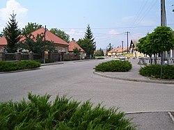 Béke út, the main street in Tard | |
 Flag  Coat of arms | |
 Tard Location of Tard | |
| Coordinates: 47°52′43″N 20°35′56″E / 47.87858°N 20.59881°ECoordinates: 47°52′43″N 20°35′56″E / 47.87858°N 20.59881°E | |
| Country | Hungary |
| Region | Northern Hungary |
| County | Borsod-Abaúj-Zemplén |
| District | Mezőkövesd |
| Area | |
| • Total | 40.49 km2 (15.63 sq mi) |
| Population (1 January 2015)[1] | |
| • Total | 1,206 |
| • Density | 30/km2 (77/sq mi) |
| Time zone | UTC+1 (CET) |
| • Summer (DST) | UTC+2 (CEST) |
| Postal code | 3416 |
| Area code | (+36) 49 |
| Website | www |

Tard is a village in Borsod-Abaúj-Zemplén county, Hungary.
References[]
- ^ "Gazetteer of Hungary, 1st January 2015" (in Hungarian). Hungarian Central Statistical Office. 3 September 2015. Retrieved 4 September 2015.
External links[]
- Street map (in Hungarian)


| Authority control |
|---|
This Borsod-Abaúj-Zemplén location article is a stub. You can help Wikipedia by . |
Categories:
- Populated places in Borsod-Abaúj-Zemplén County
- Borsod-Abaúj-Zemplén geography stubs