Tauves
Tauves | |
|---|---|
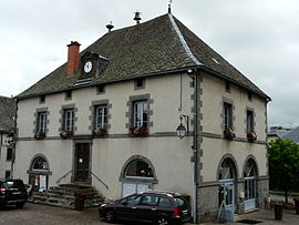 The town hall in Tauves | |
 Coat of arms | |
show Location of Tauves | |
 Tauves | |
| Coordinates: 45°33′39″N 2°37′27″E / 45.5608°N 2.6242°ECoordinates: 45°33′39″N 2°37′27″E / 45.5608°N 2.6242°E | |
| Country | France |
| Region | Auvergne-Rhône-Alpes |
| Department | Puy-de-Dôme |
| Arrondissement | Issoire |
| Canton | Le Sancy |
| Intercommunality | Dômes Sancy Artense |
| Government | |
| • Mayor (2020–2026) | Christophe Serre[1] |
| Area 1 | 33.95 km2 (13.11 sq mi) |
| Population (Jan. 2018)[2] | 772 |
| • Density | 23/km2 (59/sq mi) |
| Time zone | UTC+01:00 (CET) |
| • Summer (DST) | UTC+02:00 (CEST) |
| INSEE/Postal code | 63426 /63690 |
| Elevation | 636–1,072 m (2,087–3,517 ft) (avg. 840 m or 2,760 ft) |
| 1 French Land Register data, which excludes lakes, ponds, glaciers > 1 km2 (0.386 sq mi or 247 acres) and river estuaries. | |


Tauves is a commune in the Puy-de-Dôme department in Auvergne in central France.
Twin towns[]
Tauves is twinned with Castiglione di Sicilia, Italy.
See also[]
References[]
- ^ "Répertoire national des élus: les maires". data.gouv.fr, Plateforme ouverte des données publiques françaises (in French). 2 December 2020. Retrieved 7 December 2020.
- ^ "Populations légales 2018". INSEE. 28 December 2020.
| Wikimedia Commons has media related to Tauves. |
| show Authority control |
|---|
This Puy-de-Dôme geographical article is a stub. You can help Wikipedia by . |
Categories:
- Communes of Puy-de-Dôme
- Puy-de-Dôme geography stubs