Tilton, Illinois
Tilton | |
|---|---|
Village | |
 Location of Tilton in Vermilion County, Illinois. | |
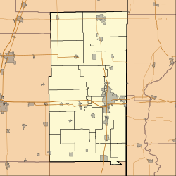 Tilton Tilton's location in Vermilion County | |
| Coordinates: 40°5′48″N 87°38′31″W / 40.09667°N 87.64194°WCoordinates: 40°5′48″N 87°38′31″W / 40.09667°N 87.64194°W | |
| Country | United States |
| State | Illinois |
| County | Vermilion |
| Township | Danville |
| Area | |
| • Total | 3.24 sq mi (8.39 km2) |
| • Land | 3.21 sq mi (8.31 km2) |
| • Water | 0.03 sq mi (0.08 km2) 0.93% |
| Elevation | 643 ft (196 m) |
| Population (2010) | |
| • Total | 2,724 |
| • Estimate (2019)[3] | 2,686 |
| • Density | 837.54/sq mi (323.40/km2) |
| Time zone | UTC-6 (CST) |
| • Summer (DST) | UTC-5 (CDT) |
| ZIP code | 61833 |
| Area code(s) | 217 |
| FIPS code | 17-75276 |
| Website | http://www.tiltonil.com/ |

Tilton is a village in Danville Township, Vermilion County, Illinois, United States. It is part of the Danville, Illinois Metropolitan Statistical Area. The population is 3,300 in 2020.
It is named after Charles Tilton, a friend of Abraham Lincoln, who worked for the railroads. Lincoln reputedly had Thanksgiving dinner at Tilton's house in the village in the 1850s.
Geography[]
Tilton is located at 40°5′48″N 87°38′31″W / 40.09667°N 87.64194°W (40.096586, -87.642071).[4]
According to the 2010 census, Tilton has a total area of 3.243 square miles (8.40 km2), of which 3.21 square miles (8.31 km2) (or 98.98%) is land and 0.033 square miles (0.09 km2) (or 1.02%) is water.[5]
Demographics[]
| Historical population | |||
|---|---|---|---|
| Census | Pop. | %± | |
| 1880 | 297 | — | |
| 1890 | 474 | 59.6% | |
| 1900 | 474 | 0.0% | |
| 1910 | 710 | 49.8% | |
| 1920 | 909 | 28.0% | |
| 1930 | 1,394 | 53.4% | |
| 1940 | 1,486 | 6.6% | |
| 1950 | 1,638 | 10.2% | |
| 1960 | 2,598 | 58.6% | |
| 1970 | 2,544 | −2.1% | |
| 1980 | 2,405 | −5.5% | |
| 1990 | 2,729 | 13.5% | |
| 2000 | 2,976 | 9.1% | |
| 2010 | 2,724 | −8.5% | |
| 2019 (est.) | 2,686 | [3] | −1.4% |
As of the census[7] of 2000, there were 2,976 people, 1,322 households, and 823 families residing in the village. The population density was 960.5 people per square mile (370.7/km2). There were 1,412 housing units at an average density of 455.7 per square mile (175.9/km2). The racial makeup of the village was 98.29% White, 0.17% African American, 0.10% Native American, 0.07% Asian, 0.34% from other races, and 1.04% from two or more races. Hispanic or Latino of any race were 1.08% of the population.
There were 1,322 households, out of which 23.8% had children under the age of 18 living with them, 47.4% were married couples living together, 11.3% had a female householder with no husband present, and 37.7% were non-families. 32.7% of all households were made up of individuals, and 14.2% had someone living alone who was 65 years of age or older. The average household size was 2.25 and the average family size was 2.83.
In the village, the population was spread out, with 22.0% under the age of 18, 8.1% from 18 to 24, 25.0% from 25 to 44, 26.9% from 45 to 64, and 18.0% who were 65 years of age or older. The median age was 41 years. For every 100 females, there were 88.2 males. For every 100 females age 18 and over, there were 86.8 males.
The median income for a household in the village was $31,810, and the median income for a family was $37,727. Males had a median income of $35,455 versus $20,988 for females. The per capita income for the village was $16,276. About 6.2% of families and 8.6% of the population were below the poverty line, including 6.7% of those under age 18 and 8.3% of those age 65 or over.
Notable people[]
- Bert Graham: infielder with the St Louis Browns
- Russ Meers: pitcher for the Chicago Cubs
- Joseph Kirkland: journalist and novelist
References[]
- ^ "2019 U.S. Gazetteer Files". United States Census Bureau. Retrieved July 14, 2020.
- ^ "USGS detail on Tilton". Retrieved 2007-09-26.
- ^ Jump up to: a b "Population and Housing Unit Estimates". United States Census Bureau. May 24, 2020. Retrieved May 27, 2020.
- ^ "US Gazetteer files: 2010, 2000, and 1990". United States Census Bureau. 2011-02-12. Retrieved 2011-04-23.
- ^ "G001 - Geographic Identifiers - 2010 Census Summary File 1". United States Census Bureau. Archived from the original on 2020-02-13. Retrieved 2015-12-25.
- ^ "Census of Population and Housing". Census.gov. Retrieved June 4, 2016.
- ^ "U.S. Census website". United States Census Bureau. Retrieved 2008-01-31.
External links[]
| show Municipalities and communities of Vermilion County, Illinois, United States |
|---|

| show Authority control |
|---|
- Villages in Vermilion County, Illinois
- Villages in Illinois