Tour-en-Sologne
Tour-en-Sologne | |
|---|---|
Commune | |
 | |
 Coat of arms | |
show Location of Tour-en-Sologne | |
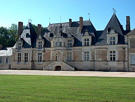
 Tour-en-Sologne | |
| Coordinates: 47°32′23″N 1°30′03″E / 47.5397°N 1.5008°ECoordinates: 47°32′23″N 1°30′03″E / 47.5397°N 1.5008°E | |
| Country | France |
| Region | Centre-Val de Loire |
| Department | Loir-et-Cher |
| Arrondissement | Blois |
| Canton | Chambord |
| Intercommunality | Grand Chambord |
| Government | |
| • Mayor (2020–2026) | Patrice Duchet |
| Area 1 | 26.34 km2 (10.17 sq mi) |
| Population (Jan. 2018)[1] | 1,117 |
| • Density | 42/km2 (110/sq mi) |
| Time zone | UTC+01:00 (CET) |
| • Summer (DST) | UTC+02:00 (CEST) |
| INSEE/Postal code | 41262 /41250 |
| Elevation | 72–123 m (236–404 ft) (avg. 85 m or 279 ft) |
| 1 French Land Register data, which excludes lakes, ponds, glaciers > 1 km2 (0.386 sq mi or 247 acres) and river estuaries. | |


Tour-en-Sologne (French pronunciation: [tuʁ ɑ̃ sɔlɔɲ], literally Tour in Sologne) is a commune of the Loir-et-Cher department in the administrative region of Centre-Val de Loire, France.
Population[]
|
|
See also[]
- Communes of the Loir-et-Cher department
References[]
- ^ "Populations légales 2018". INSEE. 28 December 2020.
External links[]
| Wikimedia Commons has media related to Tour-en-Sologne. |
| show Communes of the Loir-et-Cher department |
|---|
| show Authority control |
|---|
This Loir-et-Cher geographical article is a stub. You can help Wikipedia by . |
Categories:
- Communes of Loir-et-Cher
- Loir-et-Cher geography stubs