Waushara County, Wisconsin
Waushara County | |
|---|---|
U.S. county | |
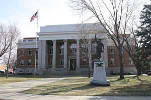 Waushara County courthouse | |
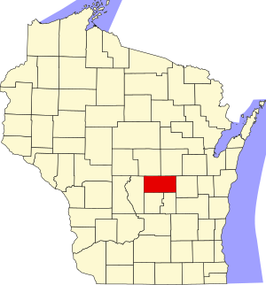 Location within the U.S. state of Wisconsin | |
 Wisconsin's location within the U.S. | |
| Coordinates: 44°07′N 89°14′W / 44.11°N 89.24°W | |
| Country | |
| State | |
| Founded | 1852 |
| Named for | Winnebago term meaning "good earth" |
| Seat | Wautoma |
| Largest city | Berlin |
| Area | |
| • Total | 637 sq mi (1,650 km2) |
| • Land | 626 sq mi (1,620 km2) |
| • Water | 11 sq mi (30 km2) 1.8%% |
| Population (2010) | |
| • Total | 24,496 |
| • Estimate (2020) | 24,326 |
| • Density | 38/sq mi (15/km2) |
| Time zone | UTC−6 (Central) |
| • Summer (DST) | UTC−5 (CDT) |
| Congressional district | 6th |
| Website | www |

Waushara County is a county located in the U.S. state of Wisconsin. As of the 2010 census, the population was 24,496.[1] Its county seat is Wautoma.[2]
Waushara County is located in central Wisconsin, about 80 miles (130 km) north of Madison.
History[]
Waushara County was established by an act of the Wisconsin Legislature on February 15, 1851. It originally consisted of a single organized . In 1852 the county achieved full organization.[3] The county seat was first located at Sacramento and was relocated to Wautoma in 1854 after a bitter fight between proponents of the two places. The name is of Winnebago origin and is believed to mean "good land".[4][5]
Geography[]
According to the U.S. Census Bureau, the county has a total area of 637 square miles (1,650 km2), of which 626 square miles (1,620 km2) is land and 11 square miles (28 km2) (1.8%) is water.[6]
Major highways[]
 Interstate 39
 U.S. Highway 51
 Highway 21 (Wisconsin)
 Highway 22 (Wisconsin)
 Highway 49 (Wisconsin)
 Highway 73 (Wisconsin)
Airports[]
- Wautoma Municipal Airport (FAA LID: Y50) serves Waushara County and the surrounding communities
- Wild Rose Idlewild Airport (FAA LID: W23) also serves Waushara County and the surrounding communities
Adjacent counties[]
- Portage County - north
- Waupaca County - northeast
- Winnebago County - east
- Green Lake County - south
- Marquette County - south
- Adams County - west
Climate[]
| ||||||||||||||||||||||||||||||||||||||||||||||||||||||||||||||||||||||||||||
Demographics[]
| Historical population | |||
|---|---|---|---|
| Census | Pop. | %± | |
| 1860 | 8,770 | — | |
| 1870 | 11,279 | 28.6% | |
| 1880 | 12,687 | 12.5% | |
| 1890 | 13,507 | 6.5% | |
| 1900 | 15,972 | 18.2% | |
| 1910 | 18,886 | 18.2% | |
| 1920 | 16,712 | −11.5% | |
| 1930 | 14,427 | −13.7% | |
| 1940 | 14,268 | −1.1% | |
| 1950 | 13,920 | −2.4% | |
| 1960 | 13,497 | −3.0% | |
| 1970 | 14,795 | 9.6% | |
| 1980 | 18,526 | 25.2% | |
| 1990 | 19,385 | 4.6% | |
| 2000 | 23,154 | 19.4% | |
| 2010 | 24,496 | 5.8% | |
| 2020 (est.) | 24,326 | [8] | −0.7% |
| U.S. Decennial Census[9] 1790–1960[10] 1900–1990[11] 1990–2000[12] 2010–2020[1] | |||

As of the census[13] of 2000, there were 23,154 people, 9,336 households, and 6,581 families residing in the county. The population density was 37 people per square mile (14/km2). There were 13,667 housing units at an average density of 22 per square mile (8/km2). The racial makeup of the county was 96.80% White, 0.27% Black or African American, 0.31% Native American, 0.35% Asian, 0.03% Pacific Islander, 1.36% from other races, and 0.89% from two or more races. 3.66% of the population were Hispanic or Latino of any race. 47.5% were of German, 9.1% Polish, 5.9% Irish, 5.7% American and 5.6% English ancestry. 94.5% spoke English, 3.4% Spanish and 1.4% German as their first language.
There were 9,336 households, out of which 27.60% had children under the age of 18 living with them, 60.00% were married couples living together, 6.70% had a female householder with no husband present, and 29.50% were non-families. 24.90% of all households were made up of individuals, and 11.90% had someone living alone who was 65 years of age or older. The average household size was 2.43 and the average family size was 2.89.
In the county, the population was spread out, with 23.50% under the age of 18, 6.00% from 18 to 24, 24.90% from 25 to 44, 26.30% from 45 to 64, and 19.20% who were 65 years of age or older. The median age was 42 years. For every 100 females there were 101.60 males. For every 100 females age 18 and over, there were 98.80 males.
In 2017, there were 222 births, giving a general fertility rate of 67.3 births per 1000 women aged 15–44, the 22nd highest rate out of all 72 Wisconsin counties. Of these, 19 of the births occurred at home.[14] Additionally, there were 10 reported induced abortions performed on women of Waushara County residence in 2017.[15]
Communities[]
Cities[]
- Berlin (mostly in Green Lake County)
- Wautoma (county seat)
Villages[]
Towns[]
Census-designated places[]
Unincorporated communities[]
- Auroraville
- Bannerman
- Borth
- Brushville
- Dakota
- Fountain Valley
- Heffron (partially)
- Metz (partial)
- Mount Morris
- Richford
- Saxeville
- Silver Lake
- Spring Lake
- West Bloomfield
Ghost towns[]
Politics[]
Waushara County has long been one of the most Republican counties in Wisconsin. Only three Democrats have carried the county at a presidential level since the formation of the Republican Party – Franklin D. Roosevelt in 1932, Bill Clinton in 1996, and Barack Obama in 2008 – of whom only Roosevelt won an absolute majority. In 1936, when Roosevelt carried Wisconsin by a two-to-one majority, Alf Landon won Waushara County by double digits, while it was one of only three Wisconsin counties, alongside Walworth and Waupaca, to vote for Barry Goldwater over Lyndon Johnson in 1964. Like almost all of rural white America, after voting for Obama, Waushara County has swung hard towards the Republican Party in subsequent presidential elections, giving Donald Trump a more than two-to-one majority in 2016.
In other statewide races, the county is equally Republican. Waushara County has never backed a Democrat for Governor since before 1900.[16] Senators Herb Kohl in 2006 and William Proxmire in 1976 and 1970 did carry Waushara County when they swept every county in the state, but no other Democratic senatorial candidate has won the county since the Seventeenth Amendment.
See also[]
References[]
- ^ Jump up to: a b "State & County QuickFacts". United States Census Bureau. Retrieved January 24, 2014.
- ^ "Find a County". National Association of Counties. Retrieved June 7, 2011.
- ^ "Wisconsin: Individual County Chronologies". Wisconsin Atlas of Historical County Boundaries. The Newberry Library. 2007. Archived from the original on April 14, 2017. Retrieved August 15, 2015.
- ^ "Winnebago Took Its Name from an Indian Tribe". Appleton Post-Crescent. December 28, 1963. p. 14. Retrieved August 25, 2014 – via Newspapers.com.

- ^ Gard, Robert E. (September 9, 2015). The Romance of Wisconsin Place Names. Wisconsin Historical Society. ISBN 9780870207082 – via Google Books.
- ^ "2010 Census Gazetteer Files". United States Census Bureau. August 22, 2012. Retrieved August 9, 2015.
- ^ "NASA Earth Observations Data Set Index". NASA. Retrieved January 30, 2016.
- ^ "County Population Totals: 2010-2020". Retrieved June 20, 2021.
- ^ "U.S. Decennial Census". United States Census Bureau. Retrieved August 9, 2015.
- ^ "Historical Census Browser". University of Virginia Library. Retrieved August 9, 2015.
- ^ Forstall, Richard L., ed. (March 27, 1995). "Population of Counties by Decennial Census: 1900 to 1990". United States Census Bureau. Retrieved August 9, 2015.
- ^ "Census 2000 PHC-T-4. Ranking Tables for Counties: 1990 and 2000" (PDF). United States Census Bureau. April 2, 2001. Retrieved August 9, 2015.
- ^ "U.S. Census website". United States Census Bureau. Retrieved May 14, 2011.
- ^ "Annual Wisconsin Birth and Infant Mortality Report, 2017 P-01161-19 (June 2019): Detailed Tables". Archived from the original on June 19, 2019. Retrieved June 23, 2019.
- ^ Reported Induced Abortions in Wisconsin, Office of Health Informatics, Division of Public Health, Wisconsin Department of Health Services. Section: Trend Information, 2013-2017, Table 18, pages 17-18
- ^ "Gubernatorial General Election Results Comparison – Wisconsin". Dave Leip’s U.S. Election Atlas.
- ^ Leip, David. "Dave Leip's Atlas of U.S. Presidential Elections". uselectionatlas.org. Retrieved August 14, 2018.
Further reading[]
- Portrait and Biographical Album of Green Lake, Marquette and Waushara Counties, Wisconsin. Chicago: Acme Publishing, 1890.
External links[]
- Waushara County website
- Waushara County map from the Wisconsin Department of Transportation
| show Places adjacent to Waushara County, Wisconsin |
|---|
| show Municipalities and communities of Waushara County, Wisconsin, United States |
|---|


Coordinates: 44°07′N 89°14′W / 44.11°N 89.24°W
| show Authority control |
|---|
- Wisconsin counties
- Waushara County, Wisconsin
- 1852 establishments in Wisconsin
- Populated places established in 1852