École, Savoie
École | |
|---|---|
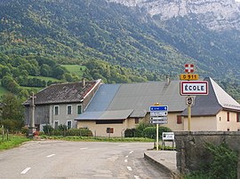 The road into École | |
show Location of École | |
 École | |
| Coordinates: 45°39′05″N 6°10′06″E / 45.6514°N 6.1683°ECoordinates: 45°39′05″N 6°10′06″E / 45.6514°N 6.1683°E | |
| Country | France |
| Region | Auvergne-Rhône-Alpes |
| Department | Savoie |
| Arrondissement | Chambéry |
| Canton | Saint-Alban-Leysse |
| Intercommunality | Grand Chambéry |
| Government | |
| • Mayor (2014–2020) | Annick Bonniez |
| Area 1 | 29.65 km2 (11.45 sq mi) |
| Population (Jan. 2018)[1] | 301 |
| • Density | 10/km2 (26/sq mi) |
| Time zone | UTC+01:00 (CET) |
| • Summer (DST) | UTC+02:00 (CEST) |
| INSEE/Postal code | 73106 /73630 |
| Elevation | 696–2,186 m (2,283–7,172 ft) |
| 1 French Land Register data, which excludes lakes, ponds, glaciers > 1 km2 (0.386 sq mi or 247 acres) and river estuaries. | |


École is a commune in the Savoie department in the Auvergne-Rhône-Alpes region in south-eastern France.
Geography[]
The village lies in the north-western part of the commune, on the left bank of the Chéran, which forms most of the commune's northern border.
See also[]
References[]
- ^ "Populations légales 2018". INSEE. 28 December 2020.
| Wikimedia Commons has media related to École (Savoie). |
This Savoie geographical article is a stub. You can help Wikipedia by . |
Categories:
- Communes of Savoie
- Savoie geography stubs