Hauteluce
Hauteluce | |
|---|---|
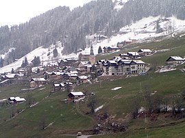 A general view of Hauteluce | |
show Location of Hauteluce | |
 Hauteluce | |
| Coordinates: 45°45′07″N 6°35′11″E / 45.7519°N 6.5864°ECoordinates: 45°45′07″N 6°35′11″E / 45.7519°N 6.5864°E | |
| Country | France |
| Region | Auvergne-Rhône-Alpes |
| Department | Savoie |
| Arrondissement | Albertville |
| Canton | Ugine |
| Government | |
| • Mayor (2020–2026) | Xavier Desmarets |
| Area 1 | 62.39 km2 (24.09 sq mi) |
| Population (Jan. 2018)[1] | 758 |
| • Density | 12/km2 (31/sq mi) |
| Time zone | UTC+01:00 (CET) |
| • Summer (DST) | UTC+02:00 (CEST) |
| INSEE/Postal code | 73132 /73620 |
| Elevation | 780–2,555 m (2,559–8,383 ft) |
| Website | www.mairie-hauteluce.fr |
| 1 French Land Register data, which excludes lakes, ponds, glaciers > 1 km2 (0.386 sq mi or 247 acres) and river estuaries. | |


Hauteluce (French pronunciation: [otlys]) is a commune in the Savoie department in the Auvergne-Rhône-Alpes region in south-eastern France.
See also[]
References[]
- ^ "Populations légales 2018". INSEE. 28 December 2020.
External links[]
| Wikimedia Commons has media related to Hauteluce. |
This Savoie geographical article is a stub. You can help Wikipedia by . |
Categories:
- Communes of Savoie
- Savoie geography stubs