La Chapelle-du-Mont-du-Chat
La Chapelle-du-Mont-du-Chat | |
|---|---|
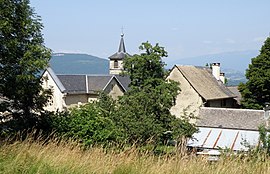 A general view of La Chapelle-du-Mont-du-Chat | |
show Location of La Chapelle-du-Mont-du-Chat | |
 La Chapelle-du-Mont-du-Chat | |
| Coordinates: 45°42′21″N 5°51′17″E / 45.7058°N 5.8547°ECoordinates: 45°42′21″N 5°51′17″E / 45.7058°N 5.8547°E | |
| Country | France |
| Region | Auvergne-Rhône-Alpes |
| Department | Savoie |
| Arrondissement | Chambéry |
| Canton | La Motte-Servolex |
| Government | |
| • Mayor (2014–2020) | Nicole Falcetta |
| Area 1 | 7.08 km2 (2.73 sq mi) |
| Population (Jan. 2018)[1] | 260 |
| • Density | 37/km2 (95/sq mi) |
| Time zone | UTC+01:00 (CET) |
| • Summer (DST) | UTC+02:00 (CEST) |
| INSEE/Postal code | 73076 /73370 |
| Elevation | 231–1,005 m (758–3,297 ft) |
| 1 French Land Register data, which excludes lakes, ponds, glaciers > 1 km2 (0.386 sq mi or 247 acres) and river estuaries. | |


La Chapelle-du-Mont-du-Chat is a commune in the Savoie department in the Auvergne-Rhône-Alpes region in south-eastern France.
See also[]
References[]
- ^ "Populations légales 2018". INSEE. 28 December 2020.
| Wikimedia Commons has media related to La Chapelle-du-Mont-du-Chat. |
This Savoie geographical article is a stub. You can help Wikipedia by . |
Categories:
- Communes of Savoie
- Savoie geography stubs