Détrier
Détrier | |
|---|---|
 | |
Location of Détrier  | |
 Détrier | |
| Coordinates: 45°26′46″N 6°05′57″E / 45.4461°N 6.0992°ECoordinates: 45°26′46″N 6°05′57″E / 45.4461°N 6.0992°E | |
| Country | France |
| Region | Auvergne-Rhône-Alpes |
| Department | Savoie |
| Arrondissement | Chambéry |
| Canton | Montmélian |
| Government | |
| • Mayor (2020–2026) | Alain Sibué |
| Area 1 | 2.25 km2 (0.87 sq mi) |
| Population (Jan. 2018)[1] | 429 |
| • Density | 190/km2 (490/sq mi) |
| Time zone | UTC+01:00 (CET) |
| • Summer (DST) | UTC+02:00 (CEST) |
| INSEE/Postal code | 73099 /73110 |
| Elevation | 332–762 m (1,089–2,500 ft) |
| 1 French Land Register data, which excludes lakes, ponds, glaciers > 1 km2 (0.386 sq mi or 247 acres) and river estuaries. | |


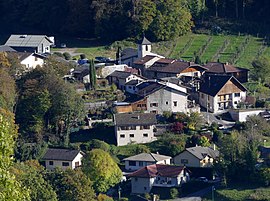
Détrier (French pronunciation: [detʁije]) is a commune in the Savoie department in the Auvergne-Rhône-Alpes region in south-eastern France.
See also[]
References[]
- ^ "Populations légales 2018". The National Institute of Statistics and Economic Studies. 28 December 2020.
| Wikimedia Commons has media related to Détrier. |
This Savoie geographical article is a stub. You can help Wikipedia by . |
Categories:
- Communes of Savoie
- Savoie geography stubs