Saint-Léger, Savoie
Saint-Léger | |
|---|---|
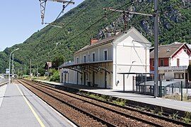 The railway station in Saint-Léger | |
show Location of Saint-Léger | |
 Saint-Léger | |
| Coordinates: 45°26′13″N 6°16′38″E / 45.4369°N 6.2772°ECoordinates: 45°26′13″N 6°16′38″E / 45.4369°N 6.2772°E | |
| Country | France |
| Region | Auvergne-Rhône-Alpes |
| Department | Savoie |
| Arrondissement | Saint-Jean-de-Maurienne |
| Canton | Saint-Pierre-d'Albigny |
| Intercommunality | Porte de Maurienne |
| Government | |
| • Mayor (2020–2026) | Mickaël Cohin |
| Area 1 | 11.06 km2 (4.27 sq mi) |
| Population (Jan. 2018)[1] | 231 |
| • Density | 21/km2 (54/sq mi) |
| Time zone | UTC+01:00 (CET) |
| • Summer (DST) | UTC+02:00 (CEST) |
| INSEE/Postal code | 73252 /73220 |
| Elevation | 352–2,200 m (1,155–7,218 ft) |
| 1 French Land Register data, which excludes lakes, ponds, glaciers > 1 km2 (0.386 sq mi or 247 acres) and river estuaries. | |


Saint-Léger (French pronunciation: [sɛ̃ leʒe] (![]() listen); Arpitan: Sent-Lagiér) is a commune in the Savoie department in the Auvergne-Rhône-Alpes region in south-eastern France.
listen); Arpitan: Sent-Lagiér) is a commune in the Savoie department in the Auvergne-Rhône-Alpes region in south-eastern France.
See also[]
References[]
- ^ "Populations légales 2018". INSEE. 28 December 2020.
| Wikimedia Commons has media related to Saint-Léger (Savoie). |
This Savoie geographical article is a stub. You can help Wikipedia by . |
Categories:
- Communes of Savoie
- Savoie geography stubs