Saint-Cassin
Saint-Cassin | |
|---|---|
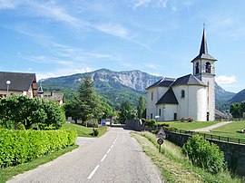 The church and road into Saint-Cassin | |
show Location of Saint-Cassin | |
 Saint-Cassin | |
| Coordinates: 45°32′20″N 5°53′40″E / 45.5389°N 5.8944°ECoordinates: 45°32′20″N 5°53′40″E / 45.5389°N 5.8944°E | |
| Country | France |
| Region | Auvergne-Rhône-Alpes |
| Department | Savoie |
| Arrondissement | Chambéry |
| Canton | Le Pont-de-Beauvoisin |
| Intercommunality | Grand Chambéry |
| Government | |
| • Mayor (2014–2020) | Philippe Dubonnet |
| Area 1 | 14.79 km2 (5.71 sq mi) |
| Population (Jan. 2018)[1] | 848 |
| • Density | 57/km2 (150/sq mi) |
| Time zone | UTC+01:00 (CET) |
| • Summer (DST) | UTC+02:00 (CEST) |
| INSEE/Postal code | 73228 /73160 |
| Elevation | 310–1,540 m (1,020–5,050 ft) |
| Website | www.saint-cassin.com |
| 1 French Land Register data, which excludes lakes, ponds, glaciers > 1 km2 (0.386 sq mi or 247 acres) and river estuaries. | |


Saint-Cassin is a commune in the Savoie department in the Auvergne-Rhône-Alpes region in southeastern France. It is part of the urban area of Chambéry.[2]
See also[]
References[]
- ^ "Populations légales 2018". INSEE. 28 December 2020.
- ^ Unité urbaine de Chambéry (73601), INSEE
External links[]
| Wikimedia Commons has media related to Saint-Cassin. |
This Savoie geographical article is a stub. You can help Wikipedia by . |
Categories:
- Communes of Savoie
- Savoie geography stubs