La Giettaz
La Giettaz | |
|---|---|
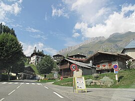 Road to the Col des Aravis at La Giettaz | |
show Location of La Giettaz | |
 La Giettaz | |
| Coordinates: 45°51′47″N 6°29′45″E / 45.8631°N 6.4958°ECoordinates: 45°51′47″N 6°29′45″E / 45.8631°N 6.4958°E | |
| Country | France |
| Region | Auvergne-Rhône-Alpes |
| Department | Savoie |
| Arrondissement | Albertville |
| Canton | Ugine |
| Government | |
| • Mayor (2014–2020) | Noël Bibollet |
| Area 1 | 35.2 km2 (13.6 sq mi) |
| Population (Jan. 2018)[1] | 391 |
| • Density | 11/km2 (29/sq mi) |
| Time zone | UTC+01:00 (CET) |
| • Summer (DST) | UTC+02:00 (CEST) |
| INSEE/Postal code | 73123 /73590 |
| Elevation | 1,002–2,611 m (3,287–8,566 ft) |
| 1 French Land Register data, which excludes lakes, ponds, glaciers > 1 km2 (0.386 sq mi or 247 acres) and river estuaries. | |


La Giettaz is a commune in the Savoie department in the Auvergne-Rhône-Alpes region in south-eastern France.
See also[]
References[]
- ^ "Populations légales 2018". INSEE. 28 December 2020.
| Wikimedia Commons has media related to La Giettaz. |
| show Authority control |
|---|
This Savoie geographical article is a stub. You can help Wikipedia by . |
Categories:
- Communes of Savoie
- Savoie geography stubs