Val-Cenis
Val-Cenis | |
|---|---|
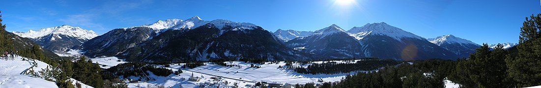
 View of Val-Cenis | |
Location of Val-Cenis  | |
 Val-Cenis | |
| Coordinates: 45°16′41″N 6°49′05″E / 45.278°N 6.818°ECoordinates: 45°16′41″N 6°49′05″E / 45.278°N 6.818°E | |
| Country | France |
| Region | Auvergne-Rhône-Alpes |
| Department | Savoie |
| Arrondissement | Saint-Jean-de-Maurienne |
| Canton | Modane |
| Intercommunality | Haute Maurienne-Vanoise |
| Government | |
| • Mayor (2020-2026) | Jacques Arnoux |
| Area 1 | 408.05 km2 (157.55 sq mi) |
| Population (Jan. 2018)[1] | 2,061 |
| • Density | 5.1/km2 (13/sq mi) |
| Time zone | UTC+01:00 (CET) |
| • Summer (DST) | UTC+02:00 (CEST) |
| INSEE/Postal code | 73290 /73500 |
| 1 French Land Register data, which excludes lakes, ponds, glaciers > 1 km2 (0.386 sq mi or 247 acres) and river estuaries. | |


Val-Cenis is a commune in the department of Savoie, southeastern France. The municipality was established on 1 January 2017 by merger of the former communes of Termignon (the seat), Bramans, Lanslebourg-Mont-Cenis, Lanslevillard and Sollières-Sardières.[2]
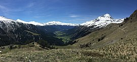
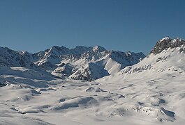
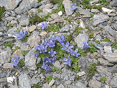
- Nature and landscapes

The commune lies at the limit of the Vanoise National Park

The Dent Parrachée
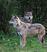
Permanent return of the wolf in the commune in 2003

(93 m)
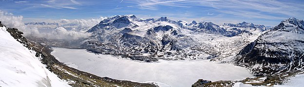
The lake and plateau of Mont Cenis
Panoramic view of the massifs of Mont Cenis and Ambin


See also[]
References[]
| Wikimedia Commons has media related to Val-Cenis. |
- ^ "Populations légales 2018". The National Institute of Statistics and Economic Studies. 28 December 2020.
- ^ Arrêté préfectoral 8 August 2016 (in French)
This Savoie geographical article is a stub. You can help Wikipedia by . |
Categories:
- Communes of Savoie
- Savoie geography stubs