Abaúj-Torna County
This article needs additional citations for verification. (June 2012) |
| Abaúj-Torna County | |
|---|---|
| County of the Kingdom of Hungary | |
| 1881–1945 | |
 Coat of arms
| |
 | |
| Capital | Kassa; Szikszó (1920-1938) |
| Area | |
• 1910 | 3,223 km2 (1,244 sq mi) |
• 1930 | 1,672 km2 (646 sq mi) |
| Population | |
• 1910 | 202288 |
• 1930 | 91428 |
| History | |
• Established | 1881 |
| 4 June 1920 | |
| 2 November 1938 | |
• Renamed to Abaúj County | 1945 |
| Today part of | (1,672 km2) (1,551 km2) |
| Košice is the current name of the capital. | |
Abaúj-Torna (Slovak: Abov-Turňa, German: Abaujwar-Tornau, Latin: comitatus Abaujvar-Tornensis) was an administrative county (comitatus) of the Kingdom of Hungary. Its capital was Kassa (present-day Košice). Its territory is now divided between Hungary and Slovakia.
Geography[]
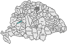
Around 1910, Abaúj-Torna county shared borders with Gömör-Kishont, Szepes, Sáros, Zemplén and Borsod counties. The rivers Hernád and Bódva flowed through the county. Its area was 3223 km² around 1910.
History[]
The county Abaúj-Torna was a combination of Abaúj and Torna counties, officially joined in 1881.
In the aftermath of World War I, the northern part of Abaúj-Torna county became part of newly formed Czechoslovakia (as Abovskoturnianska župa), as recognized by the concerned states in the 1920 Treaty of Trianon. It continued to exist as an administrative unit until 1922. The southern half stayed in Hungary as the county Abaúj-Torna, with capital Szikszó.
Following the provisions of the First Vienna Award, most of the Czechoslovak part was returned to Hungary in November 1938. It was added to the county of Abaúj-Torna, with capital Kassa (present-day Košice). After World War II, the Trianon border was restored, the county was renamed to Abaúj County again. In 1950, it merged with the county of Borsod-Gömör and the Hungarian part of Zemplén to form the present Borsod-Abaúj-Zemplén county. Since 1993, when Czechoslovakia was split, the northern part of the county's former territory is part of Slovakia's Košice Region.
Demographics[]

In 1900, the county had a population of 196,462 people and was composed of the following linguistic communities:[1]
Total:
- Hungarian: 140,050 (71.3%)
- Slovak: 45,072 (22.9%)
- German: 8,734 (4.5%)
- Ruthenian: 519 (0.3%)
- Croatian: 74 (0.0%)
- Romanian: 60 (0.0%)
- Serbian: 13 (0.0%)
- Other or unknown: 1,940 (1.0%)
According to the census of 1900, the county was composed of the following religious communities:[2]
Total:
- Roman Catholic: 113,447 (57.7%)
- Calvinist: 41,562 (21.2%)
- Greek Catholic: 20,142 (10.3%)
- Jewish: 14,069 (7.2%)
- Lutheran: 7,101 (3.6%)
- Greek Orthodox: 106 (0.0%)
- Unitarian: 18 (0.0%)
- Other or unknown: 17 (0.0%)

In 1910, the county had a population of 202,288 people and was composed of the following linguistic communities:[3]
Total:
- Hungarian: 156,668 (77.5%)
- Slovak: 36,067 (17.8%)
- German: 6,520 (3.2%)
- Ruthenian: 378 (0.2%)
- Romanian: 127 (0.0%)
- Croatian: 63 (0.0%)
- Serbian: 21 (0.0%)
- Other or unknown: 2,444 (1.2%)
According to the census of 1910, the county was composed of the following religious communities:[4]
Total:
- Roman Catholic: 118,179 (58.4%)
- Calvinist: 42,728 (21.1%)
- Greek Catholic: 20,089 (9.9%)
- Jewish: 14,251 (7.1%)
- Lutheran: 6,832 (3.4%)
- Greek Orthodox: 161 (0.0%)
- Unitarian: 24 (0.0%)
- Other or unknown: 24 (0.0%)
In 1941: 203,438 Hungarians, 18,879 Slovaks, 2581 Bunjevacs, 904 Germans, 623 Roma, 256 Ruthenians, 72 Romanians, 3 Croatians, 105 other; 140,377 Roman Catholics, 45,384 Protestants, 22,476 Greek Catholics, 14,764 Jewish, 4773 Evangelicals, 339 Greek Orthodox, 116 Baptists and 55 Unitarians.
Subdivisions[]

In the early 20th century, the subdivisions of Abaúj-Torna were:
| Districts (járás) | |
|---|---|
| District | County seat |
| Cserehát | Szepsi |
| Füzér | Hernádzsadány |
| Gönc | Abaújszántó |
| Kassa | Kassa |
| Szikszó | Szikszó |
| Torna | Torna |
| Urban counties (törvényhatósági jogú város) | |
| Kassa | |
The towns Füzér, Szikszó, Gönc and Abaújszántó are now in Hungary.
See also[]
References[]
- ^ "KlimoTheca :: Könyvtár". Kt.lib.pte.hu. Retrieved 2012-12-06.
- ^ "KlimoTheca :: Könyvtár". Kt.lib.pte.hu. Retrieved 2012-12-06.
- ^ "KlimoTheca :: Könyvtár". Kt.lib.pte.hu. Retrieved 2012-06-24.
- ^ "KlimoTheca :: Könyvtár". Kt.lib.pte.hu. Retrieved 2012-06-24.


- States and territories established in 1881
- States and territories disestablished in 1945
- States and territories disestablished in 1920
- Counties in the Kingdom of Hungary
- Divided regions