Szabolcs County
This article needs additional citations for verification. (December 2009) |
| Szabolcs County | |
|---|---|
| County of the Kingdom of Hungary (11th century-1526) County of the Eastern Hungarian Kingdom (1526-1570) County of the Kingdom of Hungary (1570-1621) County of the Principality of Transylvania (1621-1629) County of the Kingdom of Hungary (1629-1645) County of the Principality of Transylvania (1645-1648) County of the Kingdom of Hungary (1648-1923, 1938-1946) County of the Second Hungarian Republic (1946-1949) County of the Hungarian People's Republic (1949-1950) | |
 Coat of arms
| |
 | |
| Capital | Nyíregyháza |
| Area | |
| • Coordinates | 47°57′N 21°43′E / 47.950°N 21.717°ECoordinates: 47°57′N 21°43′E / 47.950°N 21.717°E |
• 1910 | 4,637 km2 (1,790 sq mi) |
| Population | |
• 1910 | 319818 |
| History | |
• Established | 11th century |
| 4 June 1920 | |
• Merged into Szabolcs-Ung County | 1923 |
• County recreated (First Vienna Award) | 2 November 1938 |
• Disestablished | 16 March 1950 |
| Today part of | (4,570 km2) (69 km2) |

Szabolcs was an administrative county (comitatus) of the Kingdom of Hungary. Its territory is now part of Hungary, except three villages which are in Zakarpattia Oblast of Ukraine. The capital of the county was Nyíregyháza.
Geography[]
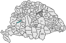
Szabolcs county shared borders with the counties Borsod, Zemplén, Ung, Bereg, Szatmár, Bihar and Hajdú. It was situated mostly south of the river Tisza. Its area was 4637 km² around 1910.
History[]
Szabolcs is one of the oldest counties of the Kingdom of Hungary. After World War I, it was merged with a very small part of former Ung County to form Szabolcs-Ung county, with capital Nyíregyháza. But, villages of Eszeny (present-day Esen), Szalóka (present-day Solovka) and Tiszaágtelek (present-day Tisaahtelek) at Tisza district were passed to Czechoslovakia. These villages were returned to Hungary between 1938 and 1945 but were passed to Soviet Union afterwards. Now, they are part of Ukraine after 1991. In 1950, the county was disestablished and Szabolcs-Szatmár County was created which included most of its territory, while some parts of it were passed to the newly created Borsod-Abaúj-Zemplén and Hajdú-Bihar counties (around Polgár and north-east of Debrecen). In 1990, Szabolcs-Szatmár County was renamed to Szabolcs-Szatmár-Bereg County.
Demographics[]
1880[]
In 1880, the county had a population of 214,008 people and was composed of the following linguistic communities:[1]
Total:
- Hungarian: 186,529 (87,16%)
- Slovak: 13,087 (6,12%)
- German: 1,781 (0,83%)
- Ruthenian: 1,698 (0,79%)
- Romanian: 1,665 (0,78%)
- Serbian and Croatian: 7 (0,00%)
- Other or unknown: 9,241 (4,32%)
According to the census of 1880, the county was composed of the following religious communities:[2]
Total:
- Calvinist: 84,674 (39,57%)
- Roman Catholic: 54,920 (25,66%)
- Greek Catholic: 39,829 (18,61%)
- Jewish: 20,119 (9,40%)
- Lutheran: 14,055 (6,57%)
- Greek Orthodox: 346 (0,16%)
- Unitarian: 7 (0,00%)
- Other or unknown: 58 (0,03%)
1900[]
In 1900, the county had a population of 288,672 people and was composed of the following linguistic communities:[3]
Total:
- Hungarian: 285,023 (98,7%)
- Slovak: 2,066 (0,7%)
- German: 796 (0,3%)
- Ruthenian: 156 (0,1%)
- Romanian: 73 (0,0%)
- Croatian: 14 (0,0%)
- Serbian: 8 (0,0%)
- Other or unknown: 53 (0,2%)
According to the census of 1900, the county was composed of the following religious communities:[4]
Total:
- Calvinist: 110,942 (38,4%)
- Roman Catholic: 80,509 (27,9%)
- Greek Catholic: 56,515 (19,6%)
- Jewish: 23,277 (8,1%)
- Lutheran: 17,239 (6,0%)
- Greek Orthodox: 128 (0,0%)
- Unitarian: 9 (0,0%)
- Other or unknown: 53 (0,0%)
1910[]

In 1910, the county had a population of 319,818 people and was composed of the following linguistic communities:[5]
Total:
- Hungarian: 316,765 (99,0%)
- Slovak: 1,117 (0,3%)
- German: 868 (0,3%)
- Romanian: 212 (0,1%)
- Ruthenian: 194 (0,1%)
- Croatian: 15 (0,0%)
- Serbian: 7 (0,0%)
- Other or unknown: 640 (0,2%)
According to the census of 1910, the county was composed of the following religious communities:[6]
Total:
- Calvinist: 121,396 (38,0%)
- Roman Catholic: 90,560 (28,3%)
- Greek Catholic: 63,353 (19,8%)
- Jewish: 25,316 (7,9%)
- Lutheran: 18,924 (5,9%)
- Greek Orthodox: 164 (0,1%)
- Unitarian: 12 (0,0%)
- Other or unknown: 93 (0,0%)
Subdivisions[]
In the early 20th century, the subdivisions of Szabolcs county were:
| Districts (járás) | |
|---|---|
| District | Capital |
| Dada alsó | Tiszalök |
| Dada felső | Gáva |
| Kisvárda | Kisvárda |
| Ligetalja | Nyíracsád |
| Nagykálló | Nagykálló |
| Nyírbakta | Nyírbakta |
| Nyírbátor | Nyírbátor |
| Nyírbogdány | Kemecse |
| Tisza | Mándok |
| Urban districts (rendezett tanácsú város) | |
| Nyíregyháza | |
References[]
- ^ http://mtdaportal.extra.hu/adatbazisok.html
- ^ http://mtdaportal.extra.hu/adatbazisok.html
- ^ "KlimoTheca :: Könyvtár". Kt.lib.pte.hu. Retrieved 2012-06-26.
- ^ "KlimoTheca :: Könyvtár". Kt.lib.pte.hu. Retrieved 2012-06-26.
- ^ "KlimoTheca :: Könyvtár". Kt.lib.pte.hu. Retrieved 2012-06-26.
- ^ "KlimoTheca :: Könyvtár". Kt.lib.pte.hu. Retrieved 2012-06-26.

- States and territories established in the 11th century
- States and territories established in 1938
- States and territories disestablished in 1920
- States and territories disestablished in 1923
- States and territories disestablished in 1950
- Counties in the Kingdom of Hungary